Category:Corsenside
civil parish in Northumberland, UK  | |||||
| Upload media | |||||
| Instance of | |||||
|---|---|---|---|---|---|
| Location | Northumberland, North East England, England | ||||
 | |||||
English: *GENUKI (Accessed: 28 November, 2008)
Subcategories
This category has the following 5 subcategories, out of 5 total.
Media in category "Corsenside"
The following 200 files are in this category, out of 473 total.
(previous page) (next page)-
 A fixed point on the Great Moor - geograph.org.uk - 6221533.jpg 1,600 × 1,200; 401 KB
-
 A meadowsweet verge - geograph.org.uk - 5850126.jpg 1,600 × 1,067; 512 KB
-
 A tributary to the Brigg Burn - geograph.org.uk - 6221775.jpg 1,600 × 1,200; 438 KB
-
 A68 in Ridsdale village - geograph.org.uk - 5845577.jpg 1,024 × 785; 117 KB
-
 A68 in West Woodburn village - geograph.org.uk - 5845519.jpg 1,024 × 735; 133 KB
-
 A68 memorial viewpoint near West Woodburn - geograph.org.uk - 5845359.jpg 1,024 × 768; 201 KB
-
 A68 near Chesterhope Common - geograph.org.uk - 1997854.jpg 1,024 × 768; 109 KB
-
 A68 near Summer Crag - geograph.org.uk - 5845546.jpg 1,024 × 751; 73 KB
-
 A68 on Chesterhope Common - geograph.org.uk - 5845596.jpg 1,024 × 690; 69 KB
-
 A68 southbound near Dyke Head - geograph.org.uk - 5845343.jpg 1,024 × 751; 106 KB
-
 Access to 'The Steel' - geograph.org.uk - 2949977.jpg 994 × 600; 111 KB
-
 Aid Moss - geograph.org.uk - 2748069.jpg 3,829 × 2,441; 1.33 MB
-
 Alder Hall above Lisles Burn - geograph.org.uk - 4941549.jpg 1,024 × 768; 246 KB
-
 Altar in Church of St Cuthbert, Corsenside - geograph.org.uk - 5730069.jpg 1,600 × 1,103; 271 KB
-
 An overgrown gate - geograph.org.uk - 5822885.jpg 640 × 427; 97 KB
-
 Approaching High Shaw - geograph.org.uk - 5414417.jpg 1,600 × 1,067; 263 KB
-
 Armstrong Street, Ridsdale - geograph.org.uk - 5687667.jpg 1,600 × 1,067; 278 KB
-
 Barn at Low Leam Farm - geograph.org.uk - 2253181.jpg 640 × 480; 63 KB
-
 Barn at Whetstone House - geograph.org.uk - 1172125.jpg 640 × 480; 113 KB
-
 Base of medieval wayside cross near Woodburnhill - geograph.org.uk - 4941644.jpg 1,024 × 768; 313 KB
-
 Bay Horse Inn - geograph.org.uk - 5730036.jpg 1,600 × 985; 276 KB
-
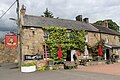 Bay Horse Inn - geograph.org.uk - 5850152.jpg 1,600 × 1,067; 409 KB
-
 Bell Knowe - geograph.org.uk - 5937958.jpg 1,600 × 1,067; 304 KB
-
 Big field, Redesdale - geograph.org.uk - 5822897.jpg 1,024 × 683; 373 KB
-
 Blackburn Bridge - geograph.org.uk - 1549036.jpg 640 × 353; 106 KB
-
 Blackburn Bridge - geograph.org.uk - 3649305.jpg 1,803 × 885; 540 KB
-
 Blackburn Bridge - geograph.org.uk - 5687686.jpg 1,600 × 1,175; 332 KB
-
 Blakelaw Farm - geograph.org.uk - 2164797.jpg 640 × 480; 111 KB
-
 Blakelaw Farm - geograph.org.uk - 4941688.jpg 1,024 × 768; 243 KB
-
 Blakelaw Farm - geograph.org.uk - 4941693.jpg 1,024 × 768; 249 KB
-
 Blyth Cottage near Chairford Bridge - geograph.org.uk - 4941602.jpg 1,024 × 768; 239 KB
-
 Boulders on Hepple Heugh - geograph.org.uk - 1607269.jpg 640 × 480; 73 KB
-
 Boundary fence through the forest - geograph.org.uk - 5520828.jpg 1,600 × 1,067; 497 KB
-
 Boundary Stone - geograph.org.uk - 4696340.jpg 480 × 640; 115 KB
-
 Boundary Stone - geograph.org.uk - 6221621.jpg 1,600 × 1,200; 355 KB
-
 Brandy Bank tea rooms on the A68 - geograph.org.uk - 2668703.jpg 800 × 600; 210 KB
-

-
 Bridge abutments on the old Wansbeck Railway - geograph.org.uk - 5414360.jpg 1,600 × 1,064; 482 KB
-

-
 Bridge on the "Wannie" line - geograph.org.uk - 2164790.jpg 640 × 480; 81 KB
-
 Bridge over dismantled railway - geograph.org.uk - 4941845.jpg 1,024 × 768; 208 KB
-
 Bridge over the Chesterhope Burn - geograph.org.uk - 5728918.jpg 1,600 × 1,067; 381 KB
-
 Bridge over the Lisles Burn - geograph.org.uk - 5687681.jpg 1,600 × 1,067; 465 KB
-

-
 Bridge, West Woodburn - geograph.org.uk - 2173949.jpg 640 × 481; 87 KB
-
 Bridleway ford over Risey Burn - geograph.org.uk - 4941824.jpg 1,024 × 768; 299 KB
-
 Bridleway near Townhead - geograph.org.uk - 4938877.jpg 1,024 × 768; 215 KB
-
 Bridleway north of Townhead - geograph.org.uk - 4938895.jpg 1,024 × 768; 239 KB
-
 Bridleway to Blakelaw - geograph.org.uk - 4944585.jpg 1,024 × 768; 237 KB
-
 Broadgate (geograph 6682417).jpg 1,024 × 683; 509 KB
-
 Broomhill - geograph.org.uk - 1549317.jpg 640 × 389; 96 KB
-
 Burn near Coldtown - geograph.org.uk - 1245156.jpg 640 × 480; 105 KB
-
 Byway near Alder Hall - geograph.org.uk - 4941462.jpg 1,024 × 768; 224 KB
-
 Byway near Alder Hall - geograph.org.uk - 4941473.jpg 1,024 × 768; 216 KB
-
 Byway south along River Rede - geograph.org.uk - 4941451.jpg 1,024 × 768; 406 KB
-
 Byway to East Woodburn - geograph.org.uk - 4941433.jpg 1,024 × 768; 281 KB
-
 Cattle in rough grazing - geograph.org.uk - 5530327.jpg 1,600 × 1,067; 271 KB
-
 Cattle on rough grazing - geograph.org.uk - 594760.jpg 640 × 480; 119 KB
-
 Cattle Pasture near the A68 - geograph.org.uk - 5145936.jpg 765 × 356; 46 KB
-
 Cattle, Low Leam - geograph.org.uk - 5822898.jpg 1,024 × 683; 321 KB
-
 Chairford Bridge - geograph.org.uk - 2726010.jpg 3,455 × 2,137; 1.64 MB
-
 Chairford Bridge near Horsley Bankfoot - geograph.org.uk - 4941588.jpg 1,024 × 768; 227 KB
-
 Chairford Bridge near Horsley Bankfoot - geograph.org.uk - 4941596.jpg 1,024 × 768; 279 KB
-
 Chairford Bridge, East Woodburn - geograph.org.uk - 3649294.jpg 1,781 × 1,182; 544 KB
-
 Chesterhope Burn - geograph.org.uk - 5730086.jpg 1,600 × 1,067; 553 KB
-
 Chesterhope Common - geograph.org.uk - 2748045.jpg 2,549 × 3,513; 1.23 MB
-
 Chesterhope Common quarries (Corsenside) - geograph.org.uk - 438432.jpg 640 × 480; 116 KB
-
 Chesterhope Common quarries - geograph.org.uk - 625158.jpg 640 × 480; 80 KB
-
 Chesterhope Common quarries - geograph.org.uk - 625161.jpg 640 × 480; 83 KB
-
 Cleughs Burn - geograph.org.uk - 2748052.jpg 3,837 × 2,517; 1.47 MB
-
 Cold Law - geograph.org.uk - 1548911.jpg 640 × 319; 60 KB
-
 Coldtown (The Bastle), Redesdale - geograph.org.uk - 119074.jpg 640 × 480; 90 KB
-
 Coldtown farm - geograph.org.uk - 5938784.jpg 1,600 × 1,067; 230 KB
-
 Colliery Air Shaft - geograph.org.uk - 6169031.jpg 3,000 × 4,000; 3.33 MB
-
 Communications mast - geograph.org.uk - 5687651.jpg 1,600 × 1,262; 185 KB
-
 Corsenside - geograph.org.uk - 1630073.jpg 640 × 343; 83 KB
-
 Corsenside - geograph.org.uk - 1630878.jpg 640 × 328; 98 KB
-
 Corsenside - geograph.org.uk - 2432406.jpg 3,164 × 1,968; 1.06 MB
-
 Corsenside - geograph.org.uk - 846922.jpg 640 × 480; 72 KB
-
 Corsenside Common - geograph.org.uk - 2432426.jpg 3,407 × 2,104; 1.1 MB
-
 Corsenside Common - geograph.org.uk - 2432448.jpg 3,456 × 1,889; 1.01 MB
-
 Corsenside Common - geograph.org.uk - 2633777.jpg 640 × 480; 276 KB
-
 Corsenside Common - geograph.org.uk - 4649240.jpg 1,500 × 1,125; 1.48 MB
-
 Corsenside Hills between Ridsdale and Woodburn Station 1.jpg 6,000 × 4,000; 11.74 MB
-
 Corsenside Hills between Ridsdale and Woodburn Station 2.jpg 6,000 × 4,000; 12.36 MB
-
 Corsenside Hills between Ridsdale and Woodburn Station 3.jpg 5,808 × 3,724; 10.35 MB
-
 Corsenside Hills between Ridsdale and Woodburn Station 4.jpg 6,000 × 4,000; 13.77 MB
-
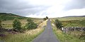
 Country road near West Woodburn - geograph.org.uk - 1390111.jpg 640 × 480; 41 KB
-
 Course of the Wannie Line west of Ray Fell - geograph.org.uk - 4944576.jpg 1,024 × 768; 276 KB
-
 Covered reservoir - geograph.org.uk - 5729755.jpg 1,600 × 1,067; 190 KB
-
 Cragg Quarry (disused) - geograph.org.uk - 2092983.jpg 3,072 × 2,304; 2.65 MB
-
 Cranester Bog - geograph.org.uk - 5722373.jpg 1,600 × 1,067; 304 KB
-
 Cross Law - geograph.org.uk - 6221776.jpg 1,600 × 1,200; 351 KB
-
 Crow Burn - geograph.org.uk - 1245175.jpg 640 × 480; 135 KB
-
 Crow Burn - geograph.org.uk - 5729759.jpg 1,600 × 1,067; 515 KB
-
 Cuddy's Cleugh - geograph.org.uk - 1172082.jpg 640 × 480; 71 KB
-
 Darney Crag - geograph.org.uk - 1631098.jpg 640 × 307; 60 KB
-
 Darney Hall - geograph.org.uk - 5822084.jpg 1,024 × 576; 395 KB
-
 Darney Quarry - geograph.org.uk - 1548934.jpg 640 × 377; 93 KB
-
 Darney Quarry - geograph.org.uk - 4219794.jpg 640 × 480; 105 KB
-
 Dere Street (A68) - geograph.org.uk - 1996863.jpg 1,024 × 768; 134 KB
-
 Descent on the A68 to West Woodburn Bridge - geograph.org.uk - 2950074.jpg 1,165 × 987; 223 KB
-
 Difficulty of feeding livestock in a wet winter - geograph.org.uk - 5729764.jpg 900 × 1,350; 318 KB
-
 Disused quarry - geograph.org.uk - 5530581.jpg 1,600 × 914; 239 KB
-
 Disused railway below Cold Law - geograph.org.uk - 4941839.jpg 1,024 × 768; 238 KB
-
 Driveway entrance to Coldtown - geograph.org.uk - 396789.jpg 640 × 480; 114 KB
-
 Driveway from Coldtown to Road (A68) - geograph.org.uk - 4753828.jpg 4,000 × 3,000; 4.48 MB
-
 Dry stone wall - geograph.org.uk - 5825220.jpg 1,600 × 1,066; 285 KB
-
 Dry stone wall - geograph.org.uk - 5938763.jpg 1,600 × 1,067; 532 KB
-
 Dry stone wall at west side of A68 - geograph.org.uk - 2431996.jpg 1,500 × 1,125; 1.48 MB
-
 Dry stone wall near Aid Crag - geograph.org.uk - 601787.jpg 640 × 480; 113 KB
-
 Dry stone wall running down to the River Rede - geograph.org.uk - 5937912.jpg 1,600 × 1,067; 155 KB
-
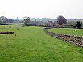
 Dykes, East Woodburn - geograph.org.uk - 5822091.jpg 1,024 × 576; 296 KB
-
 East Woodburn - geograph.org.uk - 1549339.jpg 640 × 374; 84 KB
-
 East Woodburn - geograph.org.uk - 2726006.jpg 3,427 × 2,261; 2.27 MB
-
 East Woodburn - geograph.org.uk - 5414365.jpg 1,600 × 1,067; 277 KB
-
 East Woodburn - geograph.org.uk - 5822110.jpg 1,024 × 576; 261 KB
-
 East Woodburn Bridge - geograph.org.uk - 4219767.jpg 640 × 480; 140 KB
-
 East Woodburn Bridge - geograph.org.uk - 4938906.jpg 1,024 × 768; 266 KB
-
 East Woodburn Bridge - geograph.org.uk - 4938912.jpg 1,024 × 768; 273 KB
-
 East Woodburn Bridge - geograph.org.uk - 4938922.jpg 1,024 × 769; 304 KB
-
 East Woodburn Bridge - geograph.org.uk - 5938817.jpg 1,600 × 588; 188 KB
-
 East Woodburn Bridge over River Rede - geograph.org.uk - 5938818.jpg 1,600 × 1,067; 261 KB
-
 East Woodburn Common - geograph.org.uk - 5822096.jpg 1,024 × 576; 310 KB
-
 East Woodburn from the Monkridge road - geograph.org.uk - 3649295.jpg 1,824 × 1,368; 653 KB
-
 East Woodburn village - geograph.org.uk - 2164772.jpg 640 × 480; 73 KB
-
 Elishaw Moss - geograph.org.uk - 1549293.jpg 640 × 359; 94 KB
-

-

-
 Enclosure across the Brigg Burn - geograph.org.uk - 5937936.jpg 1,600 × 1,067; 296 KB
-
 Engine house - geograph.org.uk - 2167211.jpg 1,824 × 1,216; 791 KB
-

-
 Farm buildings, Townfoot (geograph 7494757).jpg 1,024 × 683; 389 KB
-
 Farm road to High Shaw - geograph.org.uk - 2164761.jpg 640 × 480; 78 KB
-
 Farm shed near Alder Hall - geograph.org.uk - 4941580.jpg 1,024 × 769; 239 KB
-
 Farmhouse, Townfoot (geograph 7494752).jpg 1,024 × 683; 340 KB
-
 Farming in the mud - geograph.org.uk - 5729799.jpg 1,600 × 1,067; 234 KB
-
 Farmland near Townhead - geograph.org.uk - 4938884.jpg 1,024 × 768; 233 KB
-
 Farmyard, Woodburnhill - geograph.org.uk - 4941654.jpg 1,024 × 768; 246 KB
-
 Field gate - geograph.org.uk - 1997848.jpg 1,024 × 768; 122 KB
-
 Field, West Woodburn - geograph.org.uk - 5822874.jpg 1,024 × 576; 381 KB
-
 Fine dry stone wall beside little used public bridleway - geograph.org.uk - 5825165.jpg 1,600 × 1,067; 378 KB
-
 Fine dry stone walls - geograph.org.uk - 5775851.jpg 1,600 × 1,067; 357 KB
-
 Fishing pond at Linnheads - geograph.org.uk - 5825185.jpg 1,600 × 935; 241 KB
-
 Flailed heather - geograph.org.uk - 6221840.jpg 1,600 × 1,200; 270 KB
-
 Footbridge over Lisles Burn - geograph.org.uk - 4941519.jpg 1,024 × 768; 326 KB
-
 Footpath near Alder Hall - geograph.org.uk - 4941545.jpg 1,024 × 768; 369 KB
-
 Footpath near Blakelaw - geograph.org.uk - 4941686.jpg 1,024 × 768; 401 KB
-
 Footpath near East Woodburn Bridge - geograph.org.uk - 4939611.jpg 1,024 × 768; 426 KB
-
 Footpath to Parkside - geograph.org.uk - 1997829.jpg 1,024 × 768; 178 KB
-
 Footpath to Townfoot - geograph.org.uk - 4941487.jpg 1,024 × 768; 350 KB
-
 Footpath to Yearhaugh - geograph.org.uk - 4939617.jpg 1,024 × 768; 430 KB
-

-
 Ford on Black Burn - geograph.org.uk - 4941422.jpg 1,024 × 768; 407 KB
-
 Forest ride on Long Fell - geograph.org.uk - 5520569.jpg 1,600 × 1,067; 419 KB
-
 Forest road Wishaw Plantation - geograph.org.uk - 1172061.jpg 640 × 480; 67 KB
-
 Forest road Wishaw Plantation - geograph.org.uk - 1172062.jpg 640 × 480; 91 KB
-
 Forestry operations at Fourlaws - geograph.org.uk - 625154.jpg 640 × 480; 112 KB
-
 Forestry track - geograph.org.uk - 5728923.jpg 1,600 × 1,067; 309 KB
-
 Fourlaws - geograph.org.uk - 1248785.jpg 640 × 394; 91 KB
-
 Fourlaws - geograph.org.uk - 5529805.jpg 1,600 × 1,093; 266 KB
-
 Fourlaws Community Forest - geograph.org.uk - 2166977.jpg 1,824 × 1,216; 743 KB
-
 Fourlaws Hill - geograph.org.uk - 2748112.jpg 3,888 × 2,335; 1.4 MB
-
 Fourlawshill Top - geograph.org.uk - 1997862.jpg 1,024 × 768; 139 KB
-
 Fourlawshill Top - geograph.org.uk - 2748065.jpg 3,851 × 2,537; 910 KB
-
 Fourlawshill Top - geograph.org.uk - 575799.jpg 640 × 425; 80 KB
-
 Gate in solid stone wall - geograph.org.uk - 5855732.jpg 1,600 × 1,067; 314 KB
-
 Gatepost and tree west of Whetstone House - geograph.org.uk - 4944608.jpg 1,024 × 768; 296 KB
-
 Gateway beside the Lisles Burn - geograph.org.uk - 5825196.jpg 1,600 × 1,355; 546 KB
-
 Gateway to High Chesterhope - geograph.org.uk - 5730000.jpg 1,600 × 1,067; 364 KB
-
 Gateway to St Cuthbert's Corsenside and The Brigg - geograph.org.uk - 5729777.jpg 1,600 × 1,122; 275 KB
-
 Grazing sheep - geograph.org.uk - 1996856.jpg 1,024 × 768; 112 KB
-
 Grazing sheep - geograph.org.uk - 1996869.jpg 1,024 × 768; 123 KB
-
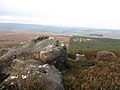
 Great Wanney Crag - geograph.org.uk - 2087516.jpg 3,072 × 2,304; 2.34 MB
-
 Great Wanney Crag - geograph.org.uk - 5292468.jpg 640 × 480; 299 KB
-
 Great Wanney Crag - geograph.org.uk - 5292476.jpg 480 × 640; 274 KB
-
 Great Wanney Crag - geograph.org.uk - 6159712.jpg 1,600 × 1,026; 406 KB
-
 Grindstone Sike - geograph.org.uk - 5822101.jpg 1,024 × 576; 379 KB
-
 Habitancvm (Roman Fort) at Risingham - geograph.org.uk - 5938438.jpg 1,600 × 1,067; 319 KB
-
 Hareshaw Head - geograph.org.uk - 2804082.jpg 640 × 480; 81 KB
-
 Hareshaw Head - geograph.org.uk - 5706318.jpg 1,800 × 1,012; 1.05 MB
-
 Harewalls - geograph.org.uk - 4941681.jpg 1,024 × 768; 207 KB
-
 Harewalls farm - geograph.org.uk - 5825112.jpg 1,600 × 1,067; 319 KB
-
 Hartside - geograph.org.uk - 1172045.jpg 640 × 480; 68 KB
-
 Hartside - geograph.org.uk - 5688070.jpg 1,600 × 1,067; 360 KB
-
 Hartside Cairn - geograph.org.uk - 5855767.jpg 1,600 × 1,067; 334 KB
-

-
 Heading north on the A68 - geograph.org.uk - 4128993.jpg 640 × 480; 70 KB
-
 Heads - geograph.org.uk - 4941678.jpg 1,024 × 769; 296 KB
-
 Heather suffering from the drought - geograph.org.uk - 5860707.jpg 1,600 × 1,016; 209 KB
-
 Hepple Heugh - geograph.org.uk - 1549693.jpg 640 × 292; 59 KB
-
 Hepple Heugh - geograph.org.uk - 2253580.jpg 640 × 480; 93 KB
-
 Hepple Heugh - geograph.org.uk - 2748075.jpg 3,888 × 2,395; 1.19 MB
-
 Hepple Heugh - geograph.org.uk - 5530307.jpg 1,600 × 1,067; 272 KB
-
 High Nick - geograph.org.uk - 2748084.jpg 3,485 × 1,375; 509 KB
-
 High Nick quarry - geograph.org.uk - 2169481.jpg 3,072 × 2,304; 2 MB
-
 High Nick Quarry - geograph.org.uk - 5721322.jpg 1,600 × 1,067; 372 KB
-
 High Nick Quarry - geograph.org.uk - 5825209.jpg 1,600 × 1,067; 357 KB
-
 High Shaw - geograph.org.uk - 1549324.jpg 640 × 387; 102 KB
-
 High Shaw Farm - geograph.org.uk - 2164777.jpg 640 × 480; 86 KB


_crossing_the_River_Rede_at_West_Woodburn_-_geograph.org.uk_-_4753814.jpg)


.jpg)


_-_geograph.org.uk_-_438432.jpg)


,_Redesdale_-_geograph.org.uk_-_119074.jpg)


_-_geograph.org.uk_-_2092983.jpg)


_-_geograph.org.uk_-_1996863.jpg)


_-_geograph.org.uk_-_4753828.jpg)


.jpg)


.jpg)


_at_Risingham_-_geograph.org.uk_-_5938438.jpg)


