Category:Countryside in Powys
Media in category "Countryside in Powys"
The following 200 files are in this category, out of 340 total.
(previous page) (next page)-
 A distant windmill - geograph.org.uk - 240522.jpg 1,024 × 768; 403 KB
-
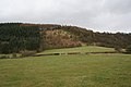
 Abergwesyn Common - geograph.org.uk - 391588.jpg 640 × 427; 118 KB
-
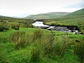
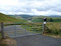 Access gate to Llyn Clywedog - geograph.org.uk - 217435.jpg 640 × 480; 93 KB
-
 Access land at Wylfa - geograph.org.uk - 240496.jpg 640 × 480; 88 KB
-
 Access land at Wylfa - geograph.org.uk - 240500.jpg 640 × 480; 153 KB
-
 Across the fields to Brynsifiog - geograph.org.uk - 589880.jpg 640 × 295; 46 KB
-

-
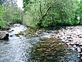
 Afon Elan - geograph.org.uk - 746309.jpg 1,000 × 666; 1.02 MB
-
 Afon Elan - geograph.org.uk - 781773.jpg 1,024 × 768; 446 KB
-
 Afon Elan above Abergwngu - geograph.org.uk - 1180017.jpg 1,000 × 750; 440 KB
-
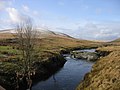
 Afon Elan below Pont ar Elan - geograph.org.uk - 1027585.jpg 640 × 440; 93 KB
-
 Afon Elan, Pont ar Elan - geograph.org.uk - 675645.jpg 640 × 480; 70 KB
-

-
 B4404 Road - geograph.org.uk - 240564.jpg 640 × 480; 126 KB
-
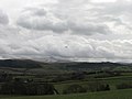
 Beacons View - geograph.org.uk - 520361.jpg 640 × 543; 77 KB
-
 Beilibedw Mawn Pool - geograph.org.uk - 391079.jpg 640 × 480; 62 KB
-
 Bracken clearance on the common - geograph.org.uk - 644139.jpg 640 × 480; 73 KB
-
 Bridge over Afon Cerist, near Caersws - geograph.org.uk - 200526.jpg 640 × 480; 110 KB
-
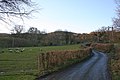
 Bush and road - geograph.org.uk - 815911.jpg 640 × 427; 68 KB
-
 Buttercup meadow near Llandegley - geograph.org.uk - 838372.jpg 640 × 359; 70 KB
-
 Bwlchgwyn - geograph.org.uk - 248226.jpg 640 × 480; 141 KB
-
 By the side of the Afon Twymyn - geograph.org.uk - 809512.jpg 479 × 640; 79 KB
-
 Byway heading to Soar - geograph.org.uk - 798929.jpg 640 × 480; 89 KB
-
 Cae'r-mynach - geograph.org.uk - 839594.jpg 640 × 427; 92 KB
-
 Cattle grazing at Colfryn - geograph.org.uk - 548934.jpg 640 × 480; 89 KB
-
 Clear fell on Esgair Cloddiad, Powys - geograph.org.uk - 1508600.jpg 640 × 383; 116 KB
-
 Confluence of Rivers Rhiw and Severn - geograph.org.uk - 1474039.jpg 640 × 480; 80 KB
-
 Confluence of the Elan and the Wye - geograph.org.uk - 902689.jpg 640 × 480; 103 KB
-

-
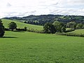
 Countryside near Godor - geograph.org.uk - 552259.jpg 640 × 427; 72 KB
-
 Countryside near Meifod - geograph.org.uk - 552256.jpg 640 × 427; 151 KB
-
 Coxhead Bank Common - geograph.org.uk - 839054.jpg 640 × 480; 76 KB
-
 Coxhead Bank Common - geograph.org.uk - 839062.jpg 640 × 480; 53 KB
-
 Coxhead Bank Common - geograph.org.uk - 839070.jpg 640 × 480; 59 KB
-
 Cwm Ffrydlan - geograph.org.uk - 242068.jpg 640 × 480; 221 KB
-
 Cwm Ffrydlan - geograph.org.uk - 242072.jpg 640 × 480; 106 KB
-
 Cwm Ffrydlan - geograph.org.uk - 242075.jpg 640 × 480; 149 KB
-
 Cwm Maen Gwynedd.jpg 4,032 × 3,024; 5.13 MB
-
 Disgwylfa Hill - geograph.org.uk - 86080.jpg 640 × 430; 87 KB
-
 Dol-afallen, River Elan - geograph.org.uk - 1243142.jpg 640 × 513; 94 KB
-
 Down from the hills - geograph.org.uk - 633096.jpg 640 × 427; 45 KB
-
 Down the valley - geograph.org.uk - 1336544.jpg 640 × 426; 96 KB
-
 Dyffryn Dyfi - geograph.org.uk - 240562.jpg 640 × 480; 81 KB
-
 Dyffryn Dyfi - geograph.org.uk - 240931.jpg 640 × 480; 143 KB
-
 Dyffryn Dyfi - geograph.org.uk - 240937.jpg 640 × 480; 103 KB
-
 Dyffryn Dyfi - geograph.org.uk - 242085.jpg 640 × 480; 98 KB
-
 Entrance to Bryntudur - geograph.org.uk - 243434.jpg 640 × 480; 127 KB
-
 Farm gate at Hendreseifion - geograph.org.uk - 240557.jpg 640 × 480; 189 KB
-
 Farm Gate beside the A493 - geograph.org.uk - 214676.jpg 640 × 480; 131 KB
-
 Farm Gate, Near Red House, Trefeglwys - geograph.org.uk - 200523.jpg 640 × 480; 118 KB
-
 Farm Gate, Pen-y-ffynyon Farm - geograph.org.uk - 200514.jpg 640 × 480; 112 KB
-
 Farm land near Abergwesyn, Powys - geograph.org.uk - 1506114.jpg 640 × 421; 130 KB
-
 Farm track to Pen-y-fedw - geograph.org.uk - 1324011.jpg 640 × 426; 108 KB
-

-
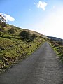
 Footpath descent towards minor road - geograph.org.uk - 574111.jpg 640 × 407; 50 KB
-
 Forestry Walk - geograph.org.uk - 232219.jpg 640 × 480; 131 KB
-
 Furrow Hill - geograph.org.uk - 68480.jpg 640 × 480; 43 KB
-
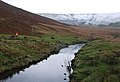
 Glacial drainage channel - geograph.org.uk - 482811.jpg 640 × 480; 111 KB
-
 Glacial overflow channel - geograph.org.uk - 421216.jpg 640 × 480; 134 KB
-
 Hendreseifion - geograph.org.uk - 240538.jpg 640 × 480; 139 KB
-
 Hivron turning - geograph.org.uk - 867328.jpg 640 × 480; 75 KB
-
 Lane at Nannerth - geograph.org.uk - 248225.jpg 640 × 480; 137 KB
-
 Lane in Dyffryn Dyfi - geograph.org.uk - 242090.jpg 640 × 480; 131 KB
-
 Llanddewi'r Cwm Hamlet - geograph.org.uk - 1546687.jpg 640 × 360; 82 KB
-
 Llandegley - geograph.org.uk - 838383.jpg 640 × 480; 67 KB
-
 Llandegley Rocks - geograph.org.uk - 614849.jpg 600 × 400; 55 KB
-
 Llangattock Church.jpg 640 × 426; 122 KB
-
 Llanymynech Hill depuis le canal de Montgomery.jpg 591 × 405; 295 KB
-
 Llyn Y Fan from Gwernwyddog - geograph.org.uk - 723153.jpg 640 × 480; 46 KB
-

-
 Looking east along the Beacons Way - geograph.org.uk - 756021.jpg 640 × 457; 50 KB
-
 Looking east to Fishpool Farm - geograph.org.uk - 712376.jpg 640 × 480; 129 KB
-
 Looking South - geograph.org.uk - 720990.jpg 427 × 640; 122 KB
-
 Looking the other way - geograph.org.uk - 740751.jpg 640 × 427; 87 KB
-
 Looking towards the Beacons - geograph.org.uk - 737538.jpg 640 × 480; 77 KB
-
 Looking towards Tyle Mawr - geograph.org.uk - 80082.jpg 640 × 480; 140 KB
-
 Looking up at Alison's seat - geograph.org.uk - 742020.jpg 640 × 427; 51 KB
-
 Low flying over the Usk Valley - geograph.org.uk - 724236.jpg 640 × 480; 35 KB
-
 Lower Neuadd Reservoir - geograph.org.uk - 754091.jpg 640 × 480; 107 KB
-
 Marshland near Howey - geograph.org.uk - 752669.jpg 640 × 480; 100 KB
-
 Minor road from Ystradfellte - geograph.org.uk - 756678.jpg 640 × 480; 82 KB
-
 Minor road to Ystradfellte - geograph.org.uk - 756680.jpg 480 × 640; 71 KB
-
 Minor roadway near Libanus - geograph.org.uk - 754566.jpg 640 × 480; 88 KB
-
 Mixed weather over Dolymynach - geograph.org.uk - 774656.jpg 1,000 × 750; 978 KB
-

-
 Montgomery Canal looking towards Wern - geograph.org.uk - 806164.jpg 640 × 426; 57 KB
-
 Montgomery Canal near Four Crosses - geograph.org.uk - 833178.jpg 640 × 480; 98 KB
-

-
 Mynydd Pen-y-fâl - geograph.org.uk - 1299281.jpg 640 × 425; 175 KB
-
 Nant Hirin joining the River Elan - geograph.org.uk - 1521629.jpg 640 × 480; 89 KB
-
 Nant-ddu - geograph.org.uk - 735790.jpg 639 × 479; 189 KB
-
 Nant-y-brain - geograph.org.uk - 748754.jpg 640 × 480; 59 KB
-
 Nantymynach Farm and Cwm Rhiwiau - geograph.org.uk - 713178.jpg 640 × 480; 107 KB
-
 Near Pentwyn farm in upper Usk valley - geograph.org.uk - 382117.jpg 640 × 425; 187 KB
-
 Near the Gospel Pass - geograph.org.uk - 743420.jpg 639 × 479; 210 KB
-
 Near Ty'n-y-fedw - geograph.org.uk - 205836.jpg 640 × 480; 95 KB
-
 New belt of trees near Cui Parc - geograph.org.uk - 734307.jpg 640 × 480; 70 KB
-
 New chalets at Pen Offa - geograph.org.uk - 438532.jpg 640 × 480; 57 KB
-
 New fence - geograph.org.uk - 553924.jpg 640 × 480; 59 KB
-
 New pond or Quarry - geograph.org.uk - 768589.jpg 640 × 480; 82 KB
-
 Newly laid hedgerow - geograph.org.uk - 768602.jpg 640 × 480; 114 KB
-
 No trace of a right of way - geograph.org.uk - 750985.jpg 640 × 480; 264 KB
-
 Northern corner of Allt Lom - geograph.org.uk - 760554.jpg 640 × 480; 119 KB
-
 Not the M25^ - geograph.org.uk - 795759.jpg 640 × 480; 103 KB
-
 Noyadd Sharmon 815656.jpg 640 × 427; 71 KB
-
 Off Track - geograph.org.uk - 711632.jpg 640 × 388; 108 KB
-
 Offa's Dyke Path outside Forden - geograph.org.uk - 827049.jpg 640 × 480; 96 KB
-
 Old wall and hedge - geograph.org.uk - 670839.jpg 480 × 640; 124 KB
-
 On Cefn Moel - geograph.org.uk - 739400.jpg 639 × 479; 188 KB
-
 On Clipyn Du. - geograph.org.uk - 741725.jpg 640 × 427; 50 KB
-
 On the Beacons Way - geograph.org.uk - 733738.jpg 640 × 480; 103 KB
-
 Open moorland at Ffos-lwyd - geograph.org.uk - 247616.jpg 640 × 480; 64 KB
-
 Overgrown hedgerows, Pen-y-bryn - geograph.org.uk - 838388.jpg 640 × 480; 138 KB
-
 Pant-y-maen farmstead - geograph.org.uk - 732373.jpg 640 × 425; 79 KB
-
 Parc Bach - geograph.org.uk - 738995.jpg 640 × 480; 66 KB
-
 Pasture at Llanwrin - geograph.org.uk - 240659.jpg 640 × 480; 106 KB
-
 Pasture in Dyffryn Dyfi - geograph.org.uk - 240573.jpg 640 × 480; 78 KB
-
 Pasture in Dyffryn Dyfi - geograph.org.uk - 240924.jpg 640 × 480; 152 KB
-
 Pasture in Dyffryn Dyfi - geograph.org.uk - 242034.jpg 640 × 480; 123 KB
-
 Pasture in Dyffryn Dyfi - geograph.org.uk - 242050.jpg 640 × 480; 131 KB
-
 Pasture in Dyffryn Dyfi - geograph.org.uk - 242096.jpg 640 × 480; 101 KB
-
 Pasture, Bwlchau - geograph.org.uk - 748594.jpg 640 × 480; 61 KB
-
 Pasture, Farm And Wood - geograph.org.uk - 315388.jpg 640 × 480; 103 KB
-
 Pastures of the Usk valley - geograph.org.uk - 724464.jpg 640 × 480; 62 KB
-
 Path south from Llandefalle Common - geograph.org.uk - 714403.jpg 640 × 480; 91 KB
-
 Penygarreg reservoir - geograph.org.uk - 760351.jpg 640 × 428; 112 KB
-
 Pont ar Ddyfi - geograph.org.uk - 240512.jpg 1,024 × 768; 593 KB
-
 Radio masts on Aran - geograph.org.uk - 234277.jpg 640 × 480; 71 KB
-
 Re-instated land - geograph.org.uk - 754643.jpg 640 × 416; 44 KB
-
 Rhiw Goch - geograph.org.uk - 668127.jpg 640 × 427; 56 KB
-
 Rhiw Trumau - geograph.org.uk - 743303.jpg 639 × 479; 191 KB
-
 Rhos - geograph.org.uk - 748599.jpg 640 × 480; 90 KB
-
-
 River Elan - geograph.org.uk - 1521467.jpg 640 × 480; 131 KB
-
 River Elan - geograph.org.uk - 1521500.jpg 640 × 480; 86 KB
-
 River Elan meanders - geograph.org.uk - 1521568.jpg 640 × 480; 109 KB
-
 River Severn flood plain - geograph.org.uk - 710568.jpg 635 × 368; 25 KB
-
 River Severn flood plain - geograph.org.uk - 710574.jpg 637 × 432; 40 KB
-
 River Teme, Crug-y-byddar - geograph.org.uk - 300336.jpg 640 × 480; 121 KB
-

-
 Road near Bagbury - geograph.org.uk - 762729.jpg 640 × 480; 111 KB
-
 Road To Llanfyllin - geograph.org.uk - 726608.jpg 640 × 388; 82 KB
-
 Road to The Cwm - geograph.org.uk - 719260.jpg 640 × 427; 62 KB
-
 Rocks in the River Elan - geograph.org.uk - 1521483.jpg 640 × 480; 132 KB
-
 Rolling farmland - geograph.org.uk - 719061.jpg 640 × 454; 85 KB
-
 Rolling Hills - geograph.org.uk - 710206.jpg 427 × 640; 65 KB
-
 Rough woodland - geograph.org.uk - 738200.jpg 639 × 479; 189 KB
-
 Round the bend - geograph.org.uk - 743594.jpg 640 × 427; 83 KB
-
 Shed by the line - geograph.org.uk - 1336279.jpg 640 × 426; 82 KB
-
 Sheep and the A44 - geograph.org.uk - 695856.jpg 640 × 480; 100 KB
-
 Sheep country 2 - geograph.org.uk - 927190.jpg 640 × 480; 81 KB
-
 Snowing again - geograph.org.uk - 743408.jpg 639 × 479; 200 KB
-
 Snowing again - geograph.org.uk - 743414.jpg 639 × 479; 225 KB
-
 South from Pen y Darren - geograph.org.uk - 668237.jpg 640 × 427; 62 KB
-
 Stile at the edge of the wood - geograph.org.uk - 248229.jpg 640 × 480; 164 KB
-

-
 Tanat Valley - geograph.org.uk - 547357.jpg 640 × 482; 142 KB
-
 The Begwns, highland common - geograph.org.uk - 55788.jpg 640 × 427; 105 KB
-
 The Campsite - geograph.org.uk - 740695.jpg 640 × 427; 65 KB
-
 The Ithon, Pen-y-bont - geograph.org.uk - 838393.jpg 640 × 480; 107 KB
-
 The other end of Yardro - geograph.org.uk - 1551275.jpg 640 × 427; 75 KB
-
 The River Elan - geograph.org.uk - 1523122.jpg 640 × 480; 115 KB
-

-
 The Severn Way, looking south - geograph.org.uk - 534021.jpg 640 × 515; 129 KB
-
 The Usk Valley - geograph.org.uk - 1323717.jpg 640 × 426; 77 KB
-
 The View To The East - geograph.org.uk - 314008.jpg 640 × 480; 97 KB
-
 The wooded slopes of Yr Allt - geograph.org.uk - 520609.jpg 640 × 480; 132 KB
-
 This is the view - geograph.org.uk - 739322.jpg 639 × 479; 217 KB
-
 Through the gap - geograph.org.uk - 233831.jpg 640 × 480; 80 KB
-
 Tidily-laid hedge - geograph.org.uk - 724620.jpg 640 × 480; 95 KB
-
 Tir-mynach - geograph.org.uk - 486083.jpg 640 × 480; 68 KB
-
 Tor y Foel viewed from the north - geograph.org.uk - 1377843.jpg 640 × 426; 107 KB
-
 Towards Castle Bank - geograph.org.uk - 743602.jpg 640 × 427; 53 KB
-
 Towards the Beacons - geograph.org.uk - 739351.jpg 639 × 479; 190 KB
-
 Tower of Pencelli church - geograph.org.uk - 1381418.jpg 640 × 426; 119 KB
-
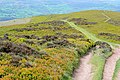
 Track ascending Llandefalle Common - geograph.org.uk - 714409.jpg 640 × 462; 77 KB
-
 Track at Botalog - geograph.org.uk - 247604.jpg 640 × 480; 85 KB
-
 Track down to the ford at Rhyd - geograph.org.uk - 527875.jpg 640 × 480; 154 KB
-
 Track from Gigrin Farm - geograph.org.uk - 1523598.jpg 640 × 480; 83 KB
-

-

-
 Trackway To Carnau Gwynion - geograph.org.uk - 481750.jpg 640 × 593; 138 KB
-
 Trallong From Abercamlais - geograph.org.uk - 486769.jpg 640 × 480; 104 KB
-
 Tredomen road over the Afon Llynfi bridge - geograph.org.uk - 538909.jpg 640 × 425; 113 KB
-
 Tree house - geograph.org.uk - 502626.jpg 480 × 640; 130 KB
-
 Tree line above Nant Cwm Llwch - geograph.org.uk - 507061.jpg 640 × 480; 134 KB
-
 Tree lined track - geograph.org.uk - 553671.jpg 640 × 480; 98 KB
-
 Tree-lined lane - geograph.org.uk - 486170.jpg 640 × 480; 85 KB
-
 Trees above Tyleheulog - geograph.org.uk - 559994.jpg 640 × 426; 135 KB
-
 Trees around the quarry - geograph.org.uk - 571044.jpg 640 × 480; 108 KB
-
 Tregunter farm - geograph.org.uk - 539903.jpg 640 × 425; 84 KB
-
 Trelydan Farm - geograph.org.uk - 569486.jpg 640 × 479; 114 KB
-
 Tributary of the Dyfi - geograph.org.uk - 240569.jpg 640 × 480; 119 KB
-
 Trickling Stream - geograph.org.uk - 740261.jpg 640 × 427; 90 KB
-
 Two long distance paths - geograph.org.uk - 588644.jpg 640 × 436; 75 KB
-
 Tyle-glas Wood - geograph.org.uk - 588291.jpg 640 × 480; 124 KB
-
 Upland Meadows Near Crai - geograph.org.uk - 487277.jpg 640 × 480; 107 KB
-
 Upland pasture, Y Byrwydd - geograph.org.uk - 600301.jpg 640 × 480; 86 KB
-
 Upper Farm - geograph.org.uk - 586842.jpg 640 × 480; 90 KB
-
 Upper reaches of the Afon Twrch - geograph.org.uk - 560020.jpg 640 × 480; 135 KB


