Category:Countryside in Walwick
Media in category "Countryside in Walwick"
The following 49 files are in this category, out of 49 total.
-
-

-

-
-
-
 Bridleway north of Walwick - geograph.org.uk - 526572.jpg 640 × 480; 111 KB
-
 Catching the last light from Walwick Fell - geograph.org.uk - 1710384.jpg 1,600 × 1,200; 326 KB
-
 Disused quarry (2) - geograph.org.uk - 1129331.jpg 640 × 480; 74 KB
-
 Disused quarry - geograph.org.uk - 1129320.jpg 640 × 480; 79 KB
-

-
-
 Field of stubble near Walwick - geograph.org.uk - 1018424.jpg 640 × 480; 101 KB
-

-

-
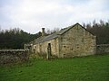
 Kennels near Walwick - geograph.org.uk - 1252208.jpg 640 × 480; 101 KB
-
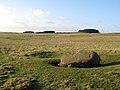 Lonely rock on Walwick Fell (2) - geograph.org.uk - 1172850.jpg 640 × 480; 90 KB
-
 Overgrown Vallum west of Walwick - geograph.org.uk - 1252252.jpg 480 × 640; 152 KB
-
 Plantation east of Walwick Fell - geograph.org.uk - 1250091.jpg 640 × 480; 129 KB
-
 Public footpaths, Walwick Fell - geograph.org.uk - 1250078.jpg 640 × 480; 86 KB
-
 Quarry spoil mound, Walwick Fell (2) - geograph.org.uk - 1221023.jpg 640 × 480; 67 KB
-
 Quarry spoil mound, Walwick Fell - geograph.org.uk - 1221016.jpg 640 × 480; 46 KB
-

-

-

-

-
 Rough pastures on Walwick Fell (2) - geograph.org.uk - 1221927.jpg 640 × 480; 71 KB
-
 Rough pastures on Walwick Fell (3) - geograph.org.uk - 1221931.jpg 640 × 480; 80 KB
-
 Rough pastures on Walwick Fell - geograph.org.uk - 1221073.jpg 640 × 480; 66 KB
-

-

-

-

-

-

-

-
 Sycamore tree near Walwick - geograph.org.uk - 1018641.jpg 640 × 480; 129 KB
-

-

-

-

-

-
 The Vallum southeast of Walwick - geograph.org.uk - 1219957.jpg 640 × 480; 70 KB
-

-
 Twisted stump near Walwick - geograph.org.uk - 1018637.jpg 640 × 480; 101 KB
-
 Walwick Fell (2) - geograph.org.uk - 1221000.jpg 640 × 480; 83 KB
-
 Walwick Fell - geograph.org.uk - 1129335.jpg 640 × 480; 95 KB
-
 Walwick Fell - geograph.org.uk - 1205930.jpg 640 × 480; 77 KB
-
 Walwick Fell - geograph.org.uk - 1583112.jpg 640 × 294; 60 KB
-
 Walwick Fell - geograph.org.uk - 1583113.jpg 600 × 450; 79 KB
_Hadrian%27s_Wall_west_of_Walwick_(2)_-_geograph.org.uk_-_1252186.jpg)
_Hadrian%27s_Wall_west_of_Walwick_(3)_-_geograph.org.uk_-_1252191.jpg)
_Hadrian%27s_Wall_west_of_Walwick_(4)_-_geograph.org.uk_-_1252219.jpg)
_Hadrian%27s_Wall_west_of_Walwick_-_geograph.org.uk_-_1252185.jpg)
_Turret_29a_(west_of_Walwick)_-_geograph.org.uk_-_1129362.jpg)


_-_geograph.org.uk_-_1129331.jpg)


_-_geograph.org.uk_-_1172850.jpg)


_-_geograph.org.uk_-_1221023.jpg)

_-_geograph.org.uk_-_1221033.jpg)

_-_geograph.org.uk_-_1221009.jpg)

_-_geograph.org.uk_-_1221927.jpg)
_-_geograph.org.uk_-_1221931.jpg)

_-_geograph.org.uk_-_1250049.jpg)
_-_geograph.org.uk_-_1250070.jpg)

_-_geograph.org.uk_-_1250064.jpg)


_-_geograph.org.uk_-_1252234.jpg)
_-_geograph.org.uk_-_1252244.jpg)


_-_geograph.org.uk_-_1221000.jpg)


