Category:County Route 80 (Suffolk County, New York)
Subcategories
This category has only the following subcategory.
C
Media in category "County Route 80 (Suffolk County, New York)"
The following 50 files are in this category, out of 50 total.
-
 285-E-Montauk-Hwy-Hampton-Bays-large-003-4-Aerial-View-1334x1000-72dpi.jpg 4,665 × 3,500; 1.27 MB
-
 510 Main Street and a Pink House; Eastport, NY.jpg 3,648 × 2,736; 2.02 MB
-
 At Long Island 2024 008.jpg 6,960 × 4,640; 20.45 MB
-
 Atlantic Seafood Fish Market; Center Moriches, NY.jpg 3,648 × 2,736; 2.1 MB
-
 Bellport Station Sign and Montauk Highway.JPG 5,152 × 3,864; 4.1 MB
-
 Bible Church of Moriches.jpg 3,648 × 2,736; 2.05 MB
-
 Carman's River Canoe and Kayak-1.jpg 3,648 × 2,736; 2.07 MB
-
 Carman's River Canoe and Kayak-2.jpg 3,648 × 2,736; 2.05 MB
-
 Carman's River Canoe and Kayak; South Haven, NY.jpg 640 × 335; 104 KB
-
 Center Moriches School-1.JPG 5,152 × 3,864; 7.54 MB
-
 Center Moriches School-2.JPG 5,152 × 3,864; 7.5 MB
-
 Center Moriches United Methodist Church from Chichester Ave.jpg 3,648 × 2,736; 2.11 MB
-
 Downtown Ctr Moriches; WB Montauk Hwy @ RR Ave-Beachfern Rd.JPG 5,152 × 3,864; 4.24 MB
-
 Downtown Ctr Moriches; WB Montauk Hwy @ Union Ave.JPG 5,152 × 3,864; 4.23 MB
-
 Downtown East Moriches; WB Montauk Hwy @ Pine Street.JPG 5,152 × 3,864; 4.14 MB
-
 Eastport Elementary School from Montauk Hwy.JPG 5,152 × 3,864; 7.98 MB
-
 Eastport Heritage Area; ToS Marker.JPG 5,152 × 3,864; 7.62 MB
-
 Eastport Town of Southampton NYS Historical Marker.JPG 5,152 × 3,864; 7.37 MB
-
 Eastport, NY American Legion Hall.jpg 3,648 × 2,736; 2.08 MB
-
 EB Montauk Hwy between Barnes and Fanning Landing Rds; Moriches.jpg 3,648 × 2,736; 2.14 MB
-
 EB Montauk Hwy; Center Moriches, NY.jpg 3,648 × 2,736; 2.07 MB
-
 Farmhouse Farms, Moriches, New York.JPG 5,152 × 3,864; 7.82 MB
-
 Former Lloyd's Antiques; Eastport, NY.jpg 3,648 × 2,736; 2.03 MB
-
 General William Floyd HM; Mastic, New York-1.jpg 3,648 × 2,736; 2.11 MB
-
 General William Floyd HM; Mastic, New York-2.jpg 3,648 × 2,736; 2.04 MB
-
 Ice Cream Cottage; Mastic, New York.jpg 3,648 × 2,736; 2.02 MB
-
 Kaler's Pond Audobon Center.JPG 5,152 × 3,864; 7.68 MB
-
 Ketcham Inn.jpg 3,264 × 2,448; 5.62 MB
-
 Mastic Liquors on Montauk Highway.jpg 3,648 × 2,736; 2.08 MB
-
 Montauk Highway over West Mill Pond - Forge River.jpg 4,000 × 3,000; 2.59 MB
-
 Old Red Moriches Elementary School.jpg 3,648 × 2,736; 2.01 MB
-
 Old Sinclair Gas Station on Montauk Hwy; East Moriches, NY.JPG 5,152 × 3,864; 4.12 MB
-
 Paving Truck at Lufker Airport.jpg 5,152 × 3,864; 7.56 MB
-
 Poospatuck Historical Marker on Montauk Highway.jpg 3,648 × 2,736; 2.08 MB
-
 Reverend Paul Cuffee Gravesite HM.jpg 3,648 × 2,736; 2.09 MB
-
 S End Chichester Avenue @ Suffolk CR 80; Center Moriches.jpg 3,648 × 2,736; 2.1 MB
-
 Soldiers and Sailors Memorial Park; East Moriches.jpg 3,648 × 2,736; 2.05 MB
-
 South Haven Cemetery NYS Historical Marker.JPG 5,152 × 3,864; 7.27 MB
-
 Spadaro Airport from Montauk Highway.JPG 5,152 × 3,864; 7.52 MB
-
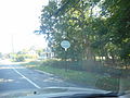
 Suffolk 80 entering Hampton Bays.jpg 5,152 × 3,864; 4.28 MB
-
 Suffolk County 80.svg 450 × 450; 20 KB
-
 Suffolk Transit 1031.JPG 640 × 480; 119 KB
-
 Terry Ketcham Inn; Hay & Book Barn.JPG 4,000 × 3,000; 2.82 MB
-
 Terry Ketcham Inn; NYS Parks Sign.JPG 4,000 × 3,000; 2.54 MB
-
 Terry-Ketcham Inn; Address.JPG 4,000 × 3,000; 2.48 MB
-
 Terry-Ketcham Inn; Historical Marker.JPG 5,152 × 3,864; 4.23 MB
-
 Terry-Ketcham Inn; Ketcham Inn Sign.JPG 5,152 × 3,864; 4.08 MB
-
 Victoria's Antiques; Eastport, NY.jpg 3,648 × 2,736; 2.11 MB
-
 Watami; Montauk Hwy in Moriches.jpg 3,648 × 2,736; 2.06 MB
-
 West end Suffolk CR 71; Eastport, NY.JPG 5,152 × 3,864; 7.35 MB


