Category:Cowbridge with Llanblethian
English: Cowbridge with Llanblethian is a community in the principal area of the Vale of Glamorgan, in Wales.
community in the Vale of Glamorgan, Wales, UK   | |||||
| Upload media | |||||
| Pronunciation audio | |||||
|---|---|---|---|---|---|
| Instance of | |||||
| Location | Vale of Glamorgan, Wales | ||||
| Population |
| ||||
| Area |
| ||||
| official website | |||||
 | |||||
Subcategories
This category has the following 4 subcategories, out of 4 total.
Media in category "Cowbridge with Llanblethian"
The following 133 files are in this category, out of 133 total.
-

-
 A4222 bridge over A48 - geograph.org.uk - 5822112.jpg 1,600 × 1,199; 686 KB
-
 A48 westbound lay-by and bridge over A4222 - geograph.org.uk - 5822119.jpg 1,600 × 1,200; 813 KB
-
 Aberthin Lane bridge over A48 - geograph.org.uk - 5822117.jpg 1,600 × 887; 452 KB
-
 Aberthin Lane near Cowbridge - geograph.org.uk - 2784391.jpg 640 × 551; 89 KB
-
 Advertising Sign in Arcade - off High Street - geograph.org.uk - 6201863.jpg 1,024 × 768; 175 KB
-
 An unusual one-way road - geograph.org.uk - 5822041.jpg 1,600 × 1,200; 644 KB
-
 B.J.s Cafe east of Cowbridge - geograph.org.uk - 2784161.jpg 640 × 459; 74 KB
-

-
 British Summer Time near Cowbridge - geograph.org.uk - 2496079.jpg 640 × 480; 76 KB
-

-
 Church Hall - geograph.org.uk - 5175995.jpg 3,264 × 2,448; 2.44 MB
-
 Church of St.John the Baptist - geograph.org.uk - 4777364.jpg 3,264 × 2,448; 3.53 MB
-
 Church of St.John the Baptist - geograph.org.uk - 4777366.jpg 3,264 × 2,448; 2.55 MB
-
 Church Street - High Street - geograph.org.uk - 6201517.jpg 1,024 × 818; 128 KB
-
 Clover rich meadow near Llanblethian - geograph.org.uk - 2495978.jpg 640 × 480; 97 KB
-
 Colourful houses in Llanblethian - geograph.org.uk - 2764709.jpg 4,000 × 3,000; 3.43 MB
-
 Common Blue Butterfly - geograph.org.uk - 4572389.jpg 640 × 480; 139 KB
-
 Constitution Hill, Llanblethian - geograph.org.uk - 2226107.jpg 4,000 × 3,000; 2.62 MB
-
 Cooper's Lane - High Street - geograph.org.uk - 6201598.jpg 1,024 × 791; 176 KB
-
 Cowbridge Athletic Club buildings - geograph.org.uk - 3667324.jpg 800 × 694; 131 KB
-
 Cowbridge bypass - geograph.org.uk - 2445218.jpg 640 × 480; 41 KB
-
 Cowbridge bypass looking east - geograph.org.uk - 2445227.jpg 640 × 480; 38 KB
-
 Cowbridge bypass looking east - geograph.org.uk - 2445264.jpg 640 × 480; 46 KB
-
 Cowbridge CF71, UK - panoramio (49).jpg 2,592 × 1,936; 1.97 MB
-
 Cowbridge Telephone Exchange - geograph.org.uk - 6177351.jpg 2,592 × 1,944; 1.41 MB
-
 Cowbridge Town Hall - geograph.org.uk - 5041814.jpg 1,024 × 751; 123 KB
-
 Cowbridge ^ Aberthaw Railway - geograph.org.uk - 2753442.jpg 640 × 480; 122 KB
-
 Cowbridge, Pavilion - geograph.org.uk - 5041804.jpg 1,024 × 756; 147 KB
-
 Cowbridge, River Thaw - geograph.org.uk - 5041809.jpg 1,024 × 768; 168 KB
-
 Cowbridge, Vale of Glamorgan - geograph.org.uk - 5041821.jpg 1,024 × 741; 158 KB
-
 Derelict Building - geograph.org.uk - 5252369.jpg 3,264 × 2,448; 2.39 MB
-
 Derelict Farm Building - geograph.org.uk - 5205150.jpg 3,264 × 2,448; 2.5 MB
-
 Ditch and Stream - geograph.org.uk - 5273106.jpg 3,264 × 2,448; 3.63 MB
-

-
 Double Stile and Footbridge - geograph.org.uk - 2872140.jpg 1,405 × 1,800; 2.29 MB
-

-
 Eastgate - viewed from The Limes - geograph.org.uk - 6201866.jpg 1,024 × 768; 171 KB
-
 Factory Brook, Llanblethian - geograph.org.uk - 5175992.jpg 2,448 × 3,264; 3.05 MB
-
 Farm Track - geograph.org.uk - 5205161.jpg 2,365 × 3,156; 1.93 MB
-
 Farm Track - geograph.org.uk - 5273103.jpg 2,448 × 3,264; 2.17 MB
-
 Ffarm Newton House Farm - geograph.org.uk - 4705364.jpg 640 × 480; 77 KB
-

-
 Flowers and Bunting - geograph.org.uk - 5471335.jpg 2,448 × 3,264; 2.99 MB
-

-
 Footpath stile on the north-east slope of Llanblethian Hill - geograph.org.uk - 2238273.jpg 4,000 × 3,000; 2.96 MB
-
 Forest Products Ltd - geograph.org.uk - 4777542.jpg 3,264 × 2,448; 3.74 MB
-

-
 Games Court, Cowbridge - geograph.org.uk - 3425091.jpg 640 × 480; 96 KB
-
 Gates to Church - geograph.org.uk - 4777368.jpg 2,448 × 3,264; 2.27 MB
-
 Ger - Near Pant Watkin - geograph.org.uk - 4386268.jpg 640 × 480; 129 KB
-

-
 Hare and Hounds - geograph.org.uk - 5252393.jpg 3,264 × 2,448; 2.03 MB
-
 Hare and Hounds - geograph.org.uk - 5924585.jpg 3,264 × 2,448; 3.05 MB
-
 Hare and Hounds, Maendy Road - geograph.org.uk - 2445300.jpg 640 × 480; 51 KB
-
 High Street - viewed from The Limes - geograph.org.uk - 6201868.jpg 1,024 × 768; 150 KB
-
 High Street - viewed from Town Hall - geograph.org.uk - 6201039.jpg 1,024 × 824; 166 KB
-
 High Street - viewed from Town Hall - geograph.org.uk - 6201042.jpg 1,024 × 777; 150 KB
-
 Hill Fort - geograph.org.uk - 2872164.jpg 2,000 × 989; 2.02 MB
-
 Hill Fort - geograph.org.uk - 5252389.jpg 3,264 × 2,448; 5.07 MB
-
 Hollybush Farm - geograph.org.uk - 5252368.jpg 3,264 × 2,448; 1.22 MB
-
 Holy Cross Church, Cowbridge - geograph.org.uk - 4890817.jpg 2,448 × 3,264; 1.99 MB
-
 Iron Age Fort and Footpath - geograph.org.uk - 5252388.jpg 7,760 × 2,515; 7.74 MB
-

-
-
 Lane to Arfryn Farm - geograph.org.uk - 5205172.jpg 3,264 × 2,448; 2.48 MB
-
 Lane to Welsh St.Donats - geograph.org.uk - 5252782.jpg 3,264 × 2,448; 2.49 MB
-
 Library - Old Hall Gardens - geograph.org.uk - 6201523.jpg 1,024 × 648; 195 KB
-
 Llwybr Newton Path - geograph.org.uk - 4705353.jpg 640 × 480; 137 KB
-
 Llwybr Newton Path - geograph.org.uk - 4705479.jpg 640 × 480; 92 KB
-

-
 Looking north across snow-bound rugby field - geograph.org.uk - 1812023.jpg 3,072 × 2,304; 1.76 MB
-
 Marlborough Grange - geograph.org.uk - 4777474.jpg 3,264 × 2,448; 1.12 MB
-
 Marlborough Grange Farmhouse - geograph.org.uk - 4777455.jpg 3,264 × 2,448; 945 KB
-
 Mounting Steps - off High Street - geograph.org.uk - 6201864.jpg 1,024 × 768; 188 KB
-
 Muddy track to St Hilary Down - geograph.org.uk - 2784086.jpg 640 × 480; 114 KB
-
 Mughal Emperor near Cowbridge - geograph.org.uk - 2784151.jpg 640 × 568; 83 KB
-
 Newhouse Farm - geograph.org.uk - 5175999.jpg 3,264 × 2,448; 3.34 MB
-
 O dan yr A48 - Under the A48 - geograph.org.uk - 4705473.jpg 640 × 480; 116 KB
-

-
 Ordnance Survey Cut Mark - geograph.org.uk - 4901178.jpg 480 × 640; 104 KB
-
 Ordnance Survey Cut Mark - geograph.org.uk - 4901194.jpg 480 × 640; 112 KB
-
 Ordnance Survey Cut Mark - geograph.org.uk - 4901462.jpg 480 × 640; 130 KB
-
 Ordnance Survey Cut Mark - geograph.org.uk - 5743550.jpg 640 × 448; 87 KB
-
 Ordnance Survey Cut Mark - geograph.org.uk - 5743556.jpg 640 × 431; 88 KB
-
 Ordnance Survey Cut Mark - geograph.org.uk - 5743558.jpg 640 × 357; 80 KB
-
 Ordnance Survey Cut Mark - geograph.org.uk - 5743560.jpg 640 × 445; 122 KB
-
 Ordnance Survey Cut Mark - geograph.org.uk - 5743563.jpg 436 × 640; 114 KB
-
 Ordnance Survey Cut Mark - geograph.org.uk - 5743570.jpg 640 × 457; 119 KB
-
 Ordnance Survey Cut Mark - geograph.org.uk - 5743575.jpg 640 × 383; 94 KB
-
 Ordnance Survey Flush Bracket (S1254) - geograph.org.uk - 4901184.jpg 480 × 640; 107 KB
-

-
 Ordnance Survey Rivet - geograph.org.uk - 5743553.jpg 640 × 495; 77 KB
-
 Ordnance Survey Rivet - geograph.org.uk - 5743581.jpg 367 × 640; 70 KB
-
 Pant Wilkin - geograph.org.uk - 5252383.jpg 3,264 × 2,448; 2.43 MB
-
 Petrol Station - geograph.org.uk - 5252367.jpg 3,264 × 2,448; 2.39 MB
-
 Plaque on Bear Hotel - High Street - geograph.org.uk - 6201611.jpg 1,024 × 931; 263 KB
-
 Plaque on Caercady House - High Street - geograph.org.uk - 6201519.jpg 1,024 × 927; 111 KB
-

-
 Plaque on The Old Hall - High Street - geograph.org.uk - 6201520.jpg 1,024 × 980; 180 KB
-
 Plaque on Woodstock House - High Street - geograph.org.uk - 6201603.jpg 1,024 × 901; 213 KB
-
 Pump - by Town Hall - High Street - geograph.org.uk - 6201036.jpg 593 × 1,024; 181 KB
-
 Railway Embankment - geograph.org.uk - 5273100.jpg 3,264 × 2,448; 2.86 MB
-
 River Thaw - High Street - geograph.org.uk - 6201871.jpg 768 × 1,024; 206 KB
-
 Road Junction - geograph.org.uk - 5184878.jpg 2,448 × 3,264; 1.47 MB
-
 SE end of the Cowbridge Bypass - geograph.org.uk - 2784069.jpg 640 × 438; 78 KB
-
 Sheep in a field near Cowbridge - geograph.org.uk - 2784248.jpg 640 × 388; 68 KB
-
 Sheep near Llanblethian - geograph.org.uk - 2764639.jpg 4,000 × 3,000; 3.18 MB
-

-
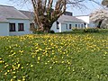 Spring dandelions in old Hall Gardens - geograph.org.uk - 1812093.jpg 3,072 × 2,304; 1.79 MB
-
 St Hilary transmitter buildings - geograph.org.uk - 2783904.jpg 640 × 383; 82 KB
-
 St Hilary transmitting mast - geograph.org.uk - 2783899.jpg 527 × 640; 56 KB
-
 St Quentin's Castle, Llanblethian - geograph.org.uk - 4980724.jpg 1,600 × 1,200; 772 KB
-
 Sunken path near Llanblethian - geograph.org.uk - 2495969.jpg 640 × 480; 135 KB
-
 Tesco - High Street - geograph.org.uk - 6201616.jpg 1,024 × 854; 164 KB
-
 The Bryn Owain inn - geograph.org.uk - 5822029.jpg 1,600 × 1,066; 734 KB
-
 The Cross Inn - geograph.org.uk - 4777361.jpg 3,264 × 2,448; 1.71 MB
-
 The Cross Inn, near Llanblethian - geograph.org.uk - 2238131.jpg 4,000 × 3,000; 1.97 MB
-
 The Market Place Restaurant - High Street - geograph.org.uk - 6201608.jpg 1,024 × 768; 149 KB
-
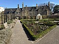 The Physic Garden, Cowbridge - geograph.org.uk - 4890508.jpg 3,264 × 2,448; 3.64 MB
-
 The Verlands from the 'Three Fields' - geograph.org.uk - 1812065.jpg 3,072 × 2,304; 1.71 MB
-
 Track to New Breach Farm, near Llanblethian - geograph.org.uk - 2238421.jpg 4,000 × 3,000; 2.8 MB
-
 Track to Sewage Works - geograph.org.uk - 5226957.jpg 3,264 × 2,448; 2.54 MB
-
 Ty Gwyn - geograph.org.uk - 5252778.jpg 3,264 × 2,448; 1.53 MB
-
 Village Cross, Llanblethian - geograph.org.uk - 4980715.jpg 1,200 × 1,600; 749 KB
-
 Wales Vale of Glamorgan Community Cowbridge with Llanblethian map.svg 512 × 322; 401 KB
-

-
 Watery Lane looking east - geograph.org.uk - 2445320.jpg 640 × 480; 76 KB
-

-
 Welcome to Llanblethian - geograph.org.uk - 4777362.jpg 3,264 × 2,448; 1.66 MB
-
 Westmoor Farm near Cowbridge - geograph.org.uk - 2784291.jpg 640 × 404; 67 KB
-

-
 Windy Ridge near Cowbridge - geograph.org.uk - 2770799.jpg 640 × 366; 62 KB


.jpg)


_-_geograph.org.uk_-_4901184.jpg)
_-_geograph.org.uk_-_4901180.jpg)


