Category:Crawley, Oxfordshire
village and civil parish in West Oxfordshire, England  | |||||
| Upload media | |||||
| Instance of | |||||
|---|---|---|---|---|---|
| Location | West Oxfordshire, Oxfordshire, South East England, England | ||||
| Located in or next to body of water | |||||
| official website | |||||
 | |||||
English: Hailey is a village and civil parish beside the River Windrush about north of Witney, Oxfordshire.
Subcategories
This category has the following 3 subcategories, out of 3 total.
C
T
Media in category "Crawley, Oxfordshire"
The following 61 files are in this category, out of 61 total.
-
 'Rose Cottage' at the bend in Farm Lane - geograph.org.uk - 5271437.jpg 1,024 × 683; 160 KB
-
 A variant pillbox at the former RAF Akeman Street - geograph.org.uk - 1850853.jpg 3,008 × 2,000; 1.58 MB
-
 Akeman Street - geograph.org.uk - 2777579.jpg 640 × 480; 107 KB
-
 Akeman Street - geograph.org.uk - 2777586.jpg 640 × 480; 66 KB
-
 Akeman Street - geograph.org.uk - 2777592.jpg 640 × 480; 103 KB
-

-
 Akeman Street in 2010 - geograph.org.uk - 1850102.jpg 3,008 × 2,000; 1.53 MB
-
 Akeman Street near Field Assarts, Oxfordshire - geograph.org.uk - 1850031.jpg 3,008 × 2,000; 1.53 MB
-

-
 Benchmark on 'Rose Cottage' - geograph.org.uk - 5271433.jpg 1,024 × 683; 321 KB
-

-
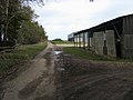
 Coming into Crawley - geograph.org.uk - 1106525.jpg 640 × 427; 77 KB
-
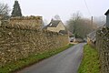
 Crawley village and war memorial - geograph.org.uk - 409125.jpg 640 × 480; 96 KB
-
 Crawley Bridge - geograph.org.uk - 3985432.jpg 640 × 480; 141 KB
-

-
 Dip in the road - geograph.org.uk - 1106407.jpg 640 × 427; 59 KB
-
 Dry Lane - geograph.org.uk - 4399849.jpg 800 × 450; 161 KB
-
 Entrance to a foggy Crawley on Leafield Road - geograph.org.uk - 5264516.jpg 1,024 × 683; 181 KB
-
 Farmland at the former RAF Akeman Street - geograph.org.uk - 1850066.jpg 3,008 × 2,000; 1.61 MB
-
 Fence adjoining former RAF Akeman Street - geograph.org.uk - 1850076.jpg 3,008 × 2,000; 1.19 MB
-
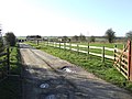
 Fields at Breach Farm - geograph.org.uk - 3422795.jpg 2,592 × 1,944; 1.86 MB
-
 Fields at Broken Hatch Farm - geograph.org.uk - 3422796.jpg 2,592 × 1,944; 1.75 MB
-
 Foxburrow Lane passes The Crawley Inn - geograph.org.uk - 3059633.jpg 3,563 × 2,664; 1.83 MB
-

-
 Junction near Broken Hatch Farm - geograph.org.uk - 1982247.jpg 640 × 480; 62 KB
-
 Junction near Crawley - geograph.org.uk - 1106424.jpg 640 × 427; 41 KB
-
 Kissing gate and footpath - geograph.org.uk - 2734630.jpg 640 × 480; 120 KB
-
 Lane junction north of Crawley - geograph.org.uk - 3985440.jpg 640 × 480; 101 KB
-
 Lane to Middletown - geograph.org.uk - 2777506.jpg 640 × 480; 65 KB
-
 Leafield Road - geograph.org.uk - 2777500.jpg 640 × 480; 51 KB
-
 Leafield Road passes The Lamb - geograph.org.uk - 3059625.jpg 3,417 × 2,576; 1.55 MB
-
 Looking east down Farm Lane - geograph.org.uk - 5263787.jpg 1,024 × 683; 192 KB
-

-
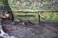 Partly-buried benchmark on Crawley Bridge - geograph.org.uk - 5264494.jpg 1,024 × 683; 323 KB
-
 Pillbox in the hedgerow - geograph.org.uk - 1850846.jpg 3,008 × 2,000; 1.56 MB
-
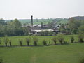
 Priest Hill (Hailey) sewage pumping station - geograph.org.uk - 4824120.jpg 1,024 × 683; 194 KB
-
 Priest Hill Lane - geograph.org.uk - 2777531.jpg 640 × 480; 60 KB
-
 Riding Lane junction south of Breach Farm - geograph.org.uk - 3059605.jpg 3,648 × 2,736; 1.72 MB
-
 Riding Lane south of the Scrap Yard - geograph.org.uk - 3059601.jpg 3,430 × 2,580; 1.34 MB
-
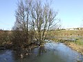 River Windrush - geograph.org.uk - 319435.jpg 640 × 480; 104 KB
-
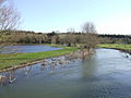 River Windrush in flood - geograph.org.uk - 319441.jpg 640 × 480; 82 KB
-
 River Windrush near Crawley - geograph.org.uk - 3929179.jpg 4,320 × 3,240; 3.45 MB
-

-
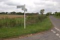
 Road to Hailey - geograph.org.uk - 1578750.jpg 640 × 427; 82 KB
-
 Sunday morning walkers on the former Akeman Street - geograph.org.uk - 1850097.jpg 3,008 × 2,000; 1.54 MB
-
 The B4022 entering Hailey - geograph.org.uk - 6248380.jpg 2,700 × 2,025; 552 KB
-
 The lane to Leafield - geograph.org.uk - 1850022.jpg 3,008 × 2,000; 1.53 MB
-
 The lane to Minster Lovell - geograph.org.uk - 1850007.jpg 3,008 × 2,000; 1.51 MB
-
 The NE end of Dry Lane - geograph.org.uk - 5264502.jpg 1,024 × 683; 199 KB
-

-
 Track follows the line of Akeman Street - geograph.org.uk - 1982260.jpg 640 × 480; 131 KB
-
 Traffic lights at the bridge - geograph.org.uk - 1106434.jpg 640 × 427; 66 KB
-
 West Lane - geograph.org.uk - 2777597.jpg 640 × 480; 120 KB
-
 Akeman Street crosses Rising Lane - geograph.org.uk - 319345.jpg 640 × 480; 104 KB
-
-
 Crawley village - geograph.org.uk - 319430.jpg 640 × 480; 82 KB
-
 Lane, field and wood - geograph.org.uk - 319361.jpg 640 × 480; 90 KB
-
 Milking Lane - geograph.org.uk - 319421.jpg 640 × 480; 121 KB
-
 Riding Lane junction - geograph.org.uk - 319364.jpg 640 × 480; 74 KB
-
 Track to Field Farm - geograph.org.uk - 319423.jpg 640 × 480; 88 KB
-


_sewage_pumping_station_-_geograph.org.uk_-_4824120.jpg)


_-_geograph.org.uk_-_13733.jpg)
_by_River_Windrush_-_geograph.org.uk_-_409121.jpg)