Category:Crockenhill
English: Crockenhill lies immediately south of Swanley town in Kent. In the first half of the twentieth century, it was an important area for growing peppermint. In the 1930s there were 420 acres (1.7 km²) under cultivation; the last crop was harvested in 1958.
village in United Kingdom  | |||||
| Upload media | |||||
| Instance of | |||||
|---|---|---|---|---|---|
| Location | Sevenoaks, Kent, South East England, England | ||||
| Different from | |||||
 | |||||
Subcategories
This category has the following 5 subcategories, out of 5 total.
Media in category "Crockenhill"
The following 200 files are in this category, out of 254 total.
(previous page) (next page)-

-
 1 mile from Junction 3, M25 - geograph.org.uk - 3307272.jpg 640 × 430; 50 KB
-
 A20 - geograph.org.uk - 3447772.jpg 640 × 430; 48 KB
-
 A20 at Swanley - geograph.org.uk - 3802447.jpg 1,024 × 768; 197 KB
-
 A20 looking west - geograph.org.uk - 3802455.jpg 640 × 428; 85 KB
-
 A20 Swanley By-Pass - geograph.org.uk - 4736389.jpg 2,272 × 1,704; 780 KB
-
 Allotments in Crockenhill - geograph.org.uk - 1302947.jpg 640 × 480; 125 KB
-
 Alongside Parkgate Farm - geograph.org.uk - 5885120.jpg 1,024 × 678; 734 KB
-

-
 Banded demoiselle - geograph.org.uk - 191598.jpg 640 × 426; 80 KB
-
 Baptist church from the cemetery opposite - geograph.org.uk - 987054.jpg 640 × 480; 226 KB
-
 Bransell Close, Crockenhill - geograph.org.uk - 4736321.jpg 2,272 × 1,704; 780 KB
-

-
 Bridge and tunnel - geograph.org.uk - 2979037.jpg 1,024 × 768; 352 KB
-
 Bridge over the A20 at Swanley - geograph.org.uk - 3802452.jpg 1,024 × 768; 221 KB
-
 Bridleway from Petham Court - geograph.org.uk - 1302981.jpg 640 × 480; 170 KB
-
 Broadway, Crockenhill - geograph.org.uk - 4736356.jpg 2,272 × 1,704; 756 KB
-
 Broadway, Crockenhill - geograph.org.uk - 984953.jpg 640 × 480; 224 KB
-
 Bus stop on Goldsel Road, Swanley - geograph.org.uk - 2889036.jpg 1,600 × 1,200; 593 KB
-
 Byway sign at Petham Court - geograph.org.uk - 3802479.jpg 640 × 480; 143 KB
-
 Cabbage harvesting - geograph.org.uk - 2126634.jpg 640 × 428; 103 KB
-
 Cacketshill Wood - geograph.org.uk - 1302954.jpg 640 × 480; 60 KB
-
 Canary Wharf from M25 - geograph.org.uk - 2728238.jpg 1,024 × 685; 55 KB
-
 Cemetery opposite the baptist chapel - geograph.org.uk - 987052.jpg 640 × 480; 230 KB
-
 Chequers pub, Crockenhill.jpg 2,016 × 1,512; 1,014 KB
-
 Church Road, Crockenhill - geograph.org.uk - 4736288.jpg 2,272 × 1,704; 797 KB
-
 Coal Tax Post no 201 - geograph.org.uk - 5881576.jpg 678 × 1,024; 1.04 MB
-
 Coal Tax Post no 202 - geograph.org.uk - 5881275.jpg 678 × 1,024; 825 KB
-
 Cray Road - geograph.org.uk - 5881285.jpg 1,024 × 678; 877 KB
-
 Cray Road - geograph.org.uk - 5881296.jpg 1,024 × 678; 835 KB
-
 Cray Road Crockenhill - geograph.org.uk - 2888655.jpg 1,600 × 1,200; 528 KB
-
 Cray Road, Crockenhill - geograph.org.uk - 2889096.jpg 1,600 × 1,200; 627 KB
-
 Cray Road, Crockenhill - geograph.org.uk - 4736318.jpg 2,272 × 1,704; 897 KB
-
 Cray Road, Crockenhill - geograph.org.uk - 4736323.jpg 2,272 × 1,704; 864 KB
-
 Cray Road, Crockenhill - geograph.org.uk - 4736337.jpg 2,272 × 1,704; 763 KB
-
 Crockenhill Baptist church - geograph.org.uk - 985188.jpg 640 × 480; 198 KB
-
 Crockenhill Baptist church notice board - geograph.org.uk - 985203.jpg 640 × 480; 160 KB
-

-
 Crockenhill crossroads - geograph.org.uk - 1834782.jpg 640 × 426; 87 KB
-

-
 Crockenhill Lane bridge over the M25 - geograph.org.uk - 3802543.jpg 1,024 × 768; 261 KB
-
 Crockenhill Lane Bridge, M25 - geograph.org.uk - 3307270.jpg 640 × 430; 45 KB
-
 Crockenhill Lane Bridge, M25 - geograph.org.uk - 3731151.jpg 640 × 430; 49 KB
-
 Crockenhill Lane Bridge, M25 - geograph.org.uk - 5724546.jpg 640 × 426; 45 KB
-
 Crockenhill Lane crossing the M25 - geograph.org.uk - 4426619.jpg 2,560 × 1,920; 1.61 MB
-

-
 Crockenhill primary school - geograph.org.uk - 987063.jpg 640 × 480; 186 KB
-
 Crockenhill primary school - geograph.org.uk - 987066.jpg 640 × 480; 278 KB
-
 Crockenhill Recreational Ground - geograph.org.uk - 2525995.jpg 3,072 × 2,304; 2.11 MB
-
 Crockenhill Road, St Mary Cray - geograph.org.uk - 676291.jpg 640 × 480; 72 KB
-
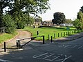
 Crockenhill village green - geograph.org.uk - 2979014.jpg 1,024 × 768; 177 KB
-
 Crockenhill Village Hall - geograph.org.uk - 163770.jpg 640 × 480; 79 KB
-
 Crockenhill village shops - geograph.org.uk - 2979023.jpg 1,024 × 768; 163 KB
-
 Crockenhill village sign - geograph.org.uk - 2979018.jpg 480 × 640; 135 KB
-
 Crockenhill village sign - geograph.org.uk - 984963.jpg 480 × 640; 173 KB
-
 Crockenhill War Memorial - geograph.org.uk - 2134901.jpg 640 × 428; 130 KB
-
 Crockenhill War Memorial - geograph.org.uk - 2766274.jpg 4,000 × 3,000; 4.12 MB
-
 Crockenhill War Memorial - geograph.org.uk - 2766275.jpg 4,000 × 3,000; 4.3 MB
-
 Crockenhill War Memorial - geograph.org.uk - 4736382.jpg 2,272 × 1,704; 1.11 MB
-
 Cropped Field off Eynsford Road - geograph.org.uk - 2059588.jpg 640 × 480; 107 KB
-
 Crouch Farm, near Crockenhill, Kent - geograph.org.uk - 159018.jpg 640 × 480; 92 KB
-
 Crouch Farm, near Crockenhill, Kent - geograph.org.uk - 873490.jpg 640 × 480; 93 KB
-
 Daltons Road - geograph.org.uk - 3334801.jpg 4,000 × 3,000; 4.29 MB
-
 Daltons Road - geograph.org.uk - 5881578.jpg 1,024 × 678; 834 KB
-
 Daltons Road - geograph.org.uk - 5882027.jpg 1,024 × 678; 1.12 MB
-
 Daltons Road, Crockenhill - geograph.org.uk - 4736303.jpg 2,272 × 1,704; 805 KB
-
 Daltons Road, Well Hill - geograph.org.uk - 1593816.jpg 640 × 480; 113 KB
-
 Darns Hill - geograph.org.uk - 5881525.jpg 1,024 × 678; 647 KB
-
 Darns Hill Cottages - geograph.org.uk - 5881529.jpg 1,024 × 678; 840 KB
-
 Derelict tractor - geograph.org.uk - 5884544.jpg 1,024 × 683; 173 KB
-
 Driveway through Lullingstone Park - geograph.org.uk - 5716719.jpg 640 × 480; 72 KB
-
 Entrance to Red Cow Farm on Eynsford Road - geograph.org.uk - 987043.jpg 640 × 480; 287 KB
-

-
 Eynsford Road leaving Crockenhill - geograph.org.uk - 4426495.jpg 2,560 × 1,920; 2.01 MB
-
 Eynsford Road leaving Crockenhill - geograph.org.uk - 4426528.jpg 2,560 × 1,920; 1.89 MB
-
 Eynsford Road near Crockenhill - geograph.org.uk - 2766315.jpg 4,000 × 3,000; 4.06 MB
-
 Eynsford Road near the M25 - geograph.org.uk - 2766368.jpg 4,000 × 3,000; 4.34 MB
-
 Eynsford Road, Crockenhill - geograph.org.uk - 1362938.jpg 640 × 480; 81 KB
-
 Farm track - geograph.org.uk - 5885106.jpg 1,024 × 678; 770 KB
-
 Farm track - geograph.org.uk - 5885107.jpg 1,024 × 678; 825 KB
-
 Farm track by M25 - geograph.org.uk - 3801594.jpg 640 × 428; 100 KB
-
 Farm track parallel to M25 Motorway - geograph.org.uk - 1349871.jpg 640 × 480; 87 KB
-
 Field at Petham Court - geograph.org.uk - 3802470.jpg 1,024 × 768; 443 KB
-

-

-
 Field of cabbages - geograph.org.uk - 3801585.jpg 640 × 428; 120 KB
-
 Field off Daltons Road - geograph.org.uk - 5884959.jpg 1,024 × 678; 709 KB
-
 Field off Daltons Road - geograph.org.uk - 5884970.jpg 1,024 × 678; 951 KB
-
 Field with London skyline - geograph.org.uk - 5884560.jpg 1,024 × 683; 152 KB
-
 Fields by Goldsel Road, Swanley - geograph.org.uk - 2889356.jpg 1,600 × 1,200; 586 KB
-
 Flooded subway - geograph.org.uk - 5885105.jpg 1,024 × 678; 987 KB
-
 Footbridge near Swanley - geograph.org.uk - 2526021.jpg 3,072 × 2,304; 2.23 MB
-
 Footpath - geograph.org.uk - 5882043.jpg 1,024 × 678; 848 KB
-
 Footpath - geograph.org.uk - 5884974.jpg 1,024 × 678; 730 KB
-
 Footpath - geograph.org.uk - 5885109.jpg 1,024 × 678; 921 KB
-
 Footpath alongside the M25 - geograph.org.uk - 3334874.jpg 4,000 × 3,000; 3.99 MB
-
 Footpath at Daltons Road - geograph.org.uk - 3334808.jpg 4,000 × 3,000; 4.09 MB
-
 Footpath junction near Gables Farm - geograph.org.uk - 1302917.jpg 640 × 480; 125 KB
-
 Footpath junction near Roughet - geograph.org.uk - 1302888.jpg 640 × 480; 151 KB
-
 Footpath near Crockenhill - geograph.org.uk - 2766279.jpg 4,000 × 3,000; 4.03 MB
-
 Footpath near Crockenhill - geograph.org.uk - 3437033.jpg 4,000 × 3,000; 4.44 MB
-
 Footpath near Crockenhill - geograph.org.uk - 5884516.jpg 1,024 × 683; 203 KB
-

-

-
 Footpath to Crockenhill - geograph.org.uk - 3437023.jpg 4,000 × 3,000; 4.25 MB
-
 Footpath to Stones Cross Road - geograph.org.uk - 2525959.jpg 3,072 × 2,304; 2.27 MB
-
 Footpath towards Crockenhill - geograph.org.uk - 3437066.jpg 4,000 × 3,000; 4.07 MB
-
 Footpath west from Petham Court - geograph.org.uk - 3802474.jpg 1,024 × 768; 350 KB
-

-
 Gables Farm - geograph.org.uk - 5881571.jpg 1,024 × 678; 848 KB
-
 Gate on footpath - geograph.org.uk - 1302881.jpg 640 × 480; 119 KB
-
 Gates, Parkgate Farm - geograph.org.uk - 2126696.jpg 640 × 428; 154 KB
-
 Goldsel Road Bridge over the A20 - geograph.org.uk - 3634925.jpg 640 × 480; 238 KB
-
 Green Court Road, Crockenhill - geograph.org.uk - 4736364.jpg 2,272 × 1,704; 768 KB
-
 Green Court Road, Crockenhill - geograph.org.uk - 4736385.jpg 2,272 × 1,704; 938 KB
-
 Green Court Road, Crockenhill, Kent - geograph.org.uk - 1138976.jpg 640 × 480; 69 KB
-
 Green Court Sports Club - geograph.org.uk - 3802488.jpg 640 × 428; 103 KB
-
 Half mile to J3, M25 - geograph.org.uk - 5724542.jpg 640 × 426; 37 KB
-
 Harvest Way, Crockenhill - geograph.org.uk - 4736298.jpg 2,272 × 1,704; 697 KB
-
 Harvestfield Park - geograph.org.uk - 1302941.jpg 640 × 480; 96 KB
-
 Horse and poplar trees - geograph.org.uk - 159049.jpg 640 × 480; 70 KB
-
 Horse near Darns Hill - geograph.org.uk - 2766289.jpg 4,000 × 3,000; 4.39 MB
-
 House on Eynsford Road - geograph.org.uk - 3802499.jpg 1,024 × 768; 355 KB
-
 House on Eynsford Road, Crockenhill - geograph.org.uk - 4426558.jpg 2,560 × 1,920; 1.99 MB
-
 Junction of Old Chapel Road - geograph.org.uk - 985106.jpg 640 × 480; 224 KB
-
 Line of tall trees, Crockenhill - geograph.org.uk - 5884550.jpg 1,024 × 683; 210 KB
-
 London coal tax pillar - geograph.org.uk - 3802512.jpg 640 × 428; 109 KB
-

-
 Lovely sign for the Fruiterers Arms - geograph.org.uk - 985226.jpg 480 × 640; 191 KB
-
 Lullingstone Park golf course - geograph.org.uk - 3801636.jpg 640 × 428; 109 KB
-
 Lullingstone Park golf course - geograph.org.uk - 5885126.jpg 1,024 × 678; 547 KB
-

-
 Lych gate, All Souls (geograph 6708019).jpg 1,024 × 684; 285 KB
-
 M25 - cutting by Daisy Farm - geograph.org.uk - 3107741.jpg 800 × 561; 73 KB
-
 M25 anticlockwise towards junction 3 - geograph.org.uk - 3485409.jpg 1,947 × 1,084; 1.04 MB
-
 M25 approaching junction 3 (M20) - geograph.org.uk - 3104728.jpg 800 × 582; 71 KB
-
 M25 clockwise - geograph.org.uk - 4231777.jpg 640 × 449; 53 KB
-
 M25 clockwise - geograph.org.uk - 4231783.jpg 640 × 480; 41 KB
-
 M25 from Parkgate Road bridge - geograph.org.uk - 3334869.jpg 4,000 × 3,000; 3.95 MB
-
 M25 near Parkgate Farm - geograph.org.uk - 2584818.jpg 640 × 430; 69 KB
-
 M25 near Swanley - geograph.org.uk - 2584825.jpg 640 × 430; 62 KB
-
 M25 one mile to junction 4 sign - geograph.org.uk - 3458495.jpg 1,599 × 961; 853 KB
-
 M25 south of Junction 3 - geograph.org.uk - 3802541.jpg 1,024 × 768; 140 KB
-
 M25 southbound - geograph.org.uk - 2735352.jpg 640 × 393; 47 KB
-
 M25 towards junction 3 - geograph.org.uk - 3449960.jpg 1,617 × 1,032; 834 KB
-
 M25 towards Swanley - geograph.org.uk - 3449967.jpg 1,641 × 976; 762 KB
-
 M25, anti-clockwise - geograph.org.uk - 5724537.jpg 640 × 426; 38 KB
-
 M25, anticlockwise - geograph.org.uk - 3307275.jpg 640 × 452; 43 KB
-
 M25, northbound - geograph.org.uk - 3731136.jpg 640 × 430; 46 KB
-
 M25, northbound - geograph.org.uk - 3731143.jpg 640 × 430; 41 KB
-
 M25, northbound - geograph.org.uk - 3736890.jpg 640 × 430; 46 KB
-
 M25, Parkgate Road Bridge - geograph.org.uk - 3307278.jpg 640 × 430; 41 KB
-
 Main Road, Crockenhill - geograph.org.uk - 4736283.jpg 2,272 × 1,704; 763 KB
-

-

-
 Marwood House - geograph.org.uk - 2526014.jpg 3,072 × 2,304; 1.84 MB
-
 Mast by the M25 - geograph.org.uk - 3731148.jpg 640 × 430; 34 KB
-
 Modern House on Skeet Hill - geograph.org.uk - 1355382.jpg 640 × 480; 68 KB
-
 Modest bike jumps, Harvestfield Park - geograph.org.uk - 2134944.jpg 640 × 428; 103 KB
-
 Near Gables Farm - geograph.org.uk - 5881531.jpg 1,024 × 678; 806 KB
-
 Near Gables Farm - geograph.org.uk - 5881535.jpg 1,024 × 678; 643 KB
-
 Near Gables Farm - geograph.org.uk - 5881538.jpg 1,024 × 678; 651 KB
-
 Old Chapel Road, Crockenhill - geograph.org.uk - 2889323.jpg 1,600 × 1,200; 543 KB
-
 Old Chapel Road, Crockenhill - geograph.org.uk - 4736306.jpg 2,272 × 1,704; 832 KB
-
 Old Chapel Road, Crockenhill - geograph.org.uk - 4736341.jpg 2,272 × 1,704; 809 KB
-
 Overgrown path west of Crockenhill - geograph.org.uk - 5884543.jpg 1,024 × 683; 241 KB
-
 Parade of shops, Crockenhill - geograph.org.uk - 984937.jpg 640 × 480; 201 KB
-
 Parkgate Road Bridge, M25 - geograph.org.uk - 2739352.jpg 640 × 451; 49 KB
-
 Parkgate Road Bridge, M25 - geograph.org.uk - 3729786.jpg 640 × 471; 53 KB
-
 Parkgate Road Bridge, M25 - geograph.org.uk - 5724533.jpg 640 × 426; 43 KB
-
 Path junction, Lullingstone Country Park - geograph.org.uk - 2126892.jpg 640 × 428; 157 KB
-
 Path junction, Lullingstone Country Park - geograph.org.uk - 3801653.jpg 640 × 428; 164 KB
-
 Path to Swanley - geograph.org.uk - 3802491.jpg 1,024 × 768; 441 KB
-
 Pear Tree Cottages - geograph.org.uk - 5881304.jpg 1,024 × 678; 916 KB
-
 Petham Court Allotments - geograph.org.uk - 3802467.jpg 1,024 × 768; 555 KB
-
 Petham Court Oasthouse - geograph.org.uk - 3802481.jpg 1,024 × 768; 290 KB
-
 Playing field from Stone Cross Road - geograph.org.uk - 987070.jpg 640 × 480; 216 KB
-
 Pre-Warboys road sign - geograph.org.uk - 1834801.jpg 640 × 426; 111 KB
-
 Public footpath from Old Chapel Road - geograph.org.uk - 984993.jpg 640 × 480; 308 KB
-
 Pylon by M25 - geograph.org.uk - 5726309.jpg 640 × 425; 31 KB
-
 Pylon by the M25 - geograph.org.uk - 3731140.jpg 640 × 430; 43 KB
-
 Railway bridge over A20 - geograph.org.uk - 3465929.jpg 640 × 427; 71 KB
-
 Railway to St Mary Cray - geograph.org.uk - 2526042.jpg 3,072 × 2,304; 1.86 MB
-
 Railway to Swanley - geograph.org.uk - 2526035.jpg 2,836 × 2,304; 1.91 MB
-
 Railway towards London - geograph.org.uk - 2979043.jpg 1,023 × 768; 244 KB
-
 Railway west of Swanley - geograph.org.uk - 1749853.jpg 640 × 426; 87 KB
-
 Recently mown field - geograph.org.uk - 5884561.jpg 1,024 × 683; 210 KB
-
 Shops on Broadway, Crockenhill - geograph.org.uk - 985115.jpg 640 × 480; 169 KB
-
 Skeet Hill Lane - geograph.org.uk - 3334839.jpg 4,000 × 3,000; 4.42 MB
-
 Skeet Hill Lane, near Lullingstone - geograph.org.uk - 2801824.jpg 1,600 × 1,200; 485 KB
-
 Skeet Hill Lane, Skeet Hill - geograph.org.uk - 1397636.jpg 640 × 480; 99 KB
-

-
 Sounds Lodge, Crockenhill - geograph.org.uk - 2889117.jpg 1,600 × 1,200; 667 KB
-
 Southbound A20 near Swanley - geograph.org.uk - 3634916.jpg 640 × 480; 262 KB
-
 Stones Cross Road, Crockenhill - geograph.org.uk - 4736374.jpg 2,272 × 1,704; 925 KB
-
 Stones Cross Road, Crockenhill, Kent - geograph.org.uk - 1138978.jpg 640 × 480; 75 KB
-
 Subway under M25 - geograph.org.uk - 1302967.jpg 640 × 480; 85 KB
-
 Subway under M25 Motorway - geograph.org.uk - 1302884.jpg 640 × 480; 80 KB
-
 Telecoms for the M25 - geograph.org.uk - 191139.jpg 640 × 426; 78 KB
-


.jpg)


_-_geograph.org.uk_-_3104728.jpg)


