Category:Crossflatts
village in United Kingdom  | |||||
| Upload media | |||||
| Instance of | |||||
|---|---|---|---|---|---|
| Location | Bingley, Bradford, West Yorkshire, Yorkshire and the Humber, England | ||||
 | |||||
English: Crossflatts is a ribbon development in Airedale along the old route of the A650 road between Bingley and Keighley, in the Metropolitan Borough of Bradford, West Yorkshire, England. The building of the Aire Valley Trunk road in recent decades has moved the bulk of the traffic away from it.
Subcategories
This category has the following 3 subcategories, out of 3 total.
C
Media in category "Crossflatts"
The following 38 files are in this category, out of 38 total.
-
 Aire Street - Canal Road - geograph.org.uk - 1119046.jpg 640 × 480; 212 KB
-

-
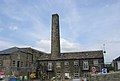 Airedale Mills - Micklethwaite Lane - geograph.org.uk - 835020.jpg 640 × 434; 39 KB
-
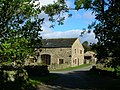 Barn conversion at Marley - geograph.org.uk - 1530496.jpg 640 × 480; 129 KB
-
 Bingley By-pass - Keighley Road - geograph.org.uk - 835038.jpg 640 × 423; 40 KB
-
 Bingley By-pass - Keighley Road - geograph.org.uk - 835040.jpg 640 × 416; 44 KB
-
 Bridge TJC3-64 - A650 - Crossflatts - geograph.org.uk - 835070.jpg 640 × 400; 35 KB
-
 Canal East of Morton Swing Bridge - geograph.org.uk - 1069333.jpg 640 × 480; 85 KB
-
 Castlefields Lane - Keighley Road - geograph.org.uk - 1119048.jpg 640 × 480; 277 KB
-
 Castlefields Road - Castlefields Lane - geograph.org.uk - 1119049.jpg 640 × 444; 195 KB
-
 Cedar Street - Canal Road - geograph.org.uk - 1119045.jpg 640 × 443; 201 KB
-
 Crossflatts Main Street - geograph.org.uk - 86177.jpg 640 × 426; 103 KB
-

-
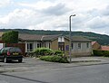
 Crossflatts Primary School - Morton Lane - geograph.org.uk - 1119026.jpg 640 × 480; 298 KB
-

-

-

-

-
-
 Micklethwaite Swing Bridge, Crossflatts - geograph.org.uk - 25254.jpg 640 × 480; 140 KB
-
 Milestone next to Morton swing bridge (geograph 6052640).jpg 1,024 × 768; 188 KB
-

-
 Playground - Queen's Road - geograph.org.uk - 1119042.jpg 640 × 434; 243 KB
-
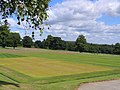
 Playing Fields - Queen's Road - geograph.org.uk - 1119043.jpg 640 × 433; 168 KB
-

-
 Ravenroyd.jpg 5,685 × 3,790; 19.34 MB
-
 Ryshworth Club Ltd - Keighley Road - geograph.org.uk - 835032.jpg 640 × 400; 48 KB
-
-
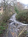 Stream - Morton Lane - geograph.org.uk - 1119027.jpg 480 × 640; 305 KB
-
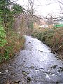 Stream - Morton Lane - geograph.org.uk - 1119028.jpg 480 × 640; 320 KB
-
 Sty Lane - geograph.org.uk - 1069337.jpg 640 × 480; 82 KB
-

-
 The Crescent - Keighley Road - geograph.org.uk - 1119035.jpg 640 × 445; 161 KB
-

-
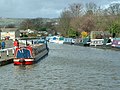
 Crossflatts Boatyard - geograph.org.uk - 353119.jpg 640 × 480; 100 KB
-
 Floral display centre of Bingley - geograph.org.uk - 356471.jpg 640 × 425; 186 KB
-
 Micklethwaite Wharf - geograph.org.uk - 353115.jpg 640 × 480; 105 KB
-
 Sports Turf Research Institute - geograph.org.uk - 40329.jpg 640 × 480; 91 KB


.jpg)


