Category:Crowle, Lincolnshire, photographs taken on 2009-03-12
Media in category "Crowle, Lincolnshire, photographs taken on 2009-03-12"
The following 12 files are in this category, out of 12 total.
-
 Brewery Road into Crowle - geograph.org.uk - 1201147.jpg 640 × 480; 95 KB
-
 Bridleway to Bonnyhale Road - geograph.org.uk - 1200853.jpg 640 × 480; 57 KB
-
 Bridleway to Medge Hall - geograph.org.uk - 1201063.jpg 640 × 480; 35 KB
-
 Cottage Farm - geograph.org.uk - 1201096.jpg 640 × 480; 52 KB
-
 Entrance to Crowle Cemetery - geograph.org.uk - 1201082.jpg 640 × 480; 68 KB
-
 Fields to Masons Poultry Farm - geograph.org.uk - 1200766.jpg 640 × 480; 64 KB
-
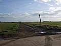
 Lane to West Ings - geograph.org.uk - 1200743.jpg 640 × 480; 78 KB
-
 Lone tree - geograph.org.uk - 1200726.jpg 640 × 480; 84 KB
-
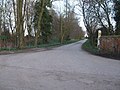
 North Axholme Comprehensive School - geograph.org.uk - 1200943.jpg 640 × 480; 105 KB
-
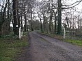 Private lane to Tetley Hall - geograph.org.uk - 1200930.jpg 640 × 480; 118 KB
-
 Road to Curlews farm - geograph.org.uk - 1200909.jpg 640 × 480; 99 KB
-
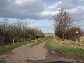 Track to Eastoft Moors Drain - geograph.org.uk - 1200818.jpg 640 × 480; 73 KB


