Category:Cyfrwy

mountain (811m) in Gwynedd  | |||||
| Upload media | |||||
| Instance of | |||||
|---|---|---|---|---|---|
| Part of | |||||
| Location | Gwynedd, Wales | ||||
| Mountain range | |||||
| Topographic prominence |
| ||||
| Elevation above sea level |
| ||||
| Parent peak | |||||
 | |||||
Media in category "Cyfrwy"
The following 44 files are in this category, out of 44 total.
-
 A look back at Cyfrwy and Craig Las - geograph.org.uk - 1314855.jpg 640 × 480; 98 KB
-
 Banc-y-Frân - geograph.org.uk - 1752273.jpg 1,024 × 768; 222 KB
-
 Barmouth from Cadair Idris - geograph.org.uk - 1264812.jpg 640 × 480; 61 KB
-
 Cadair Idris and Cyfrwy - geograph.org.uk - 1017986.jpg 640 × 426; 44 KB
-
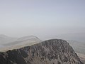
 Cadair Idris from Cyfrwy (The Saddle) - geograph.org.uk - 1264825.jpg 640 × 480; 102 KB
-

-
 Cadair Idris seen from Carnedd Lŵyd - geograph.org.uk - 1631067.jpg 800 × 600; 666 KB
-
 Cader Idris and Cyfrwy - geograph.org.uk - 1313363.jpg 640 × 480; 90 KB
-
 Cader Idris and Cyfrwy - geograph.org.uk - 1313542.jpg 640 × 480; 51 KB
-
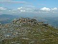 Cairn on Cyfrwy - geograph.org.uk - 1101367.jpg 640 × 480; 80 KB
-
 Cyfrwy - geograph.org.uk - 1017980.jpg 640 × 426; 62 KB
-
 Cyfrwy - geograph.org.uk - 1199972.jpg 640 × 417; 69 KB
-

-
 Cyfrwy and Llyn y Gadair below - geograph.org.uk - 1017967.jpg 426 × 640; 61 KB
-
 Cyfrwy Arete, Cadair Idris - geograph.org.uk - 16023.jpg 640 × 456; 99 KB
-
 Cyfrwy from high up on the Pony Path - geograph.org.uk - 520460.jpg 800 × 508; 228 KB
-

-
 Cyfrwy from the shores of Llyn y Gadair - geograph.org.uk - 358687.jpg 640 × 480; 102 KB
-
 Cyfrwy from the west - geograph.org.uk - 1082220.jpg 640 × 425; 85 KB
-
 Cyfrwy from the west - geograph.org.uk - 1615856.jpg 800 × 600; 199 KB
-

-
 Field by Dyffrydan - geograph.org.uk - 1032849.jpg 640 × 437; 111 KB
-
 Llyn y Gadair - geograph.org.uk - 1017970.jpg 426 × 640; 64 KB
-
 Llyn y Gadair - geograph.org.uk - 1017976.jpg 426 × 640; 61 KB
-
 Llyn y Gadair - geograph.org.uk - 1024528.jpg 640 × 426; 84 KB
-

-
 Llynnau Cregennen - geograph.org.uk - 1027906.jpg 640 × 423; 33 KB
-

-
 North from Cadair Idris. - geograph.org.uk - 1188010.jpg 640 × 427; 52 KB
-
 On the Pony Path - geograph.org.uk - 1313568.jpg 640 × 480; 94 KB
-
 Scarp of Cadair Idris, winter. - geograph.org.uk - 1188033.jpg 480 × 640; 53 KB
-
 Slopes north of Rhiw Gwredydd - geograph.org.uk - 879855.jpg 1,000 × 679; 280 KB
-
 The Cyfrwy Crags from above Llyn y Gadair - geograph.org.uk - 358653.jpg 480 × 640; 122 KB
-
 The final ascent - geograph.org.uk - 1618339.jpg 640 × 428; 71 KB
-
 The morainic belt below Llyn Gadair - geograph.org.uk - 372400.jpg 640 × 480; 66 KB
-
 The northwest face of Pen y Gadair - geograph.org.uk - 1101548.jpg 640 × 431; 168 KB
-

-
-
 View east from Carnedd Lwyd - geograph.org.uk - 519753.jpg 1,000 × 750; 375 KB
-
 View from Cyfrwy - geograph.org.uk - 1017973.jpg 426 × 640; 59 KB
-
 View towards Cyfrwy from Craig Cau - geograph.org.uk - 1615794.jpg 800 × 600; 186 KB
-
 Carnedd Lwyd summit - geograph.org.uk - 464758.jpg 640 × 479; 58 KB
-
 On the Pony Path - geograph.org.uk - 520483.jpg 800 × 600; 230 KB
-
 Slopes north of Cyfrwy - geograph.org.uk - 519760.jpg 1,000 × 750; 325 KB


_-_geograph.org.uk_-_1264825.jpg)


_-_geograph.org.uk_-_358660.jpg)


