Category:Dalbeattie Forest
Media in category "Dalbeattie Forest"
The following 69 files are in this category, out of 69 total.
-
 7 Stanes Cycle Trail, Dalbeattie - geograph.org.uk - 1030871.jpg 640 × 480; 116 KB
-
 Car park, Dalbeattie Town Woods - geograph.org.uk - 1531540.jpg 640 × 480; 112 KB
-
 Cycle Trail in Dalbeattie Forest - geograph.org.uk - 392621.jpg 480 × 640; 175 KB
-
 Cycle Trail in Dalbeattie Forest - geograph.org.uk - 392687.jpg 640 × 480; 229 KB
-
 Cycle Trail in Dalbeattie Forest - geograph.org.uk - 392702.jpg 480 × 640; 236 KB
-
 Cycle Trail in Dalbeattie Forest - geograph.org.uk - 392711.jpg 640 × 480; 235 KB
-
 Cycle Trail in Dalbeattie Forest - geograph.org.uk - 392718.jpg 480 × 640; 245 KB
-
 Cycle Trail in Dalbeattie Forest - geograph.org.uk - 392726.jpg 480 × 640; 212 KB
-
 Cycle Trail in Dalbeattie Forest - geograph.org.uk - 392729.jpg 480 × 640; 269 KB
-
 Cycle Trail in Dalbeattie Forest - geograph.org.uk - 392740.jpg 480 × 640; 208 KB
-
 Cycle Trail in Dalbeattie Forest - geograph.org.uk - 392744.jpg 640 × 480; 219 KB
-
 Cycle Trail in Dalbeattie Forest - geograph.org.uk - 392751.jpg 640 × 480; 198 KB
-
 Cycle Trail in Dalbeattie Forest - geograph.org.uk - 392765.jpg 640 × 480; 235 KB
-
 Cycle Trail in Dalbeattie Forest - geograph.org.uk - 392767.jpg 640 × 480; 216 KB
-
 Cycle Trail in Dalbeattie Forest - geograph.org.uk - 392780.jpg 480 × 640; 210 KB
-
 Cycle Trail in Dalbeattie Forest - geograph.org.uk - 392798.jpg 640 × 480; 232 KB
-
 Cycle Trail in Dalbeattie Forest - geograph.org.uk - 392803.jpg 640 × 480; 227 KB
-
 Cycle Trail in Dalbeattie Forest - geograph.org.uk - 392814.jpg 640 × 480; 594 KB
-
 Cycle Trail in Dalbeattie Forest - geograph.org.uk - 392825.jpg 640 × 480; 173 KB
-
 Cycle Trail in Dalbeattie Forest - geograph.org.uk - 392829.jpg 640 × 480; 223 KB
-
 Cycle Trail in Dalbeattie Forest - geograph.org.uk - 392835.jpg 640 × 480; 253 KB
-
 Cycle Trail in Dalbeattie Forest - geograph.org.uk - 392837.jpg 480 × 640; 212 KB
-
 Cycle Trail in Dalbeattie Forest - geograph.org.uk - 392840.jpg 640 × 480; 209 KB
-
 Cycle Trail in Dalbeattie Forest - geograph.org.uk - 392858.jpg 480 × 640; 222 KB
-
 Cycle Trail in Dalbeattie Forest - geograph.org.uk - 392861.jpg 480 × 640; 224 KB
-
 Cycle Trail in Dalbeattie Forest - geograph.org.uk - 392864.jpg 640 × 480; 212 KB
-
 Cycle Trail in Dalbeattie Forest - geograph.org.uk - 392887.jpg 640 × 480; 184 KB
-
 Cycle Trail in Dalbeattie Forest - geograph.org.uk - 392888.jpg 640 × 480; 206 KB
-
 Cycle Trail in Dalbeattie Forest - geograph.org.uk - 392890.jpg 480 × 640; 217 KB
-
 Cycle Trail in Dalbeattie Forest - geograph.org.uk - 392893.jpg 640 × 480; 211 KB
-
 Cycle Trail in Dalbeattie Forest - geograph.org.uk - 392896.jpg 640 × 480; 185 KB
-
 Cycle Trail in Dalbeattie Forest - geograph.org.uk - 392914.jpg 640 × 480; 238 KB
-
 Cycle Trail in Dalbeattie Forest - geograph.org.uk - 453116.jpg 640 × 480; 270 KB
-
 Cycle Trail in Dalbeattie Forest - geograph.org.uk - 453125.jpg 480 × 640; 239 KB
-
 Dalbeattie Forest - geograph.org.uk - 392806.jpg 640 × 480; 216 KB
-
 Dalbeattie Forest - geograph.org.uk - 392810.jpg 640 × 480; 210 KB
-
 Dalbeattie Forest - geograph.org.uk - 392912.jpg 640 × 480; 212 KB
-
 Dalbeattie Town Woods - geograph.org.uk - 1431931.jpg 640 × 480; 131 KB
-
 End of Cycle Trails in Dalbeattie Forest - geograph.org.uk - 392693.jpg 640 × 480; 214 KB
-

-
 Forest Cycle Trail Near Richorn Car Park - geograph.org.uk - 392618.jpg 480 × 640; 253 KB
-
 Forest Track - geograph.org.uk - 577728.jpg 437 × 640; 96 KB
-
 Forest track near Dalbeattie - geograph.org.uk - 501086.jpg 640 × 426; 135 KB
-
 Gorse and Bog in Dalbeattie Forest - geograph.org.uk - 392777.jpg 480 × 640; 217 KB
-
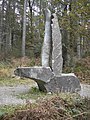 Granite Sculpture. - geograph.org.uk - 614787.jpg 480 × 640; 129 KB
-
 Hardrock Challenge 2007 - geograph.org.uk - 571766.jpg 423 × 640; 164 KB
-
 In Dalbeattie Forest - geograph.org.uk - 577734.jpg 640 × 428; 118 KB
-
 Jacob's Ladder in Dalbeattie Forest - geograph.org.uk - 392910.jpg 480 × 640; 205 KB
-

-
 Log Pile in Dalbeattie Forest - geograph.org.uk - 453109.jpg 480 × 640; 226 KB
-
 Moyle Hill Fort area, Colvend and Southwick.jpg 640 × 480; 133 KB
-
 Moyle Hill Fort, Trig Point, path, and seat, Colvend and Southwick.jpg 2,560 × 1,920; 3.39 MB
-
 Moyle Hill track, Dalbeattie Forest..jpg 427 × 640; 274 KB
-
 Open Area in Dalbeattie Forest - geograph.org.uk - 392844.jpg 640 × 480; 229 KB
-
 Picnic area, Dalbeattie Town Woods - geograph.org.uk - 1531545.jpg 640 × 480; 111 KB
-
 Rally car in Dalbeattie Forest - geograph.org.uk - 501092.jpg 640 × 426; 91 KB
-
 Rally car in Gallowleck Plantation - geograph.org.uk - 501095.jpg 640 × 426; 91 KB
-
 Road junction on the A710 - geograph.org.uk - 1030858.jpg 640 × 480; 107 KB
-
 Spooky Woods in Dalbeattie Forest - geograph.org.uk - 392901.jpg 480 × 640; 192 KB
-
 The Slab in Dalbeattie Forest - geograph.org.uk - 392848.jpg 480 × 640; 197 KB
-
 Track in Dalbeattie Forest - geograph.org.uk - 392771.jpg 640 × 480; 208 KB
-
 Track in Dalbeattie Forest - geograph.org.uk - 392851.jpg 640 × 480; 184 KB
-
 Track in Dalbeattie Forest - geograph.org.uk - 392865.jpg 640 × 480; 184 KB
-
 Track in Dalbeattie Forest - geograph.org.uk - 392877.jpg 640 × 480; 215 KB
-
 Track in Dalbeattie Forest - geograph.org.uk - 392895.jpg 640 × 480; 215 KB
-
 Track in Dalbeattie Forest - geograph.org.uk - 453102.jpg 480 × 640; 230 KB
-
 Western Side of Moyle Hill - geograph.org.uk - 392746.jpg 480 × 640; 225 KB
-
 Windblown Trees in Dalbeattie Forest - geograph.org.uk - 392883.jpg 640 × 480; 640 KB
-
 Woodland path, Dalbeattie - geograph.org.uk - 1431926.jpg 640 × 480; 136 KB


