Category:Dane End
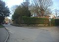
English: Dane End is a village to the north of Ware in Hertfordshire, England situated between the A602 and A10. It is within the East Hertfordshire District Council and has a population of around 700. Dane End means the 'valley ends' and is located where a tributary of the River Lea comes off the surrounding chalk.
human settlement in United Kingdom  | |||||
| Upload media | |||||
| Instance of | |||||
|---|---|---|---|---|---|
| Location |
| ||||
 | |||||
Media in category "Dane End"
The following 13 files are in this category, out of 13 total.
-
 Antique garage, Dane End - geograph.org.uk - 2836470.jpg 1,600 × 1,200; 641 KB
-
 Dane End (5501083850).jpg 2,640 × 1,980; 1.01 MB
-
 Dane End - geograph.org.uk - 194265.jpg 640 × 480; 110 KB
-
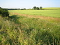 Dane End Tributary and Smart's Hill - geograph.org.uk - 194261.jpg 640 × 480; 130 KB
-
 Dane End village - geograph.org.uk - 2836452.jpg 1,594 × 1,134; 284 KB
-
 Dane End village, Munden Lane - geograph.org.uk - 2836461.jpg 1,600 × 1,200; 554 KB
-
 Dane End, Bridleway to Whitehill Farm - geograph.org.uk - 195180.jpg 640 × 480; 132 KB
-
 Dane End, Munden Road - geograph.org.uk - 194783.jpg 640 × 480; 87 KB
-
 Dane End, The Forge - geograph.org.uk - 194938.jpg 640 × 480; 101 KB
-
 Disused petrol pumps, The Forge, Dane End, Hertfordshire - geograph.org.uk - 1870541.jpg 2,448 × 3,264; 2.46 MB
-
 Old filling station, Dane End - geograph.org.uk - 3445170.jpg 4,320 × 3,240; 4.14 MB
-
 Road to Dane End - geograph.org.uk - 214687.jpg 640 × 480; 105 KB
-
 The Old Forge, Dane End, Hertfordshire - geograph.org.uk - 1871532.jpg 3,264 × 2,448; 2.94 MB

.jpg)


