Category:Danger Point Lighthouse
| Object location | | View all coordinates using: OpenStreetMap |
|---|
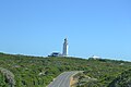
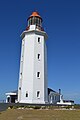
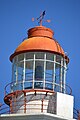
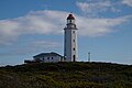
English: Danger Point Lighthouse
lighthouse in South Africa  | |||||
| Upload media | |||||
| Instance of | |||||
|---|---|---|---|---|---|
| Location |
| ||||
| Service entry |
| ||||
| Inception |
| ||||
| Source of energy | |||||
 | |||||
Media in category "Danger Point Lighthouse"
The following 14 files are in this category, out of 14 total.
-
 00000-Danger Point Lighthouse-s.jpg 1,500 × 2,258; 946 KB
-
 1895-Danger Point Lighthouse 01.JPG 4,608 × 3,072; 3.01 MB
-
 1895-Danger Point Lighthouse 02.JPG 4,608 × 3,072; 3.5 MB
-
 1895-Danger Point Lighthouse 03.JPG 3,072 × 4,608; 3.38 MB
-
 1895-Danger Point Lighthouse 04.JPG 3,072 × 4,608; 2.72 MB
-
 Danger Point lighthouse, Gansbaai.jpg 1,200 × 1,600; 340 KB
-
 Danger Point Lighthouse-1895. Near Gansbaai. 01.JPG 3,072 × 4,608; 3.2 MB
-
 Danger Point Lighthouse-1895. Near Gansbaai. 02.JPG 4,608 × 3,072; 3.77 MB
-
 Danger Point Lighthouse-1895. Near Gansbaai. 03.JPG 4,608 × 3,072; 3.84 MB
-
 Danger Point Lighthouse-1895. Near Gansbaai. 04.JPG 4,608 × 3,072; 3.53 MB
-
 Danger Point Lighthouse-1895. Near Gansbaai. 05.JPG 3,072 × 4,608; 3.64 MB
-
 Danger Point Lighthouse-1895. Near Gansbaai. 06.JPG 4,608 × 3,072; 3.25 MB
-
 Danger Point Lighthouse-1895. Near Gansbaai. 07.JPG 3,072 × 4,608; 3.11 MB
-
 Danger point.jpg 4,584 × 3,056; 2.95 MB


