Category:De Goede Hoop, Mijnsheerenland
| Object location | | View all coordinates using: OpenStreetMap |
|---|
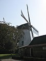
windmill in Mijnsheerenland, Netherlands  | |||||
| Upload media | |||||
| Instance of |
| ||||
|---|---|---|---|---|---|
| Location | Mijnsheerenland, Hoeksche Waard, South Holland, Netherlands | ||||
| Street address |
| ||||
| Located on street |
| ||||
| Has use | |||||
| Heritage designation |
| ||||
| Source of energy | |||||
 | |||||
|
This is a category about rijksmonument number 30150
|
| Address |
|
Media in category "De Goede Hoop, Mijnsheerenland"
The following 3 files are in this category, out of 3 total.
-
 De Goede Hoop - panoramio.jpg 1,944 × 2,592; 1.59 MB
-
 Mijnsheerenland molen.jpg 1,944 × 2,592; 1.69 MB
-
 Poldermolen van achteren gefotografeerd - Mijnsheerenland - 20159370 - RCE.jpg 873 × 1,200; 212 KB

