Category:De Hoge Terhand (OudeIeperstraat, Terhand)
|
This is a category about onroerend erfgoed number 32974
|
| Object location | | View all coordinates using: OpenStreetMap |
|---|
Media in category "De Hoge Terhand (OudeIeperstraat, Terhand)"
The following 2 files are in this category, out of 2 total.
-
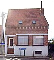 Le Haut Terhand OudeIeperstraat.jpg 2,324 × 2,589; 2.5 MB
-
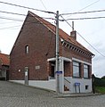 OudeIeperstraat 036 - 145500 - onroerenderfgoed.jpg 591 × 601; 88 KB

