Category:De Hoop, Sprundel
| Object location | | View all coordinates using: OpenStreetMap |
|---|
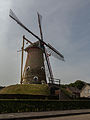
windmill in Sprundel, Netherlands  | |||||
| Upload media | |||||
| Instance of | |||||
|---|---|---|---|---|---|
| Location | Sprundel, Rucphen, North Brabant, Netherlands | ||||
| Street address |
| ||||
| Located on street |
| ||||
| Has use | |||||
| Heritage designation |
| ||||
| Source of energy | |||||
 | |||||
|
This is a category about rijksmonument number 32967
|
| Address |
|
Media in category "De Hoop, Sprundel"
The following 9 files are in this category, out of 9 total.
-
 Bergkorenmolen - Sprundel - 20203617 - RCE.jpg 1,200 × 1,179; 278 KB
-
 Bergkorenmolen - Sprundel - 20203618 - RCE.jpg 1,200 × 1,179; 245 KB
-
 Korenmolen - Sprundel - 20203616 - RCE.jpg 773 × 1,200; 127 KB
-
 Korenmolen, aanzicht - Sprundel - 20203621 - RCE.jpg 788 × 1,200; 149 KB
-
 Korenmolen, gedeeltelijk afgegraven molenberg - Sprundel - 20203619 - RCE.jpg 1,200 × 810; 202 KB
-
 Korenmolen, in restauratie - Sprundel - 20203622 - RCE.jpg 1,200 × 1,174; 249 KB
-
 Korenmolon, aanzicht - Sprundel - 20203620 - RCE.jpg 807 × 1,200; 211 KB
-
 Sprundel - molen De Hoop.jpg 1,000 × 1,500; 866 KB
-
 Sprundel, beltmolen de Hoop RM32967 foto5 2015-06-17 11.35.jpg 3,240 × 4,320; 6.92 MB


