Category:De Mûnts
| Object location | | View all coordinates using: OpenStreetMap |
|---|
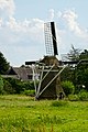
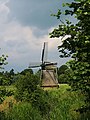
windmill in Buitenpost, Netherlands  | |||||
| Upload media | |||||
| Instance of |
| ||||
|---|---|---|---|---|---|
| Location | Buitenpost, Friesland, Netherlands | ||||
| Located on street |
| ||||
| Has use |
| ||||
| Heritage designation |
| ||||
| Source of energy | |||||
 | |||||
|
This is a category about rijksmonument number 7039
|
| Address |
|
Media in category "De Mûnts"
The following 13 files are in this category, out of 13 total.
-
 20210811 De Mûnts1 Buienpost.jpg 3,456 × 5,184; 4.26 MB
-
 20210811 De Mûnts2 Buienpost.jpg 3,456 × 5,184; 3.38 MB
-
 Buitenpost windmill.JPG 1,200 × 1,600; 360 KB
-
 Bûtenpost, De Mûnts,.jpg 3,643 × 2,557; 1.55 MB
-
 De Munts 01.JPG 3,072 × 2,304; 2.75 MB
-
 De Munts 02.JPG 2,304 × 3,072; 2.91 MB
-
 De Munts 03.JPG 3,072 × 2,304; 3.43 MB
-
 De Mûnts poldermolen.JPG 3,838 × 2,754; 2.03 MB
-

-

-
 De Mûnts.jpg 3,456 × 4,608; 3.31 MB
-
 Watermolen "De Mints" - Buitenpost - 20044858 - RCE.jpg 1,200 × 1,200; 228 KB
-
 Watermolen "De Mints" - Buitenpost - 20044859 - RCE.jpg 1,184 × 1,200; 258 KB


