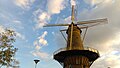
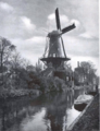
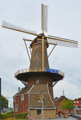
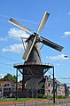
Category:De Roos, Delft
| Object location | | View all coordinates using: OpenStreetMap |
|---|
windmill in Delft, Netherlands  | |||||
| Upload media | |||||
| Instance of | |||||
|---|---|---|---|---|---|
| Location | Delft, South Holland, Netherlands | ||||
| Has use | |||||
| Heritage designation |
| ||||
| Inception |
| ||||
| Source of energy | |||||
 | |||||
|
This is a category about rijksmonument number 12159
|
| Address |
|
Media in category "De Roos, Delft"
The following 96 files are in this category, out of 96 total.
-
 2005-06 Deft.JPG 2,848 × 2,136; 1.57 MB
-
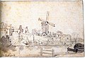
 Aan de Wal te Delft Hendrik Hendricus Spilman (1742-1784) Rikjjsmuseum Amsterdam.png 1,051 × 537; 1.04 MB
-
 C van der Heide, Fijne Delftsche Boterjanhagel koekblik, foto 5.JPG 3,463 × 3,149; 2.85 MB
-
 Calotte rotative moulin de Roos gros plan.png 297 × 146; 57 KB
-
 De Roos Delf 2.jpg 2,128 × 2,832; 5.46 MB
-
 De Roos mill Delft 01.png 3,456 × 5,184; 27.71 MB
-
 De Roos mill Delft 02.jpg 3,456 × 5,184; 2.87 MB
-
 De Roos mill Delft 03.jpg 3,456 × 5,184; 2.61 MB
-
 DE ROOS MOLEN PHOENIXSTRAAT OUDE KERK BAJINTOREN DELFT PANORAMA.png 606 × 527; 648 KB
-
 De Roos1.jpg 1,704 × 2,272; 761 KB
-
 De Roos2.jpg 1,704 × 2,272; 763 KB
-
 Delft (14).JPG 853 × 1,280; 845 KB
-
 Delft (8219430288).jpg 1,718 × 2,310; 1.54 MB
-
 Delft - 2013 - panoramio (901).jpg 2,048 × 1,536; 356 KB
-
 Delft - 2013 - panoramio (902).jpg 2,048 × 1,536; 403 KB
-
 Delft - 2014 - panoramio (17).jpg 4,928 × 3,264; 6.84 MB
-
 Delft - 2014 - panoramio (20).jpg 2,976 × 4,784; 1.33 MB
-
 Delft - 2015 - panoramio (278).jpg 3,648 × 5,472; 1.97 MB
-
 Delft - 2015 - panoramio (279).jpg 3,648 × 5,472; 3.11 MB
-
 Delft - 2015 - panoramio (280).jpg 5,472 × 3,648; 2.09 MB
-
 Delft 12 53 20 699000.jpeg 4,032 × 3,024; 4 MB
-
 Delft 12 53 30 912000.jpeg 4,032 × 3,024; 3.53 MB
-
 DELFT 2007 (8190210477).jpg 2,912 × 4,368; 3.19 MB
-
 Delft Blick von der Nieuwe Kerk auf De Roos.jpg 2,303 × 3,062; 3.61 MB
-
 Delft DeRoosMill 017 6064.jpg 3,803 × 5,445; 13.56 MB
-
 Delft Land 01.jpg 1,200 × 1,600; 156 KB
-
 Delft MolenDeRoosPhoenixstraat 20230809 versie2.jpg 4,017 × 3,012; 2.16 MB
-
 Delft MolenDeRoosPhoenixstraat 20230809.jpg 2,964 × 2,223; 1.36 MB
-
 Delft tram 2022 4.jpg 5,472 × 3,648; 10.17 MB
-
 Delft Vanheemstrastraat and De Roos.jpg 3,732 × 5,254; 13.06 MB
-
 Delft windmill (8232384162).jpg 1,720 × 2,312; 2.21 MB
-
 Delft, Molen de Roos RM12159 IMG 0495 2024-04-07 13.06.jpg 3,532 × 5,208; 11.11 MB
-
 Delft35.JPG 2,816 × 2,112; 2.35 MB
-
 Delft37.JPG 2,816 × 2,112; 3.88 MB
-
 Exterieur - Delft - 20306324 - RCE.jpg 1,200 × 1,188; 303 KB
-
 Exterieur OVERZICHT - Delft - 20306320 - RCE.jpg 1,190 × 1,200; 333 KB
-
 Exterieur OVERZICHT - Delft - 20306323 - RCE.jpg 1,199 × 1,200; 409 KB
-
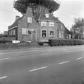
 Exterieur VOORGEVEL WOONHUIS - Delft - 20306319 - RCE.jpg 1,194 × 1,200; 277 KB
-
 Exterieur VOORGEVELS WOONHUIS EN AANBOUW - Delft - 20306322 - RCE.jpg 1,192 × 1,200; 288 KB
-
 Exterieur WOONHUIS - Delft - 20306321 - RCE.jpg 1,186 × 1,200; 324 KB
-
-
 Géoloc De Roos Molen Delft centre-bourg historique.png 980 × 580; 395 KB
-
 Herfst 2008 in Delft 1.jpg 1,944 × 2,592; 925 KB
-

-

-

-

-

-
 Kaart figuratief Delft 1678 Roos molen Oosterijke toren.png 836 × 529; 1,002 KB
-
 Mill Roos Delft.JPG 3,264 × 4,928; 7.06 MB
-
 Mills in Delft collecties TU Delft 1703 kaart De Roos molen.png 913 × 454; 983 KB
-
 Mol de Roos in Delft.jpg 2,910 × 3,572; 2.75 MB
-
 Molen de roos - 12159.jpg 1,600 × 1,200; 152 KB
-
 Molen de Roos - Delft - 2009 - panoramio (1).jpg 3,648 × 2,736; 2.4 MB
-
 Molen de Roos - panoramio.jpg 768 × 1,024; 387 KB
-
 Molen de Roos 01.jpg 4,208 × 2,368; 2.19 MB
-
 Molen de Roos 02.jpg 800 × 600; 605 KB
-
 Molen de Roos 1885, ligne 1 tramway site DelftKijk.png 771 × 522; 926 KB
-
 Molen de Roos 1915 met Kanaal Oude Delft site DelftKijk.png 401 × 522; 373 KB
-
 Molen de roos 2009 on phoenixstraat delft treinlijn 1.png 342 × 524; 401 KB
-
 Molen de roos 2022 on phoenixstraat delft treinlijn 1.png 352 × 522; 323 KB
-
 Molen de Roos mill Delft 1.jpg 4,928 × 3,264; 6.78 MB
-
 Molen de Roos mill Delft 2.jpg 4,928 × 3,264; 6.87 MB
-
 Molen de Roos mill Delft 3.jpg 4,928 × 3,264; 5.98 MB
-
 Molen de Roos mill Delft 4.jpg 3,264 × 4,928; 6.53 MB
-
 Molen de Roos mill Delft 5.jpg 3,264 × 4,928; 6.18 MB
-
 Molen de Roos mill Delft 6.jpg 3,264 × 4,928; 8.39 MB
-
 Molen De Roos mill Delft.JPG 4,608 × 3,072; 6.34 MB
-
 Molen de roos.jpg 1,200 × 1,600; 183 KB
-
 Molen Delft.jpg 768 × 1,024; 440 KB
-
 Molen, Delft, Holland.jpg 2,257 × 2,951; 1.27 MB
-

-
 Moulin De Roos et logis du meunier à Delft début du XXe siècle.png 727 × 518; 448 KB
-

-
-
 Overzicht van de molen - Delft - 20421061 - RCE.jpg 800 × 1,200; 140 KB
-

-
 Phoenixstraat - Delft - 2011 - panoramio.jpg 4,608 × 3,072; 4.19 MB
-
 Phoenixstraat Spoorzone Delft 2017.jpg 5,472 × 3,648; 8.62 MB
-
 Pieter Jansz. van Asch - The Delft City Wall with the Houttuinen - WGA1014.jpg 1,139 × 770; 143 KB
-
 Restauratie van ronde stenen stellingmolen - Delft - 20369752 - RCE.jpg 1,200 × 1,200; 236 KB
-
 RM12158 Delft - Phoenixstraat 111.jpg 2,448 × 3,264; 2.2 MB
-
-

-

-
 Ronde stenen stellingmolen tijdens restauratie - Delft - 20363734 - RCE.jpg 1,200 × 1,200; 151 KB
-
 Ronde stenen stellingmolen tijdens restauratie - Delft - 20363735 - RCE.jpg 1,200 × 1,200; 217 KB
-
 Roos mill Wateringsevest Delft.jpg 5,472 × 3,648; 9.86 MB
-
 Spoorsingel Delft 2018 7.jpg 5,472 × 3,648; 9.04 MB
-
 Spoorsingel spoorzone Delft 2017 8.jpg 3,648 × 5,472; 8.46 MB
-

-
 Verbouwing en molen in Delft.jpg 4,288 × 3,216; 3.66 MB
-
 View of Windmill in Delft by Hendricus Hendrik Spilman.png 528 × 372; 313 KB
-

-
 Woonhuis naast ronde stenen stellingmolen - Delft - 20053261 - RCE.jpg 1,200 × 802; 178 KB
-
 Woonhuis voor ronde stenen stellingmolen - Delft - 20053262 - RCE.jpg 1,200 × 803; 230 KB

_Rikjjsmuseum_Amsterdam.png)


.JPG)
.jpg)
.jpg)
.jpg)
.jpg)
.jpg)
.jpg)
.jpg)
.jpg)


.jpg)


.jpg)


_van_de_N.S._op_het_spoorviaduct_te_Delft,_met_rechts_de_molen_De_Roos_aan_de_Phoenixstraat.jpg)


.jpg)


