Category:De Vlijt, Zuidwolde
| Object location | | View all coordinates using: OpenStreetMap |
|---|
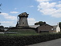
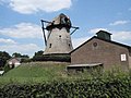
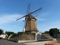
windmill in Zuidwolde, Netherlands  | |||||
| Upload media | |||||
| Instance of | |||||
|---|---|---|---|---|---|
| Location | Zuidwolde, Drenthe, Netherlands | ||||
| Street address |
| ||||
| Located on street |
| ||||
| Has use | |||||
| Heritage designation |
| ||||
| Inception |
| ||||
| Source of energy | |||||
 | |||||
|
This is a category about rijksmonument number 41099
|
| Address |
|
Media in category "De Vlijt, Zuidwolde"
The following 25 files are in this category, out of 25 total.
-
 Conisch gangwerk - Zuidwolde - 20225947 - RCE.jpg 1,200 × 1,174; 221 KB
-
 De Vlijt (Zuidwolde) 1.JPG 4,272 × 2,848; 4.42 MB
-
 De Vlijt (Zuidwolde) 2.JPG 2,848 × 4,272; 2.08 MB
-
 De Vlijt (Zuidwolde) 3.JPG 4,272 × 2,848; 3.89 MB
-
 De Vlijt (Zuidwolde) 4.JPG 4,272 × 2,848; 4.26 MB
-
 De Vlijt (Zuidwolde) 5.JPG 2,848 × 4,272; 1.86 MB
-
 De Vlijt (Zuidwolde) 6.JPG 4,272 × 2,848; 4.13 MB
-
 Droogbalken van vijzelspil - Zuidwolde - 20225945 - RCE.jpg 1,200 × 1,186; 244 KB
-
 Fundering van de molen - Zuidwolde - 20225938 - RCE.jpg 1,200 × 1,181; 282 KB
-
 Fundering van de molen - Zuidwolde - 20225939 - RCE.jpg 1,200 × 1,174; 225 KB
-

-
 Korenmolen bebouwing er omheen - Zuidwolde - 20225943 - RCE.jpg 1,200 × 1,175; 262 KB
-
 Korenmolen bebouwing er omheen - Zuidwolde - 20225944 - RCE.jpg 1,200 × 1,181; 264 KB
-
 Korenmolen, bebouwing er omheen - Zuidwolde - 20225942 - RCE.jpg 1,200 × 1,177; 239 KB
-
 Korenmolen, in slechte staat - Zuidwolde - 20225929 - RCE.jpg 1,200 × 1,200; 238 KB
-
 Kruiwerk korenmolen - Zuidwolde - 20225946 - RCE.jpg 1,200 × 1,174; 278 KB
-
 Molen de Vlijt 1878 - Zuidwolde - 20225910 - RCE.jpg 929 × 1,200; 172 KB
-
 Molen De Vlijt Zuidwolde 1.JPG 3,648 × 2,736; 4.26 MB
-
 Molen De Vlijt Zuidwolde 2.JPG 3,648 × 2,736; 3.94 MB
-
 Rietgedekte molen tijdens herstel - Zuidwolde - 20225932 - RCE.jpg 1,200 × 1,200; 253 KB
-
 Rietgedekte molen tijdens herstel - Zuidwolde - 20225933 - RCE.jpg 1,200 × 1,200; 234 KB
-
 Súdwâlde, 'De Meule van Wassens' (De mûne fan Wassens).jpg 2,000 × 1,335; 1.19 MB
-

-

-
 Zuidwolde Dr. Molen de Vlijt.jpg 4,000 × 3,000; 4.84 MB

_1.JPG)
_2.JPG)
_3.JPG)
_4.JPG)
_5.JPG)
_6.JPG)


.jpg)


