Category:December 2009 in Kent
Deutsch: Bilder, die im Dezember 2009 in Kent aufgenommen worden sind. Bitte beachten Sie, dass dies weder das Datum des Uploads noch das Datum des Scannens eines Fotos ist.
English: Images/pictures taken in Kent during December 2009. Note this is not the date of the upload, nor the date a photo was scanned.
Español: Fotografías o imágenes tomadas en Kent durante diciembre 2009. No es la fecha de subida ni escaneo, sino la fecha en que las fotografías o imágenes se crearon.
Esperanto: Bildoj faritaj en Kent en decembro 2009. Tio ne estas la dato, kiam la bildoj estis alŝutitaj aŭ skanitaj.
Français : Photographies ou images prises en Kent durant décembre 2009. Ce n'est pas la date du téléchargement ou du scan.
Galego: Fotografías ou imaxes tomadas en Kent durante decembro 2009. Non é a data de subida nin escaneamento, senón a data na que se crearon as fotografías ou imaxes.
Italiano: Fotografie o immagini scattate a Kent nel dicembre 2009. Nota bene: la data non si riferisce né a quella di upload né a quella in cui la foto è stata digitalizzata.
Norsk bokmål: Bilder tatt i Kent i løpet av desember 2009. Merk at dette ikke er datoen for opplasting, eller når et bilde har blitt skannet.
Norsk nynorsk: Bilete teke i Kent i løpet av desember 2009. Merk at dette ikkje er datoen for opplasting, eller når eit bilete har vorte skanna.
Русский: Изображения, сделанные в Kent в течение декабрь 2009 (не дата загрузки изображения).
Українська: Зображення, зроблені в Kent протягом грудень 2009. Зауважте, що це не дата завантаження чи дата сканування фотографії.
| December 2008 | ← | December 2009 | → | December 2010 | |||||||
| Jan | Feb | Mar | Apr | May | Jun | Jul | Aug | Sep | Oct | Nov | Dec |
| 285 | 415 | 318 | 418 | 437 | 130 | 396 | 95 | 302 | 475 | 139 | 146 |
|---|---|---|---|---|---|---|---|---|---|---|---|
Media in category "December 2009 in Kent"
The following 146 files are in this category, out of 146 total.
-
 8 Thornhill Gardens - geograph.org.uk - 1610758.jpg 640 × 427; 89 KB
-
-
 A264, Langton Rd - geograph.org.uk - 1609110.jpg 463 × 640; 87 KB
-
 A264, Langton Rd - geograph.org.uk - 1609135.jpg 640 × 430; 169 KB
-
 Amazon and Tiger, Harvel - geograph.org.uk - 1613885.jpg 640 × 480; 56 KB
-
 Bayhall Road - geograph.org.uk - 1610672.jpg 427 × 640; 85 KB
-
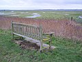 Bench in the Elmley Marshes - geograph.org.uk - 1652848.jpg 640 × 479; 93 KB
-
 Bishops Down Park Rd - geograph.org.uk - 1607992.jpg 640 × 430; 182 KB
-
 Bretland Rd, Rusthall - geograph.org.uk - 1608114.jpg 640 × 430; 136 KB
-

-
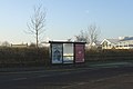 Bus Stop Ashford Market - geograph.org.uk - 1719691.jpg 640 × 427; 44 KB
-
 Canterbury B and Q Warehouse - geograph.org.uk - 1609033.jpg 640 × 427; 57 KB
-
 Canterbury East - signal box and South Eastern 375630.jpg 1,024 × 768; 211 KB
-
 Car Park, Sturry Rd Park and Ride - geograph.org.uk - 1618449.jpg 640 × 430; 118 KB
-
 Cattle, Sawkinge Farm - geograph.org.uk - 1619293.jpg 640 × 430; 137 KB
-
 Christmas Trees on Sherwood Park - geograph.org.uk - 1610749.jpg 640 × 427; 85 KB
-
-
 Converted School, York Rd - geograph.org.uk - 1609594.jpg 640 × 430; 144 KB
-
 Coppicing, Trenleypark Wood - geograph.org.uk - 1618829.jpg 640 × 430; 190 KB
-
 Cotes Court - geograph.org.uk - 1610692.jpg 640 × 427; 81 KB
-
 Cricket ground, Rusthall Common - geograph.org.uk - 1609131.jpg 640 × 430; 111 KB
-

-
 Dover Priory - South Eastern 395009 and 375905.jpg 1,024 × 768; 184 KB
-
 Down Lane Hall, Culverden Down - geograph.org.uk - 1607868.jpg 640 × 468; 91 KB
-
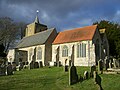
 St Michael's Church, East Peckham - geograph.org.uk - 1569528.jpg 640 × 430; 140 KB
-
 East Peckham, St. Michael.jpg 2,048 × 1,536; 652 KB
-

-
 Entrance to Dunorlan Park - geograph.org.uk - 1610667.jpg 640 × 427; 83 KB
-

-
 Entrance to Nevill Park - geograph.org.uk - 1609138.jpg 640 × 335; 110 KB
-

-

-
-
 Farmland in the Stour Valley - geograph.org.uk - 1621072.jpg 640 × 430; 137 KB
-
 Farmland in the Stour Valley - geograph.org.uk - 1621091.jpg 640 × 430; 108 KB
-
 Farmland in the Stour Valley - geograph.org.uk - 1621417.jpg 640 × 430; 117 KB
-
 Farmland in the Stour Valley - geograph.org.uk - 1621430.jpg 640 × 430; 114 KB
-
 Farmland in the Stour Valley - geograph.org.uk - 1621480.jpg 640 × 430; 131 KB
-

-
-
 Field near Longfield - geograph.org.uk - 1640953.jpg 640 × 480; 40 KB
-
 Field near Swanley Village - geograph.org.uk - 1640976.jpg 640 × 480; 41 KB
-
 Fir Tree Rd, Tunbridge Wells Common - geograph.org.uk - 1609162.jpg 640 × 430; 166 KB
-
 Flats, Upper Grosvenor Rd - geograph.org.uk - 1609762.jpg 640 × 430; 121 KB
-
 Flooding by the Great Stour - geograph.org.uk - 1619648.jpg 640 × 430; 86 KB
-
 Flooding by the Great Stour - geograph.org.uk - 1619680.jpg 640 × 397; 85 KB
-
 Flooding by the Great Stour - geograph.org.uk - 1619683.jpg 640 × 430; 139 KB
-
 Flooding in the Stour Valley - geograph.org.uk - 1621617.jpg 640 × 430; 135 KB
-

-

-

-
 Floodplain, Great Stour and Little Stour - geograph.org.uk - 1620875.jpg 640 × 430; 118 KB
-

-
 Footbridge across the Little Stour - geograph.org.uk - 1620200.jpg 640 × 430; 138 KB
-
 Footbridge across the Little Stour - geograph.org.uk - 1620218.jpg 640 × 430; 134 KB
-
 Footbridge near Marshleyharbour Wood - geograph.org.uk - 1610364.jpg 640 × 427; 135 KB
-
 Footbridge over the Little Stour - geograph.org.uk - 1620823.jpg 640 × 430; 134 KB
-
 Footpath junction in Grimshill Wood - geograph.org.uk - 1652716.jpg 640 × 479; 112 KB
-
 Footpath junction near Yantlet Creek - geograph.org.uk - 1628387.jpg 640 × 479; 109 KB
-
 Footpath to Pickleden Wood - geograph.org.uk - 1627262.jpg 620 × 465; 104 KB
-

-
 Garden Rd from Camden Rd - geograph.org.uk - 1609654.jpg 640 × 430; 125 KB
-

-
 Gate into Marshleyharbour Wood - geograph.org.uk - 1610352.jpg 640 × 427; 123 KB
-
 Gate on a footpath to Tinker Wood - geograph.org.uk - 1620074.jpg 640 × 427; 82 KB
-
 Gate on the Saxon Shore Way, River Stour - geograph.org.uk - 1621548.jpg 640 × 430; 140 KB
-
 Gate to a footpath by Holywell Farm - geograph.org.uk - 1602463.jpg 427 × 640; 91 KB
-
 Gated path into the heathland - geograph.org.uk - 1610796.jpg 640 × 427; 67 KB
-

-
 Hadley Court, Culverden Down - geograph.org.uk - 1607893.jpg 640 × 430; 138 KB
-
 Happy Friar Chinese Takeaway - geograph.org.uk - 1610733.jpg 640 × 427; 73 KB
-
 Hoopers, Mount Pleasant - geograph.org.uk - 1609564.jpg 640 × 430; 133 KB
-
 Huntleys Park - geograph.org.uk - 1607928.jpg 640 × 430; 142 KB
-
-
-
 Lake, Stodmarsh Nature Reserve - geograph.org.uk - 1619426.jpg 640 × 430; 134 KB
-
 Lake, Stodmarsh Nature Reserve - geograph.org.uk - 1619473.jpg 640 × 430; 130 KB
-
 Lake, Stodmarsh Nature Reserve - geograph.org.uk - 1619491.jpg 640 × 360; 84 KB
-
 Lake, Stodmarsh Nature Reserve - geograph.org.uk - 1619494.jpg 640 × 430; 119 KB
-
 Lake, Stodmarsh Nature Reserve - geograph.org.uk - 1619502.jpg 640 × 430; 125 KB
-
 Lake, Stodmarsh Nature Reserve - geograph.org.uk - 1619517.jpg 640 × 430; 123 KB
-
 Lampen Stream, Stodmarsh Nature Reserve - geograph.org.uk - 1619394.jpg 640 × 430; 169 KB
-
 Lampen Wall, Stodmarsh Nature reserve - geograph.org.uk - 1619486.jpg 640 × 430; 149 KB
-
 London Road (A20), Farningham - geograph.org.uk - 1633292.jpg 640 × 480; 40 KB
-
 London Road (A20), Farningham - geograph.org.uk - 1633294.jpg 640 × 480; 38 KB
-
 London Road (A20), West Kingsdown - geograph.org.uk - 1638696.jpg 640 × 480; 81 KB
-
 Lonsdale Gardens - geograph.org.uk - 1609577.jpg 640 × 499; 111 KB
-
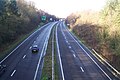
 M20 Motorway - geograph.org.uk - 1602675.jpg 640 × 480; 80 KB
-
 Marsh Farm Rd - geograph.org.uk - 1621676.jpg 640 × 430; 149 KB
-
 Marsh Farm Rd - geograph.org.uk - 1621683.jpg 640 × 430; 134 KB
-
 Marsh Farm Rd - geograph.org.uk - 1621696.jpg 640 × 430; 118 KB
-
 Marsh Farm Rd - geograph.org.uk - 1621742.jpg 640 × 430; 135 KB
-
 Marsh Farm Rd - geograph.org.uk - 1621756.jpg 640 × 430; 135 KB
-
 Marsh Farm Rd - geograph.org.uk - 1621758.jpg 640 × 430; 122 KB
-
 Marsh Farm Rd approaching Minster - geograph.org.uk - 1621765.jpg 640 × 430; 122 KB
-
 Marshland by the Great Stour - geograph.org.uk - 1619841.jpg 640 × 421; 89 KB
-
 Marshland by the Great Stour - geograph.org.uk - 1619853.jpg 640 × 394; 93 KB
-
 Monument at Blue Bell Hill Carpark - geograph.org.uk - 1639077.jpg 640 × 479; 50 KB
-
 Passing point on Cornford Lane - geograph.org.uk - 1610601.jpg 640 × 427; 117 KB
-

-
 Port of Dover - panoramio - giggel.jpg 3,456 × 2,592; 2.66 MB
-

-

-

-
 Railway to Hoo Junction - geograph.org.uk - 1628372.jpg 640 × 427; 63 KB
-
 Ravensdale House - geograph.org.uk - 1610722.jpg 640 × 427; 64 KB
-
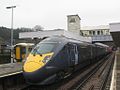
 Rochester Railway Station - geograph.org.uk - 1612188.jpg 640 × 480; 72 KB
-
 Rochester Railway Station - geograph.org.uk - 1627772.jpg 640 × 480; 78 KB
-
 Roundabout outside the Spa Hotel - geograph.org.uk - 1609147.jpg 640 × 430; 134 KB
-
 Royal Victoria Grove - geograph.org.uk - 1609174.jpg 640 × 430; 201 KB
-

-
 Rusthall High St - geograph.org.uk - 1608125.jpg 640 × 430; 153 KB
-
 Saxon Chief, Maidstone - geograph.org.uk - 1621062.jpg 640 × 480; 92 KB
-
 Shopping parade, Camden Rd - geograph.org.uk - 1609627.jpg 640 × 430; 125 KB
-

-
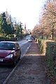
 Southwood Avenue - geograph.org.uk - 1607858.jpg 640 × 430; 142 KB
-
 Speed Camera on the A64 Pembury Road - geograph.org.uk - 1610710.jpg 640 × 427; 96 KB
-
 St Barnabas Primary School, Quarry Rd - geograph.org.uk - 1609725.jpg 640 × 430; 117 KB
-
 St Mary the Virgin Church, Minster - geograph.org.uk - 1621789.jpg 640 × 430; 157 KB
-
 St Mary the Virgin, Minster - geograph.org.uk - 1621797.jpg 640 × 430; 150 KB
-
 St. Giles' church, Kingston - geograph.org.uk - 1605564.jpg 640 × 429; 57 KB
-
 Stone St off Camden Rd - geograph.org.uk - 1609691.jpg 640 × 430; 127 KB
-
 All Saints, Swanscombe - geograph.org.uk - 1629582.jpg 640 × 480; 62 KB
-
 The Church of St Nicholas, Sturry - geograph.org.uk - 1618569.jpg 640 × 430; 146 KB
-
 The church of St. Giles, Kingston - geograph.org.uk - 1605550.jpg 640 × 428; 104 KB
-
 The Duke of York, Langton Rd - geograph.org.uk - 1609143.jpg 640 × 487; 102 KB
-
 The Flower Basket - geograph.org.uk - 1609696.jpg 640 × 430; 123 KB
-
 The Street, Mereworth - geograph.org.uk - 1621024.jpg 640 × 480; 87 KB
-
-

-
 The Wheatsheaf, Leybourne - geograph.org.uk - 1620795.jpg 640 × 480; 58 KB
-
 The World of Sewing, Camden Rd - geograph.org.uk - 1609661.jpg 640 × 430; 123 KB
-

-
 Town houses, York Rd - geograph.org.uk - 1609595.jpg 640 × 430; 147 KB
-
 Travelodge Maidstone Central - geograph.org.uk - 1639023.jpg 640 × 479; 72 KB
-
 Vale Rd - geograph.org.uk - 1609561.jpg 640 × 506; 98 KB
-
-
 View into Camden Square - geograph.org.uk - 1609639.jpg 640 × 430; 135 KB
-

-
-

-
 Wellington Rocks - geograph.org.uk - 1609175.jpg 640 × 358; 89 KB
-
 Wellington Rocks, Tunbridge Wells Common - geograph.org.uk - 1609168.jpg 640 × 430; 126 KB
-
 Western Rd off Quarry Rd - geograph.org.uk - 1609731.jpg 640 × 430; 114 KB
-
 Wood St off Camden Rd - geograph.org.uk - 1609674.jpg 640 × 430; 126 KB
-
 Zebra Crossing on Sandyhurst Road - geograph.org.uk - 1610727.jpg 640 × 427; 74 KB


,_Farningham_-_geograph.org.uk_-_1633292.jpg)
,_Farningham_-_geograph.org.uk_-_1633294.jpg)
,_West_Kingsdown_-_geograph.org.uk_-_1638696.jpg)


