Category:December 2019 in the East Riding of Yorkshire
Ceremonial counties of England: Bedfordshire · Berkshire · Cambridgeshire · Cheshire · Cornwall · Derbyshire · Devon · Dorset · Durham · East Riding of Yorkshire · East Sussex · Essex · Gloucestershire · Greater London · Greater Manchester · Herefordshire · Hertfordshire · Lancashire · Leicestershire · Lincolnshire · Merseyside · Norfolk · North Yorkshire · Nottinghamshire · Oxfordshire · Somerset · Staffordshire · Suffolk · Surrey · Tyne and Wear · Warwickshire · West Midlands · West Sussex · West Yorkshire ·
City-counties: Bristol ·
Former historic counties:
Other former counties:
City-counties: Bristol ·
Former historic counties:
Other former counties:
Deutsch: Bilder, die im Dezember 2019 in the East Riding of Yorkshire aufgenommen worden sind. Bitte beachten Sie, dass dies weder das Datum des Uploads noch das Datum des Scannens eines Fotos ist.
English: Images/pictures taken in the East Riding of Yorkshire during December 2019. Note this is not the date of the upload, nor the date a photo was scanned.
Español: Fotografías o imágenes tomadas en the East Riding of Yorkshire durante diciembre 2019. No es la fecha de subida ni escaneo, sino la fecha en que las fotografías o imágenes se crearon.
Esperanto: Bildoj faritaj en the East Riding of Yorkshire en decembro 2019. Tio ne estas la dato, kiam la bildoj estis alŝutitaj aŭ skanitaj.
Français : Photographies ou images prises en the East Riding of Yorkshire durant décembre 2019. Ce n'est pas la date du téléchargement ou du scan.
Galego: Fotografías ou imaxes tomadas en the East Riding of Yorkshire durante decembro 2019. Non é a data de subida nin escaneamento, senón a data na que se crearon as fotografías ou imaxes.
Italiano: Fotografie o immagini scattate a the East Riding of Yorkshire nel dicembre 2019. Nota bene: la data non si riferisce né a quella di upload né a quella in cui la foto è stata digitalizzata.
Norsk bokmål: Bilder tatt i the East Riding of Yorkshire i løpet av desember 2019. Merk at dette ikke er datoen for opplasting, eller når et bilde har blitt skannet.
Norsk nynorsk: Bilete teke i the East Riding of Yorkshire i løpet av desember 2019. Merk at dette ikkje er datoen for opplasting, eller når eit bilete har vorte skanna.
Русский: Изображения, сделанные в the East Riding of Yorkshire в течение декабрь 2019 (не дата загрузки изображения).
Українська: Зображення, зроблені в the East Riding of Yorkshire протягом грудень 2019. Зауважте, що це не дата завантаження чи дата сканування фотографії.
| December 2018 | ← | December 2019 | → | December 2020 | |||||||
| Jan | Feb | Mar | Apr | May | Jun | Jul | Aug | Sep | Oct | Nov | Dec |
| 11 | 18 | 83 | 157 | 55 | 8 | 2 | 71 | 30 | 24 | 6 | 130 |
|---|---|---|---|---|---|---|---|---|---|---|---|
Subcategories
This category has only the following subcategory.
Media in category "December 2019 in the East Riding of Yorkshire"
The following 129 files are in this category, out of 129 total.
-
 A flooded Ferry Lane, Thearne (geograph 6349427).jpg 800 × 588; 116 KB
-
 A1079, Beverley Bypass (geograph 6360781).jpg 640 × 480; 78 KB
-
 A1079, Beverley Bypass (geograph 6361408).jpg 800 × 600; 67 KB
-
 A1174, Woodmansey (geograph 6349409).jpg 800 × 600; 68 KB
-
 A164 towards Beverley (geograph 6361405).jpg 800 × 600; 90 KB
-
 A164 towards Beverley (geograph 6361407).jpg 800 × 600; 74 KB
-
 Beverley Parklands (geograph 6350697).jpg 4,528 × 3,072; 2.95 MB
-
 Bracken Lane (geograph 6349444).jpg 1,024 × 768; 171 KB
-
 Broadgate (B1230) (geograph 6355970).jpg 4,275 × 3,056; 2.45 MB
-

-
 Bus stop and shelter on York Road, Bishop Burton - geograph.org.uk - 6354143.jpg 5,184 × 3,888; 6.73 MB
-
 Bus stop and shelter on York Road, Bishop Burton - geograph.org.uk - 6354146.jpg 5,184 × 3,888; 6.36 MB
-
 Bus stop on Broadgate (B1230) (geograph 6355963).jpg 4,674 × 3,304; 3.94 MB
-
 Bus stop on York Road, Bishop Burton - geograph.org.uk - 6354145.jpg 5,184 × 3,888; 6.43 MB
-
 Chapel Row, Thearne (geograph 6349359).jpg 640 × 458; 63 KB
-

-
 Church Lane, Kilnwick (geograph 6349441).jpg 1,024 × 768; 257 KB
-
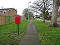
 Close up, Elizabeth II postbox on Hull Road, Woodmansey (geograph 6350258).jpg 2,062 × 3,866; 2.05 MB
-
 Close up, Elizabeth II postbox on Middlehowe Green, Walkington (geograph 6358089).jpg 1,440 × 2,728; 1.14 MB
-
 Close up, Elizabeth II postbox on Woodmansey Mile, Beverley (geograph 6358209).jpg 2,215 × 3,438; 1.64 MB
-
 Close up, Elizabeth II postbox on York Road, Bishop Burton - geograph.org.uk - 6354140.jpg 2,185 × 4,185; 2.16 MB
-

-
 Crossroads on Walkington Heads (geograph 6360767).jpg 800 × 574; 129 KB
-
 Dale Gate heading out of Bishop Burton (geograph 6360760).jpg 800 × 600; 179 KB
-
 Deer in field by Carr House Farm (geograph 6353449).jpg 1,024 × 768; 205 KB
-
 Deer Park Way, Beverley (geograph 6361416).jpg 800 × 499; 52 KB
-
 Defibrillator on Walkington Village Hall (geograph 6360811).jpg 600 × 800; 157 KB
-
 Drain beside Hull Road (A1174) (geograph 6349420).jpg 800 × 600; 113 KB
-
 Drove Lane (geograph 6353459).jpg 1,024 × 768; 137 KB
-
 East End (B1230), Walkington (geograph 6355230).jpg 4,644 × 3,329; 3.64 MB
-

-
 Elizabeth II postbox on Beverley Parklands (geograph 6350693).jpg 1,776 × 3,030; 1.24 MB
-
 Elizabeth II postbox on Hull Road, Woodmansey (geograph 6350257).jpg 480 × 640; 96 KB
-
 Elizabeth II postbox on Lincoln Way, Beverley (geograph 6358198).jpg 327 × 640; 56 KB
-
 Elizabeth II postbox on Middlehowe Green, Walkington (geograph 6358087).jpg 3,096 × 2,268; 1.77 MB
-
 Elizabeth II postbox on Normandy Avenue, Beverley (geograph 6355977).jpg 2,316 × 3,923; 2.04 MB
-
 Elizabeth II postbox on Plaxton Bridge Road, Woodmansey (geograph 6349188).jpg 2,611 × 3,595; 2.56 MB
-
 Elizabeth II postbox on Shopeth Way, Woodmansey (geograph 6349177).jpg 1,575 × 2,658; 821 KB
-
 Elizabeth II postbox on the B1230, Broadgate (geograph 6355960).jpg 1,368 × 2,418; 1.17 MB
-

-
 Elizabeth II postbox on York Road, Bishop Burton - geograph.org.uk - 6354138.jpg 5,184 × 3,888; 5.22 MB
-
 Elizabeth II postbox, Thearne (geograph 6349350).jpg 2,317 × 3,560; 1.83 MB
-
 Entering Thearne (geograph 6349422).jpg 800 × 600; 101 KB
-
 Entrance to Morrisons Supermarket, Beverley (geograph 6354105).jpg 4,343 × 3,526; 3.53 MB
-
 Entrance to Wood End Farm (geograph 6355148).jpg 1,024 × 768; 158 KB
-
 Entrance Walkington (geograph 6360783).jpg 800 × 572; 76 KB
-
 EYMS bus, Bridlington Park & Ride - geograph.org.uk - 6342595.jpg 800 × 472; 64 KB
-
 Farm buildings near Kilnwick (geograph 6349452).jpg 1,024 × 686; 137 KB
-
 Farm track and drain (geograph 6353443).jpg 1,024 × 768; 134 KB
-
 Ferry Lane, Thearne (geograph 6349358).jpg 3,945 × 3,022; 3.18 MB
-
 Field looking towards Park Farm (geograph 6355128).jpg 1,024 × 768; 257 KB
-
 Field off Walkington Road (geograph 6361367).jpg 800 × 600; 86 KB
-
 Field path towards Carr House (geograph 6353452).jpg 1,024 × 768; 168 KB
-
 Garden Centre, Woodmansey (geograph 6349416).jpg 800 × 492; 56 KB
-
 George V postbox on East End, Walkington (geograph 6355228).jpg 301 × 640; 53 KB
-
 George V postbox on Queensgate, Beverley (geograph 6349704).jpg 2,754 × 5,118; 3.04 MB
-
 Grazing off Hull Road (geograph 6350009).jpg 800 × 541; 50 KB
-
 Grazing off Thearne Lane, Thearne (geograph 6349423).jpg 800 × 600; 83 KB
-
 Grazing towards Yewtree Plantation (geograph 6361397).jpg 800 × 600; 73 KB
-
 Hillside field with bales off Dale Gate (geograph 6360758).jpg 800 × 600; 138 KB
-
 House on Autherd Garth, Walkington (geograph 6360801).jpg 800 × 575; 123 KB
-
 House on Figham Springs Way, Beverley (geograph 6358215).jpg 800 × 612; 90 KB
-
 Houses on Beverley Parklands (geograph 6350694).jpg 4,356 × 3,335; 3.02 MB
-
 Houses on Beverley Parklands (geograph 6350696).jpg 5,184 × 3,888; 4.15 MB
-
 Houses on Beverley Parklands (geograph 6350698).jpg 5,184 × 3,888; 3.86 MB
-
 Houses on Hull Road, Woodmansey (geograph 6349434).jpg 800 × 512; 53 KB
-
 Houses on Hull Road, Woodmansey (geograph 6350259).jpg 4,154 × 2,905; 2.29 MB
-
 Houses on Queensgate, Beverley (geograph 6349706).jpg 5,184 × 3,888; 4.79 MB
-
 Houses on Victoria Road, Beverley (geograph 6361409).jpg 800 × 567; 93 KB
-
 Houses on West End, Walkington (geograph 6360826).jpg 800 × 547; 85 KB
-
 Hull Road (A1174), Woodmansey (geograph 6350260).jpg 640 × 536; 54 KB
-
 Hull Road (A1174), Woodmansey (geograph 6350261).jpg 4,402 × 3,370; 2.62 MB
-
-

-

-

-
 Lincoln Way, Beverley (geograph 6358203).jpg 5,184 × 3,888; 5.51 MB
-
 Lindum House Care Home, Beverley (geograph 6361415).jpg 800 × 499; 51 KB
-
 Little Weighton Road (geograph 6361364).jpg 800 × 600; 88 KB
-
 LJs Bar on Lincoln Way, Beverley (geograph 6358200).jpg 800 × 600; 98 KB
-
 Lodges on Broadgate (B1230) (geograph 6355967).jpg 4,657 × 3,108; 4.39 MB
-
 Long Lane, Woodmansey (geograph 6349433).jpg 800 × 495; 89 KB
-
 Mc Donalds Restaurant, Beverley (geograph 6361413).jpg 800 × 577; 101 KB
-
 Middlehowe Green, Walkington (geograph 6358097).jpg 5,184 × 3,888; 6.53 MB
-
 Mill House on Coppleflat Lane (geograph 6360776).jpg 800 × 600; 165 KB
-
 Morrisons Supermarket, Beverley (geograph 6354106).jpg 4,773 × 3,151; 2.69 MB
-
 New houses on Woodmansey Mile, Beverley (geograph 6361420).jpg 800 × 518; 82 KB
-

-
 New housing on Saunders Lane, Walkington (geograph 6360827).jpg 800 × 455; 140 KB
-
 New Lidl supermarket for Beverley (geograph 6349106).jpg 800 × 600; 79 KB
-
 Normandy Avenue, Beverley (geograph 6355979).jpg 5,184 × 3,888; 4.36 MB
-
 Normandy Avenue, Beverley (geograph 6355982).jpg 5,184 × 3,888; 3.39 MB
-
 North Carr Lane (geograph 6353445).jpg 1,024 × 768; 155 KB
-
 Oak Cottage Plantation replanted (geograph 6355140).jpg 1,024 × 768; 130 KB
-
 Path beside Middlehowe Green, Walkington (geograph 6358095).jpg 5,184 × 3,888; 6.92 MB
-
 Path off Middlehowe Green, Walkington (geograph 6358093).jpg 4,411 × 3,102; 3.9 MB
-
 Plaxton Bridge Road, Woodmansey (geograph 6349190).jpg 4,491 × 3,052; 3.85 MB
-
 Plaxton Bridge Road, Woodmansey (geograph 6349192).jpg 4,706 × 3,507; 3.36 MB
-
 Plaxton Bridge Road, Woodmansey (geograph 6349194).jpg 5,184 × 3,888; 4.33 MB
-
 Ploughed field and pylons (geograph 6360773).jpg 800 × 600; 80 KB
-
 Poplar Farm, Thearne (geograph 6349354).jpg 800 × 590; 168 KB
-
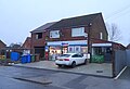
 Post Office and shop on East End (B1230), Walkington (geograph 6355233).jpg 4,922 × 3,650; 2.87 MB
-
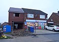
 Post Office and shop on East End (B1230), Walkington (geograph 6355234).jpg 4,250 × 3,580; 2.72 MB
-
 Postbox, Morrisons Supermarket Beverley (geograph 6354103).jpg 2,146 × 3,895; 1.87 MB
-
 Princess Way, Beverley (geograph 6361414).jpg 640 × 446; 119 KB
-
 Queensgate, Beverley (geograph 6349707).jpg 4,989 × 3,181; 3.45 MB
-
 Queensgate, Beverley (geograph 6349710).jpg 4,915 × 3,279; 3.2 MB
-
 Scholefield Avenue Woodmansey (geograph 6349394).jpg 800 × 600; 122 KB
-
 Shops on Lincoln Way, Beverley (geograph 6358199).jpg 5,184 × 3,888; 6.09 MB
-
 Shops on Shopeth Way, Woodmansey (geograph 6349180).jpg 4,300 × 2,954; 2.94 MB
-
 Shops on Shopeth Way, Woodmansey (geograph 6349182).jpg 4,960 × 3,494; 3.5 MB
-
 Sign for the Barrel public house, Walkington (geograph 6360808).jpg 557 × 800; 137 KB
-
 Sign for the Dog and Duck, Walkington (geograph 6360821).jpg 800 × 796; 102 KB
-

-
 Sodden field by Carr House (geograph 6353454).jpg 1,024 × 768; 142 KB
-
 St. Peters Church, Woodmansey (geograph 6349399).jpg 800 × 600; 124 KB
-
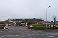 Supermarket service station, Beverley (geograph 6361412).jpg 800 × 535; 62 KB
-
 The Beverley and Barmston Drain (geograph 6349430).jpg 800 × 600; 103 KB
-
 The Warton Arms, Woodmansey (geograph 6350010).jpg 800 × 555; 83 KB
-
 Victoria Road (A164), Beverley (geograph 6361410).jpg 640 × 480; 89 KB
-
 Walkington Heads (geograph 6360763).jpg 800 × 600; 127 KB
-
 Walkington Road (geograph 6361368).jpg 800 × 600; 94 KB
-
 Walkington Sanctuary Stone (geograph 6360798).jpg 800 × 600; 233 KB
-
 Walkington Village Hall (geograph 6360810).jpg 800 × 664; 100 KB
-
 War memorial, Woodmansey (geograph 6349403).jpg 800 × 529; 62 KB
-
 Waterlogged field entrance, Norhlands (geograph 6360761).jpg 800 × 600; 114 KB
-
 Woodmansey Mile, Beverley (geograph 6358213).jpg 5,184 × 3,888; 5.76 MB
-
 Woodmansey Mile, Beverley (geograph 6358217).jpg 5,184 × 3,888; 3.58 MB
-
 Woodmansey Primary School (geograph 6349396).jpg 800 × 524; 67 KB
.jpg)
.jpg)
.jpg)
.jpg)
.jpg)
.jpg)
.jpg)
.jpg)
_(geograph_6355970).jpg)


_(geograph_6355963).jpg)

.jpg)
.jpg)
.jpg)
.jpg)
.jpg)
.jpg)

.jpg)
.jpg)
.jpg)
.jpg)
.jpg)
.jpg)
_(geograph_6349420).jpg)
.jpg)
,_Walkington_(geograph_6355230).jpg)

.jpg)
.jpg)
.jpg)
.jpg)
.jpg)
.jpg)
.jpg)
.jpg)
.jpg)

.jpg)
.jpg)
.jpg)
.jpg)
.jpg)

.jpg)
.jpg)
.jpg)
.jpg)
.jpg)
.jpg)
.jpg)
.jpg)
.jpg)
.jpg)
.jpg)
.jpg)
.jpg)
.jpg)
.jpg)
.jpg)
.jpg)
.jpg)
.jpg)
.jpg)
.jpg)
.jpg)
.jpg)
,_Woodmansey_(geograph_6350260).jpg)
,_Woodmansey_(geograph_6350261).jpg)
_(geograph_6352048).jpg)
_(geograph_6352050).jpg)
.jpg)
,_Beverley_(geograph_6361411).jpg)
.jpg)
.jpg)
.jpg)
.jpg)
_(geograph_6355967).jpg)
.jpg)
.jpg)
.jpg)
.jpg)
.jpg)
.jpg)
.jpg)
.jpg)
.jpg)
.jpg)
.jpg)
.jpg)
.jpg)
.jpg)
.jpg)
.jpg)
.jpg)
.jpg)
.jpg)
.jpg)
,_Walkington_(geograph_6355233).jpg)
,_Walkington_(geograph_6355234).jpg)
.jpg)
.jpg)
.jpg)
.jpg)
.jpg)
.jpg)
.jpg)
.jpg)
.jpg)
.jpg)
.jpg)
.jpg)
.jpg)
.jpg)
.jpg)
.jpg)
,_Beverley_(geograph_6361410).jpg)
.jpg)
.jpg)
.jpg)
.jpg)
.jpg)
.jpg)
.jpg)
.jpg)
.jpg)