Category:Deighton, York
village and civil parish in the unitary authority of the City of York, North Yorkshire, England  | |||||
| Upload media | |||||
| Instance of | |||||
|---|---|---|---|---|---|
| Location | City of York, North Yorkshire, Yorkshire and the Humber, England | ||||
| Population |
| ||||
 | |||||
English: Deighton is a village and civil parish in the unitary authority of the City of York, North Yorkshire, England. It lies on the A19 about five miles south of York. According to the 2001 census the parish had a population of 308. Prior to 1996 it had been part of the Selby district.
Subcategories
This category has the following 7 subcategories, out of 7 total.
B
- Bridge Dike (6 F)
- Bridleways in Deighton CP (8 F)
C
F
- Fields in Deighton CP (37 F)
N
- Naburn Lane, Deighton (6 F)
- North Selby Mine (18 F)
P
Media in category "Deighton, York"
The following 31 files are in this category, out of 31 total.
-

-
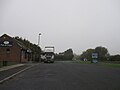 A19 lay-by - geograph.org.uk - 4751055.jpg 640 × 480; 33 KB
-
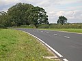 A19 towards York - geograph.org.uk - 2561538.jpg 1,600 × 1,200; 492 KB
-
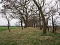 Belt of trees near Crabtree Farm - geograph.org.uk - 6022263.jpg 1,024 × 768; 348 KB
-
 Blanshard's Wood - geograph.org.uk - 6495073.jpg 1,024 × 683; 637 KB
-
 Common Plantation - geograph.org.uk - 5640535.jpg 1,024 × 768; 165 KB
-
 Cycle path near Moreby Far Wood - geograph.org.uk - 3717951.jpg 427 × 640; 153 KB
-
 Deteriorating road surface - geograph.org.uk - 5765070.jpg 640 × 427; 191 KB
-
 Drain near Crabtree New Farm - geograph.org.uk - 6022255.jpg 1,024 × 768; 152 KB
-
 Farm track and Lockwood's Plantation - geograph.org.uk - 5638790.jpg 1,024 × 768; 173 KB
-
 Farm track near Crabtree Farm - geograph.org.uk - 6022257.jpg 1,024 × 768; 183 KB
-
 Helipad - geograph.org.uk - 2028722.jpg 640 × 480; 262 KB
-
 Kill Your Speed - geograph.org.uk - 1920758.jpg 640 × 480; 105 KB
-
 Main Street, Deighton - geograph.org.uk - 2561533.jpg 1,600 × 1,200; 400 KB
-
 Minor road junction with the A19 - geograph.org.uk - 2561525.jpg 1,600 × 1,200; 597 KB
-
 New Road - geograph.org.uk - 1920726.jpg 640 × 480; 92 KB
-
 New Road next to the A19 - geograph.org.uk - 1920744.jpg 640 × 480; 107 KB
-
 New Road towards the A19 - geograph.org.uk - 2561520.jpg 1,600 × 1,200; 513 KB
-
 No overtaking - geograph.org.uk - 5765067.jpg 640 × 427; 230 KB
-
 North House Farm Cottages - geograph.org.uk - 4098136.jpg 1,600 × 949; 565 KB
-
 Painting Garden 2 Home at Crockey Hill - geograph.org.uk - 4098044.jpg 1,600 × 1,064; 745 KB
-
 Passing Blanshard's Wood - geograph.org.uk - 6495070.jpg 1,024 × 683; 501 KB
-
 Permissive path in Moreby Far Wood - geograph.org.uk - 6022158.jpg 1,024 × 768; 298 KB
-
 Road leading to North House Farm - geograph.org.uk - 4098131.jpg 1,600 × 1,064; 515 KB
-
 The White Swan, Deighton - geograph.org.uk - 2561531.jpg 1,600 × 1,200; 352 KB
-
 Towards North Mine on New Road - geograph.org.uk - 1920719.jpg 640 × 480; 93 KB
-
 Track leading to Lockwood's Plantation - geograph.org.uk - 4098081.jpg 1,600 × 1,064; 649 KB
-
 Track to North House - geograph.org.uk - 5764998.jpg 640 × 427; 236 KB
-

-
 Two drains into one - geograph.org.uk - 5641428.jpg 1,024 × 768; 168 KB
-
 White Swan - geograph.org.uk - 4938652.jpg 640 × 427; 56 KB


