Category:Demographic maps by race
Media in category "Demographic maps by race"
The following 18 files are in this category, out of 18 total.
-
 "Negro Population Seattle 1960" map (53167019351).jpg 2,367 × 3,361; 1.81 MB
-
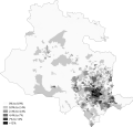
 Black Birmingham 2011 census.png 14,331 × 17,553; 13.25 MB
-
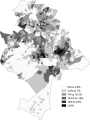
 Black Bradford 2011 census.png 18,387 × 17,611; 10.13 MB
-
 Black Bristol 2011 census.png 15,328 × 17,487; 10.26 MB
-
 Black Coventry 2011 census.png 20,104 × 17,432; 11.24 MB
-
 Black Greater London 2011 census.png 21,322 × 16,471; 25.12 MB
-
 Black Greater Manchester 2011 census.png 23,790 × 17,434; 25.56 MB
-
 Black Leeds 2011 census.png 21,558 × 17,663; 14.24 MB
-
 Black Leicester 2011 census.png 16,409 × 17,610; 9.31 MB
-
 Black Luton 2011 census.png 23,141 × 17,437; 9.11 MB
-
 Black Nottingham 2011 census.png 13,213 × 17,550; 8.11 MB
-
 Black Sheffield 2011 census.png 25,406 × 17,611; 12.64 MB
-
 Black Slough 2011 census.png 26,066 × 16,981; 7.32 MB
-
 Black West Midlands 2011 census.png 25,895 × 17,058; 26.04 MB
-
 Black West Yorkshire 2011 census.png 22,806 × 17,495; 22.44 MB
-
 Caribbean Or Black Glasgow 2011 census.png 20,995 × 17,436; 18.11 MB
-
 South Africa 2001 Black African population proportion map.svg 1,072 × 933; 561 KB
-
 South Africa 2011 Black African population proportion map.svg 809 × 709; 1.07 MB
.jpg)


