Category:Demographic maps of Eure
Subcategories
This category has the following 2 subcategories, out of 2 total.
*
P
- Population density maps of Eure (13 F)
Media in category "Demographic maps of Eure"
The following 2 files are in this category, out of 2 total.
-
 27 EURE carte grille communale densite INSEE.png 3,507 × 2,480; 3.74 MB
-
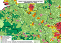
 Carte big data du canton Evreux 2.png 1,849 × 1,199; 121 KB

