<nowiki>Dent de Perroc; dent de Perroc; دنت د پروک; 佩羅克峰; ڈنٹ ڈی پیرک; Dent de Perroc; Dent de Perroc; დან-დე-პეროკი; Dent de Perroc; 佩羅克峰; 佩罗克峰; Dent de Perroc; Dent de Perroc; Dent de Perroc; دينت دي بيروك; Dent de Perroc; جبل دينت دى بيروك; crëp te la Svizra te la grupa Elpes dl Wallis; সুইজারল্যান্ডের পর্বত; montagne suisse; הר בשווייץ; berg in Zwitserland; mal; լեռ Շվեյցարիայում; Berg in der Schweiz; mountain in Switzerland; sliabh san Eilvéis; جبل في سويسرا; гора у Швейцарії; Montagna nel Canton Vallese; 佩罗克峰</nowiki>


 A a pic arolla fev 23.jpg 908 × 1,210; 277 KB
 Aiguille de la Tsa.jpg 1,024 × 680; 516 KB
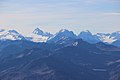 Bouquetins, Dent de Perroc and L'Eveque (15423290070).jpg 5,184 × 3,456; 4.67 MB
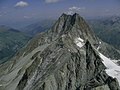 Dent de Perroc et Pointe des Genevois vues de l'Aiguille de la Tsa.jpg 2,000 × 1,500; 1.24 MB
 Dent de Perroc.JPG 1,704 × 2,272; 1.44 MB
 DentDePerrocEvolene.jpg 2,816 × 2,112; 2.22 MB
 Oberhalb Bricola.jpg 4,000 × 3,000; 4.61 MB
 Panorama Bricola 2021a.jpg 13,364 × 4,014; 15.07 MB
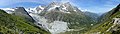 Panorama Bricola 2021b.jpg 14,547 × 4,140; 16.6 MB
 Panorama oberhalb Bricola.jpg 28,672 × 4,474; 40.24 MB
 Vignettes.jpg 768 × 475; 128 KB

.jpg)

,_Perroc_(3.676_m),_Genevois_(3.674_m),_Glacier_du_Mont_Min%C3%A9_-_panoramio.jpg)


