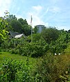
Category:Dianelunds koloniträdgårdsförening
| Upload media | |||||
| Instance of | |||||
|---|---|---|---|---|---|
| Location | Stockholm Municipality, Stockholm County, Sweden | ||||
 | |||||
Media in category "Dianelunds koloniträdgårdsförening"
The following 5 files are in this category, out of 5 total.
-
Dianelund 2011a.jpg 2,658 × 1,950; 1.86 MB
-
Dianelund 2011b.jpg 2,937 × 2,172; 2.65 MB
-
Dianelund 2011c.jpg 3,000 × 2,076; 1.86 MB
-
Dianelund 2011d.jpg 3,030 × 2,169; 2.11 MB
-
Dianelunds koloniområde Årsta Stockholm 01.jpg 1,695 × 1,998; 1.09 MB


