Category:Dirt roads in Leicestershire
Ceremonial counties of England: Bedfordshire · Berkshire · Buckinghamshire · Cambridgeshire · Cheshire · Cornwall · Cumbria · Derbyshire · Devon · Dorset · Durham · East Riding of Yorkshire · East Sussex · Essex · Gloucestershire · Greater London · Greater Manchester · Hampshire · Herefordshire · Hertfordshire · Isle of Wight · Kent · Lancashire · Leicestershire · Lincolnshire · Merseyside · Norfolk · North Yorkshire · Northamptonshire · Northumberland · Nottinghamshire · Oxfordshire · Rutland · Shropshire · Somerset · South Yorkshire · Staffordshire · Suffolk · Surrey · Warwickshire · West Sussex · West Yorkshire · Wiltshire · Worcestershire
City-counties:
Former historic counties:
Other former counties:
City-counties:
Former historic counties:
Other former counties:
Media in category "Dirt roads in Leicestershire"
The following 20 files are in this category, out of 20 total.
-
 A circular walk from Redmile, (46) - geograph.org.uk - 794936.jpg 640 × 427; 93 KB
-
 Approaching the village of Blaston - geograph.org.uk - 566640.jpg 640 × 480; 148 KB
-
 Bales and barns at The Grange Farm Exton - geograph.org.uk - 145832.jpg 504 × 640; 141 KB
-
 Bridleway near Eastwell - geograph.org.uk - 632890.jpg 640 × 427; 119 KB
-
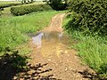 Byway Ford at Marefield.jpg 3,264 × 2,448; 4.68 MB
-

-
 Farm track near Saltby Airfield - geograph.org.uk - 703215.jpg 640 × 427; 110 KB
-
 Farm track near Tugby - geograph.org.uk - 884697.jpg 640 × 459; 83 KB
-
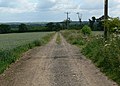
 Farm Track North of Shepshed - geograph.org.uk - 1340209.jpg 640 × 480; 105 KB
-
 Farm Track North of Shepshed - geograph.org.uk - 1340212.jpg 640 × 480; 94 KB
-

-
 Former mine road - geograph.org.uk - 1298821.jpg 640 × 426; 86 KB
-

-
 Pear Tree Lane Loughborough - geograph.org.uk - 1338356.jpg 640 × 480; 130 KB
-
 Pear Tree Lane Loughborough - geograph.org.uk - 1338361.jpg 640 × 480; 110 KB
-
 Track towards Thorpe Langton - geograph.org.uk - 725487.jpg 640 × 480; 95 KB
-
 Tracks - geograph.org.uk - 238778.jpg 640 × 480; 126 KB
-
 View towards Ragdale Wood - geograph.org.uk - 883384.jpg 640 × 458; 100 KB
-
 Farm road at Hoefields Farm - geograph.org.uk - 266563.jpg 640 × 427; 85 KB
-

_-_geograph.org.uk_-_794936.jpg)


