Category:Dirt roads in Powys
Media in category "Dirt roads in Powys"
The following 200 files are in this category, out of 255 total.
(previous page) (next page)-
 "Does my bum look big in this" - geograph.org.uk - 816468.jpg 640 × 427; 71 KB
-
-

-
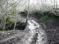
 A bit of a mess - geograph.org.uk - 1386900.jpg 640 × 480; 120 KB
-
 A fine spot to rough camp for the night - panoramio.jpg 3,264 × 2,448; 1.84 MB
-
 A forestry road in Hafren - geograph.org.uk - 1127550.jpg 640 × 480; 180 KB
-
 A gate on the hairpin - geograph.org.uk - 1164803.jpg 640 × 480; 121 KB
-
 A muddy Wye Valley Walk beside the river^ - geograph.org.uk - 2609069.jpg 2,592 × 1,944; 1.47 MB
-
 A New Track - geograph.org.uk - 314124.jpg 640 × 465; 132 KB
-
 A Private Track - geograph.org.uk - 314122.jpg 640 × 480; 103 KB
-
-
 A steady climb towards Blaenbidno - geograph.org.uk - 1114185.jpg 640 × 480; 174 KB
-
 A track in Cwm-Llinau - geograph.org.uk - 1095252.jpg 640 × 480; 202 KB
-
 A view along the forest track - geograph.org.uk - 1266935.jpg 640 × 480; 135 KB
-
 Access to Dol-llys fach - geograph.org.uk - 968340.jpg 640 × 480; 114 KB
-
 Access to the moor - geograph.org.uk - 674044.jpg 640 × 480; 117 KB
-
 Across Mynydd Epynt - geograph.org.uk - 1179778.jpg 640 × 427; 191 KB
-

-
 Approaching Penisarplwyf - geograph.org.uk - 695290.jpg 639 × 479; 205 KB
-
 Approaching Pentwyn - geograph.org.uk - 739366.jpg 639 × 479; 203 KB
-
 Beilibedw track. - geograph.org.uk - 429136.jpg 640 × 480; 89 KB
-
 Bridge over the Warren Brook - geograph.org.uk - 1095027.jpg 640 × 480; 100 KB
-

-
 Bridleway through the Tywi Forest, Powys - geograph.org.uk - 1501153.jpg 470 × 640; 140 KB
-
 Bridleway to Builth Wells - geograph.org.uk - 669414.jpg 640 × 480; 108 KB
-
 Bwlch Hyddgen - geograph.org.uk - 668312.jpg 640 × 427; 71 KB
-
 Byway heading to Soar - geograph.org.uk - 798929.jpg 640 × 480; 89 KB
-
 Byway into the Tywi Forest, Powys - geograph.org.uk - 1045166.jpg 640 × 480; 140 KB
-
 Byway near the Afon Tywi, Powys - geograph.org.uk - 1045135.jpg 640 × 432; 113 KB
-
 Byway to Strata Florida, Powys - geograph.org.uk - 1045092.jpg 640 × 480; 129 KB
-
 Byway to Strata Florida, Powys - geograph.org.uk - 1045119.jpg 640 × 465; 157 KB
-
 Byway to Strata Florida, Powys - geograph.org.uk - 1045125.jpg 640 × 480; 142 KB
-
 Byway to Strata Florida, Powys - geograph.org.uk - 1570154.jpg 640 × 447; 123 KB
-
 Byway to Strata Florida, Powys - geograph.org.uk - 1570261.jpg 640 × 434; 135 KB
-
 Byway to Strata Florida, Powys - geograph.org.uk - 1571313.jpg 640 × 640; 158 KB
-
 Byway to Strata Florida, Powys - geograph.org.uk - 1572755.jpg 640 × 439; 126 KB
-
 Ceulan track - geograph.org.uk - 809639.jpg 479 × 640; 89 KB
-
 Claerwen road - geograph.org.uk - 1204533.jpg 640 × 359; 80 KB
-
 Clear route across the moors - geograph.org.uk - 693297.jpg 639 × 479; 188 KB
-

-
 Coed Cwm Bach - geograph.org.uk - 3981228.jpg 3,600 × 2,400; 4.06 MB
-
 Concrete bridge and mountain track - geograph.org.uk - 269962.jpg 640 × 480; 63 KB
-
 Cycle route down to A40 - geograph.org.uk - 937712.jpg 640 × 480; 96 KB
-
 Dead end - geograph.org.uk - 1551031.jpg 640 × 427; 121 KB
-
 Dinas Farm - geograph.org.uk - 318231.jpg 640 × 480; 116 KB
-
 Dirt Track - geograph.org.uk - 692545.jpg 640 × 401; 93 KB
-
 Down the forest-side track - geograph.org.uk - 1593005.jpg 640 × 480; 103 KB
-
 Down the hill to Corner - geograph.org.uk - 806666.jpg 640 × 480; 72 KB
-
 Down Towards The River - geograph.org.uk - 315762.jpg 640 × 480; 106 KB
-
 Drive up to Llwyn Onn - geograph.org.uk - 732227.jpg 640 × 425; 79 KB
-

-

-
 End of the track by Bryn-du - geograph.org.uk - 1425051.jpg 640 × 480; 149 KB
-
 Entrance to Battle Hill - geograph.org.uk - 617698.jpg 640 × 480; 216 KB
-
 Entrance to Careg-ywen - geograph.org.uk - 861324.jpg 640 × 426; 64 KB
-
 Entrance to Tycerrig - geograph.org.uk - 1572893.jpg 640 × 480; 70 KB
-
 Esgair Dafydd, forest road - geograph.org.uk - 839607.jpg 640 × 480; 94 KB
-
 Esgair Dayfdd, forest road junction - geograph.org.uk - 839619.jpg 640 × 480; 79 KB
-
 Ewes and lambs 4 - geograph.org.uk - 738085.jpg 640 × 480; 143 KB
-
 Farm access track - geograph.org.uk - 229509.jpg 640 × 480; 145 KB
-
 Farm and forestry track - geograph.org.uk - 1107275.jpg 480 × 640; 271 KB
-
 Farm Roller and Track - geograph.org.uk - 166575.jpg 640 × 426; 132 KB
-
 Farm track - geograph.org.uk - 1047942.jpg 640 × 480; 84 KB
-
 Farm Track - Moelfre - geograph.org.uk - 38908.jpg 400 × 597; 52 KB
-
 Farm track above Wolfpits Farm - geograph.org.uk - 686467.jpg 640 × 480; 86 KB
-
 Farm track along Banc y Belan - geograph.org.uk - 809340.jpg 640 × 479; 59 KB
-
 Farm track and fields - geograph.org.uk - 798557.jpg 640 × 480; 106 KB
-
 Farm track and footpath - geograph.org.uk - 579831.jpg 640 × 480; 93 KB
-
 Farm track at Bwlch Lluan - geograph.org.uk - 1234866.jpg 640 × 480; 143 KB
-
 Farm track at Cefn-gwenthrew - geograph.org.uk - 986704.jpg 2,592 × 1,944; 1.29 MB
-
 Farm track from the A483 - geograph.org.uk - 570370.jpg 640 × 480; 104 KB
-
 Farm track near Trefeglwys - geograph.org.uk - 472367.jpg 640 × 480; 112 KB
-
 Farm track to Burl Hill - geograph.org.uk - 687355.jpg 640 × 480; 90 KB
-
 Farm track to Cwm Gwalley - geograph.org.uk - 687153.jpg 640 × 480; 84 KB
-
 Farm track to Glanhirin - geograph.org.uk - 651428.jpg 640 × 480; 57 KB
-
 Farm track to Mount Pleasant - geograph.org.uk - 686416.jpg 640 × 480; 99 KB
-

-
 Felled Timber - geograph.org.uk - 519374.jpg 640 × 480; 235 KB
-
 Field Access - geograph.org.uk - 315361.jpg 640 × 466; 108 KB
-
 Flanks of Cowlod - geograph.org.uk - 840088.jpg 640 × 477; 82 KB
-
 Footpath off minor road below Glandwr - geograph.org.uk - 539056.jpg 640 × 425; 119 KB
-
 Footpath to Glan Irfon - geograph.org.uk - 353301.jpg 640 × 439; 163 KB
-
 Footpath to Twyn-y Garn - geograph.org.uk - 798707.jpg 640 × 480; 105 KB
-
 Ford and Track on Gwaunceste Hill - geograph.org.uk - 391089.jpg 640 × 480; 68 KB
-
 Ford over Grwyne Fawr - geograph.org.uk - 405185.jpg 640 × 480; 93 KB
-
 Forest road below Bryn Mawr - geograph.org.uk - 900958.jpg 640 × 480; 87 KB
-
 Forest road near Lluast - geograph.org.uk - 899969.jpg 640 × 480; 64 KB
-
 Forest road, Nant Llyn Coch-hwyad - geograph.org.uk - 1941028.jpg 640 × 480; 99 KB
-
 Forest Track - geograph.org.uk - 251094.jpg 640 × 480; 136 KB
-
 Forest track - geograph.org.uk - 553934.jpg 640 × 480; 120 KB
-
 Forest track at Penrhos - geograph.org.uk - 1328181.jpg 640 × 480; 111 KB
-
 Forest track in Radnor Wood - geograph.org.uk - 682641.jpg 640 × 480; 74 KB
-
 Forest Track in Radnor Wood - geograph.org.uk - 682648.jpg 640 × 480; 92 KB
-
 Forest track junction - geograph.org.uk - 809763.jpg 479 × 640; 69 KB
-
 Forestry Commission - geograph.org.uk - 328000.jpg 640 × 480; 80 KB
-

-
 Forestry Road - geograph.org.uk - 1044666.jpg 640 × 428; 407 KB
-
 Forestry road - geograph.org.uk - 402276.jpg 640 × 480; 115 KB
-
 Forestry road at Belan - geograph.org.uk - 1115222.jpg 640 × 480; 160 KB
-
 Forestry road in Coed Nantyrhwch, Powys - geograph.org.uk - 3682775.jpg 1,024 × 768; 534 KB
-
 Forestry road in Coed Nantyrhwch, Powys - geograph.org.uk - 3684709.jpg 1,024 × 768; 549 KB
-
 Forestry road in Hafren - geograph.org.uk - 1125882.jpg 640 × 480; 199 KB
-
 Forestry Road near Llyn Brianne, Powys - geograph.org.uk - 1039385.jpg 640 × 480; 123 KB
-
 Forestry Road near Llyn Brianne, Powys - geograph.org.uk - 1058763.jpg 640 × 454; 146 KB
-

-
 Forestry track - geograph.org.uk - 241787.jpg 640 × 480; 131 KB
-
 Forestry Track - geograph.org.uk - 520659.jpg 640 × 480; 303 KB
-
 Forestry track in Cwm Broadwell Wood - geograph.org.uk - 684609.jpg 640 × 480; 113 KB
-
 Forestry track near Hengwm-cyfeiliog - geograph.org.uk - 296819.jpg 640 × 480; 257 KB
-
 Forestry track up Cefn Fannog - geograph.org.uk - 988219.jpg 640 × 470; 117 KB
-
 Gate and field near Cafn bach - geograph.org.uk - 968332.jpg 640 × 480; 93 KB
-
 Gate on bridleway - geograph.org.uk - 601152.jpg 640 × 480; 115 KB
-
 Gate to the open mountainside - geograph.org.uk - 655895.jpg 640 × 480; 109 KB
-
 Gated Forestry track - geograph.org.uk - 251090.jpg 640 × 480; 128 KB
-
 Gated Pathway - geograph.org.uk - 692518.jpg 640 × 410; 117 KB
-
 Gated Way - geograph.org.uk - 710301.jpg 640 × 402; 88 KB
-
 Gwern-stablau Farm - geograph.org.uk - 242042.jpg 640 × 480; 146 KB
-
 Henallt Wood - geograph.org.uk - 669439.jpg 640 × 480; 116 KB
-
 In Coed Nantyrhwch, Powys - geograph.org.uk - 3687566.jpg 1,024 × 768; 595 KB
-
 Junction of tracks at Glaslyn - geograph.org.uk - 296036.jpg 640 × 480; 121 KB
-
 Junction of Tracks on Glascwm Hill - geograph.org.uk - 391116.jpg 640 × 480; 90 KB
-
 Lane down from A470 - geograph.org.uk - 601203.jpg 480 × 640; 173 KB
-
 Lane towards Aberedw - geograph.org.uk - 694008.jpg 639 × 479; 155 KB
-
 Lane towards Aberedw - geograph.org.uk - 694021.jpg 639 × 479; 165 KB
-
 Lane towards Aberedw Hill - geograph.org.uk - 694032.jpg 639 × 479; 170 KB
-
 Lane with silage bales - geograph.org.uk - 1612495.jpg 640 × 480; 94 KB
-
 Little used track, Cefn Coch - geograph.org.uk - 987683.jpg 480 × 640; 120 KB
-

-
 Maes-socyn garage - geograph.org.uk - 404443.jpg 640 × 480; 115 KB
-
 Minor Road Approach - geograph.org.uk - 692496.jpg 640 × 398; 71 KB
-
 Moorland track - geograph.org.uk - 1115504.jpg 640 × 480; 204 KB
-
 Moorland track - geograph.org.uk - 1115515.jpg 640 × 480; 179 KB
-
 Mountain road - geograph.org.uk - 561038.jpg 640 × 480; 113 KB
-
 Muddy footpath - geograph.org.uk - 318254.jpg 640 × 480; 108 KB
-
 Mynydd Bychan forest track - geograph.org.uk - 1189938.jpg 640 × 480; 141 KB
-
 Narrow lane - geograph.org.uk - 1346302.jpg 640 × 480; 284 KB
-
 Near Nantyrychain - geograph.org.uk - 86884.jpg 640 × 480; 85 KB
-
 No Go Area - geograph.org.uk - 687948.jpg 640 × 480; 223 KB
-
 Old drove road - geograph.org.uk - 311601.jpg 480 × 640; 120 KB
-
 Old lane to Tynypant - geograph.org.uk - 1048373.jpg 640 × 480; 132 KB
-
 Old road from Abertridwr to Penygarnedd - geograph.org.uk - 559258.jpg 640 × 480; 132 KB
-

-
 Path on Bryn Teg - geograph.org.uk - 434071.jpg 640 × 480; 53 KB
-
 Penygarreg Reservoir - geograph.org.uk - 3657775.jpg 1,024 × 680; 212 KB
-
 Poor condition county road - geograph.org.uk - 752655.jpg 640 × 480; 90 KB
-
 Public footpath near Pant-y-Falog - geograph.org.uk - 425720.jpg 640 × 480; 103 KB
-

-
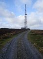
 Radnor Forest - geograph.org.uk - 694368.jpg 640 × 427; 97 KB
-
 Radnor Forest - Original road - geograph.org.uk - 697323.jpg 640 × 427; 127 KB
-
 Radnor Forest Track - geograph.org.uk - 666849.jpg 640 × 480; 101 KB
-
 Rally track in Cwm Cyff - geograph.org.uk - 2979841.jpg 3,872 × 2,592; 4.47 MB
-

-
 Restricted byway - geograph.org.uk - 669966.jpg 640 × 480; 131 KB
-
 Road junction, Radnor Forest - geograph.org.uk - 909893.jpg 640 × 359; 60 KB
-
 Road to Pen-twyn - geograph.org.uk - 489629.jpg 640 × 480; 136 KB
-
 Roadway into Ffos y Ffwdan forest - geograph.org.uk - 605135.jpg 640 × 427; 79 KB
-

-
 Sarn Helen - geograph.org.uk - 693628.jpg 640 × 480; 98 KB
-
 St Teilo's Barn, Llandeilo Graban - geograph.org.uk - 578728.jpg 640 × 426; 132 KB
-

-
-
 The finised job - geograph.org.uk - 1269606.jpg 426 × 640; 83 KB
-
 The lane to Cefnwilgy Fach - geograph.org.uk - 405291.jpg 640 × 480; 81 KB
-
 The Severn Way, looking SW - geograph.org.uk - 534025.jpg 640 × 409; 37 KB
-

-
 The Track To Caen-y-mynydd - geograph.org.uk - 313921.jpg 640 × 480; 91 KB
-
 The track to Glynmeddig - geograph.org.uk - 816857.jpg 640 × 427; 300 KB
-

-
 The track to Twyn Dylluan-ddu - geograph.org.uk - 190451.jpg 640 × 480; 94 KB
-

-
 Track above Llanbadarn-y-garreg - geograph.org.uk - 578265.jpg 640 × 426; 122 KB
-
 Track across Llandeilo Hill - geograph.org.uk - 578396.jpg 640 × 426; 139 KB
-
 Track across the head of Nant Geifr - geograph.org.uk - 2962614.jpg 1,024 × 768; 148 KB
-
 Track and field boundary - geograph.org.uk - 571051.jpg 640 × 480; 121 KB
-
 Track approaching Penisarplwyf - geograph.org.uk - 695279.jpg 639 × 479; 199 KB
-
 Track ascending Llandefalle Common - geograph.org.uk - 714409.jpg 640 × 462; 77 KB
-
 Track at Sweet Lamb - geograph.org.uk - 1169243.jpg 640 × 480; 199 KB
-
 Track by Nant Medwaledd - geograph.org.uk - 310690.jpg 640 × 480; 67 KB
-
 Track by Pwll y Gaseg - geograph.org.uk - 278395.jpg 640 × 427; 66 KB
-
 Track by woodland - geograph.org.uk - 670751.jpg 480 × 640; 114 KB
-
 Track down from Cwm Cynwyn - geograph.org.uk - 2113820.jpg 640 × 480; 93 KB
-
 Track east of Gaer Farm - geograph.org.uk - 111446.jpg 640 × 394; 78 KB
-
 Track from A470 - geograph.org.uk - 601182.jpg 640 × 480; 146 KB
-
 Track heading across Bryn Mawr - geograph.org.uk - 2844783.jpg 640 × 427; 103 KB
-
 Track in Hafren Forest - geograph.org.uk - 761943.jpg 640 × 480; 89 KB
-
 Track into Cerrig yr Wyn - geograph.org.uk - 2480663.jpg 640 × 480; 221 KB
-
 Track junction in the Dyfnant Forest - geograph.org.uk - 1508325.jpg 640 × 480; 158 KB
-
 Track junction in the forest - geograph.org.uk - 1775219.jpg 778 × 584; 198 KB
-
 Track junction near Coed yr Allt fawr - geograph.org.uk - 296820.jpg 640 × 480; 266 KB
-
 Track junction near Ffridd y Garnedd - geograph.org.uk - 1509465.jpg 640 × 480; 149 KB
-
 Track near Blaen-y-cwm - geograph.org.uk - 269953.jpg 640 × 480; 58 KB
-
 Track near Mynydd Dwyriw - geograph.org.uk - 165867.jpg 640 × 426; 136 KB
-
 Track north to New Building - geograph.org.uk - 378133.jpg 640 × 480; 98 KB
-
 Track on Bache Hill - geograph.org.uk - 684399.jpg 640 × 480; 119 KB
-
 Track on Kerry Hill - geograph.org.uk - 163953.jpg 640 × 426; 117 KB
-
 Track on Little Hill - geograph.org.uk - 429035.jpg 640 × 480; 69 KB
-
 Track on the east side of Cwm Oergwm - geograph.org.uk - 190725.jpg 640 × 480; 94 KB
-
 Track running SSW into gridsquare SO2992 - geograph.org.uk - 220040.jpg 640 × 480; 139 KB
-
-
 Track to Beili Farm - geograph.org.uk - 287337.jpg 640 × 480; 247 KB


