Category:Distant views of Culter Fell
Media in category "Distant views of Culter Fell"
The following 21 files are in this category, out of 21 total.
-
 Dun Law - geograph.org.uk - 1522246.jpg 640 × 480; 92 KB
-
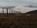 Fence on Hunt Law - geograph.org.uk - 320097.jpg 640 × 480; 45 KB
-
 Great Knock - geograph.org.uk - 510634.jpg 640 × 480; 76 KB
-
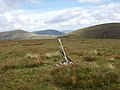
 Middle Hill summit - geograph.org.uk - 638442.jpg 480 × 640; 104 KB
-
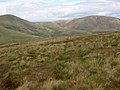
 North side of Broad Law - geograph.org.uk - 181907.jpg 640 × 427; 169 KB
-
 North slopes, The Scrape - geograph.org.uk - 572810.jpg 640 × 480; 57 KB
-
 On Little Knock - geograph.org.uk - 509843.jpg 640 × 480; 73 KB
-
 Pool on Cowgill Rig - geograph.org.uk - 916755.jpg 640 × 480; 96 KB
-
 Snowgill Hill - geograph.org.uk - 922490.jpg 640 × 359; 55 KB
-
 Summit cairn, Coomb Hill - geograph.org.uk - 52265.jpg 640 × 480; 260 KB
-
-
 The summit 'cairn' on Hillshaw Head - geograph.org.uk - 1424768.jpg 640 × 480; 77 KB
-
 The summit of Chapelgill Hill - geograph.org.uk - 32762.jpg 640 × 480; 72 KB
-

-

-
 Woody Cleugh - geograph.org.uk - 923976.jpg 640 × 480; 76 KB
-
 Perryflats Road, Perryflatts - geograph.org.uk - 626464.jpg 640 × 480; 60 KB
-
 Sheep and Pine Trees - geograph.org.uk - 101762.jpg 640 × 466; 119 KB
-
 Summit, Collie Law - geograph.org.uk - 150618.jpg 640 × 480; 273 KB
-
 The Summit of Goseland Hill - geograph.org.uk - 145013.jpg 640 × 480; 248 KB
-
 Tweeddale, Altarstone. - geograph.org.uk - 235096.jpg 640 × 480; 96 KB


