Category:Distant views of Dunrod Hill
Media in category "Distant views of Dunrod Hill"
The following 26 files are in this category, out of 26 total.
-
 Commoncraig - geograph.org.uk - 1634216.jpg 640 × 480; 97 KB
-
 Countryside Near Inverkip - geograph.org.uk - 275607.jpg 640 × 480; 113 KB
-
 Daff Reservoir - geograph.org.uk - 893111.jpg 640 × 480; 92 KB
-
 Daff Reservoir from Leap Moor - geograph.org.uk - 132809.jpg 640 × 480; 120 KB
-
 Daff Reservoir overflow - geograph.org.uk - 893062.jpg 640 × 480; 89 KB
-
 Dunrod Hill and Loch Thom - geograph.org.uk - 174030.jpg 640 × 480; 57 KB
-

-
 Everton Farm - geograph.org.uk - 491738.jpg 625 × 480; 110 KB
-
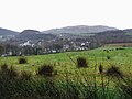
 Fields above Inverkip - geograph.org.uk - 1194671.jpg 640 × 480; 72 KB
-
 Inverkip from Berfern - geograph.org.uk - 428377.jpg 640 × 480; 94 KB
-
 Kelly Cut - geograph.org.uk - 535475.jpg 640 × 480; 92 KB
-
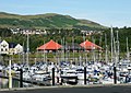
 Kip Marina - geograph.org.uk - 1635339.jpg 640 × 480; 91 KB
-
 Kip Marina and Dunrod Hill - geograph.org.uk - 1422837.jpg 640 × 454; 94 KB
-
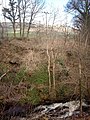 Kip Water in Dunrod Glen - geograph.org.uk - 145783.jpg 480 × 640; 162 KB
-
 Leap Moor and Leapmoor Forest - geograph.org.uk - 1103130.jpg 640 × 480; 62 KB
-
 Leap Moor and Leapmoor Forest - geograph.org.uk - 1103138.jpg 640 × 480; 60 KB
-
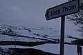
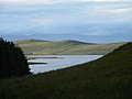 Loch Thom - geograph.org.uk - 1417724.jpg 640 × 480; 40 KB
-
 Lyle Hill viewpoint car park, view south to hills and IRH.jpg 3,667 × 2,751; 2.28 MB
-
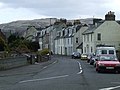 Main Street - geograph.org.uk - 771993.jpg 640 × 480; 87 KB
-
 Moorland at Kelly Cut - geograph.org.uk - 1103120.jpg 640 × 480; 60 KB
-
 Shielhill Farm - geograph.org.uk - 486981.jpg 640 × 450; 71 KB
-
 The Kelly Cut - geograph.org.uk - 1103183.jpg 640 × 480; 64 KB
-
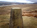 Triangulation Pillar on Corlick Hill - geograph.org.uk - 143231.jpg 640 × 480; 109 KB
-
 Water pipe marker - geograph.org.uk - 145788.jpg 480 × 640; 147 KB
-
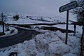 Wintry Shielhill Glen Road - geograph.org.uk - 1735727.jpg 3,872 × 2,592; 1.92 MB
-
 Wintry Shielhill Glen Road - geograph.org.uk - 1735736.jpg 3,872 × 2,592; 2.88 MB


