Category:Distant views of Erskine Bridge
Media in category "Distant views of Erskine Bridge"
The following 19 files are in this category, out of 19 total.
-
 Bowling Harbour - geograph.org.uk - 712825.jpg 640 × 374; 54 KB
-
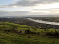 Clydebank from Kilpatrick Hills - geograph.org.uk - 326607.jpg 640 × 480; 72 KB
-
 Depth gauge - geograph.org.uk - 712862.jpg 480 × 640; 82 KB
-
 Erskine Bridge from Bowling - geograph.org.uk - 326589.jpg 640 × 480; 76 KB
-
 Erskine Bridge from Kilbowie Hill - geograph.org.uk - 1354050.jpg 640 × 480; 101 KB
-
 Erskine Bridge from NW.JPG 2,592 × 1,944; 2.18 MB
-
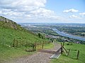
 Fine view from the Kilpatrick Hills - geograph.org.uk - 829027.jpg 640 × 480; 79 KB
-
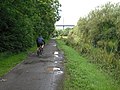
 Footpath above the shore at Bowling - geograph.org.uk - 1481096.jpg 640 × 480; 108 KB
-
 Forth and Clyde Canal - geograph.org.uk - 1469795.jpg 640 × 480; 116 KB
-
 Forth and Clyde Canal - geograph.org.uk - 1470772.jpg 640 × 480; 106 KB
-
 Gate on the walk to Loch Humphrey - geograph.org.uk - 830288.jpg 640 × 480; 85 KB
-
 River Clyde at Bowling - geograph.org.uk - 713085.jpg 640 × 480; 82 KB
-
 River Clyde at Clydebank - geograph.org.uk - 757845.jpg 640 × 480; 55 KB
-
 Shore near Bowling Outer Basin - geograph.org.uk - 1481086.jpg 640 × 360; 58 KB
-

-
 View across Bowling Harbour - geograph.org.uk - 304336.jpg 640 × 480; 66 KB
-

-

-
 West along canal, Dalmuir - geograph.org.uk - 326604.jpg 640 × 480; 84 KB


