Category:Distant views of Ettrick Pen
Media in category "Distant views of Ettrick Pen"
The following 13 files are in this category, out of 13 total.
-
 Bloodhope Head - geograph.org.uk - 408411.jpg 640 × 480; 102 KB
-
 Cairn on the shoulder of Ward Law - geograph.org.uk - 48561.jpg 640 × 480; 76 KB
-
 Entertrona Burn - geograph.org.uk - 29609.jpg 640 × 406; 74 KB
-
 Ettrick Pen - geograph.org.uk - 29631.jpg 640 × 417; 65 KB
-
 Fence, Mitchell Hill - geograph.org.uk - 762213.jpg 640 × 480; 241 KB
-
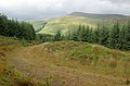 Forest track on Ewe Rig - geograph.org.uk - 1425072.jpg 640 × 424; 91 KB
-
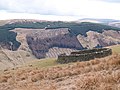
 Forestry clear fell area - geograph.org.uk - 961017.jpg 427 × 640; 153 KB
-
 Glendearg Burn - geograph.org.uk - 762329.jpg 640 × 480; 239 KB
-
 Loch Fell summit. - geograph.org.uk - 29626.jpg 640 × 343; 37 KB
-
 Sheepfold on Wardlaw Ettrick Valley - geograph.org.uk - 557020.jpg 640 × 480; 107 KB
-

-
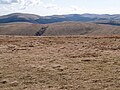 The view south from Andrewhinney Hill - geograph.org.uk - 1266347.jpg 640 × 480; 107 KB
-
 Wall and fence, Bodesbeck Law - geograph.org.uk - 237490.jpg 480 × 640; 107 KB


