Category:Distant views of Hundleshope Heights
Media in category "Distant views of Hundleshope Heights"
The following 14 files are in this category, out of 14 total.
-
 Bleak Hope - geograph.org.uk - 227853.jpg 640 × 480; 276 KB
-
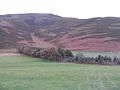
 Field corner below Cademuir - geograph.org.uk - 1413081.jpg 640 × 424; 113 KB
-
 Grazing at Hundleshope - geograph.org.uk - 1608482.jpg 640 × 480; 58 KB
-
 Hundleshope - geograph.org.uk - 895707.jpg 640 × 359; 43 KB
-
 Looking towards Newby Kipps - geograph.org.uk - 1609417.jpg 640 × 480; 68 KB
-
 Pasture near Crookston - geograph.org.uk - 1609278.jpg 640 × 480; 52 KB
-
 Pasture near Crookston - geograph.org.uk - 1609305.jpg 640 × 480; 69 KB
-
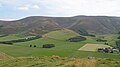
 Pasture, shelter belt and hillsides - geograph.org.uk - 1609284.jpg 640 × 480; 60 KB
-
 Pool, summit of Stob Law - geograph.org.uk - 142729.jpg 640 × 480; 226 KB
-
 Sheepfold, Newholm Hope - geograph.org.uk - 181724.jpg 480 × 640; 313 KB
-
 Snow patch, Broom Hill - geograph.org.uk - 142737.jpg 640 × 480; 215 KB
-
 Summit cairn, Canada Hill - geograph.org.uk - 142711.jpg 640 × 480; 232 KB
-
 The Lyne Water from Drochil Castle - geograph.org.uk - 1703560.jpg 800 × 530; 101 KB
-
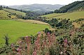 Valley of the Soonhope Burn - geograph.org.uk - 1463293.jpg 640 × 424; 134 KB


