Category:Distant views of Lowther Hill
Media in category "Distant views of Lowther Hill"
The following 20 files are in this category, out of 20 total.
-
 Approaching Lowther Hill - geograph.org.uk - 633999.jpg 640 × 429; 42 KB
-
 Beside the footpath to the Enterkin Pass - geograph.org.uk - 416963.jpg 640 × 480; 117 KB
-
 Bridle Path to Enterkin Pass.jpg 620 × 334; 60 KB
-
 Footpath to Enterkin Pass - geograph.org.uk - 417062.jpg 640 × 480; 119 KB
-
 Glenleith Fell - geograph.org.uk - 1513258.jpg 480 × 640; 94 KB
-
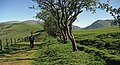
 Knockenhair Farm - geograph.org.uk - 1455234.jpg 640 × 423; 194 KB
-
 Looking east from Bail Hill - geograph.org.uk - 1313954.jpg 640 × 480; 81 KB
-
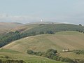
 Lowther Hill - geograph.org.uk - 1553721.jpg 640 × 480; 42 KB
-
 Lowther Hill from Old Town Burn - geograph.org.uk - 3188.jpg 640 × 464; 81 KB
-
 Lowther Hill from the southwest - geograph.org.uk - 981572.jpg 640 × 480; 45 KB
-
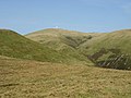
 Lowther Ridge. - geograph.org.uk - 90578.jpg 640 × 405; 52 KB
-
 Near Durisdeer - geograph.org.uk - 219859.jpg 640 × 480; 125 KB
-
 On the south-eastern slope of Steygail - geograph.org.uk - 417860.jpg 640 × 479; 100 KB
-
 Pasture near Dalveen - geograph.org.uk - 1369878.jpg 640 × 480; 77 KB
-
 Pasture, cattle pens and spoil heap - geograph.org.uk - 1314145.jpg 640 × 480; 91 KB
-
 Potrennick Burn. - geograph.org.uk - 90570.jpg 640 × 399; 49 KB
-
 Road Junction at Carronbridge - geograph.org.uk - 1402956.jpg 640 × 480; 73 KB
-
 Rough grazing by the Fingland Road - geograph.org.uk - 1316574.jpg 640 × 480; 88 KB
-
 Southern Uplands scene - geograph.org.uk - 417041.jpg 640 × 480; 122 KB
-


