Category:Distant views of Meigle Hill
Media in category "Distant views of Meigle Hill"
The following 32 files are in this category, out of 32 total.
-
 Balmoral Road, Galashiels - geograph.org.uk - 1250864.jpg 640 × 426; 84 KB
-
 Clovenfords station site geograph-3151141-by-Ben-Brooksbank.jpg 2,395 × 1,397; 3.67 MB
-
 Dismantled railway at Caddonlee - geograph.org.uk - 597534.jpg 640 × 480; 125 KB
-
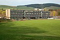 Galashiels Academy - geograph.org.uk - 1250880.jpg 640 × 426; 73 KB
-
 Galashiels Golf Course - geograph.org.uk - 504107.jpg 640 × 480; 103 KB
-
 Glenmayne House - geograph.org.uk - 696729.jpg 640 × 480; 137 KB
-
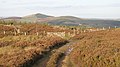
 Northern side of Red Score Nick - geograph.org.uk - 1024392.jpg 640 × 480; 94 KB
-
 On Blaikie's Hill in January - geograph.org.uk - 1650271.jpg 640 × 427; 146 KB
-
 Red Score Nick - geograph.org.uk - 1024389.jpg 640 × 359; 85 KB
-
 Rolling Borders Countryside - geograph.org.uk - 712962.jpg 640 × 480; 132 KB
-
 Shanny Rig - geograph.org.uk - 998648.jpg 640 × 359; 87 KB
-
 The 16th hole at Galashiels Golf Course - geograph.org.uk - 497535.jpg 640 × 480; 141 KB
-
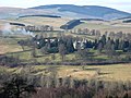
 The Gala Valley - geograph.org.uk - 744125.jpg 640 × 480; 49 KB
-
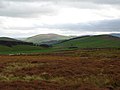
 Towards Meigle and Blakehope Hills - geograph.org.uk - 1150475.jpg 640 × 365; 74 KB
-
 Towards Meigle Hill - geograph.org.uk - 1126737.jpg 640 × 346; 107 KB
-
 Tweeddale from Ashiestiel Hill - geograph.org.uk - 1044214.jpg 640 × 480; 89 KB
-
 Ungrazed land, Elibank - geograph.org.uk - 1763751.jpg 640 × 480; 106 KB
-
 Waiting to tee off at the 16th hole - geograph.org.uk - 716227.jpg 640 × 480; 114 KB
-
 Woodland in the mist - geograph.org.uk - 754562.jpg 640 × 480; 49 KB
-
 Cairn on Galashiels Golf Course - geograph.org.uk - 504083.jpg 640 × 480; 104 KB
-
 Field at Crotchetknowe - geograph.org.uk - 332376.jpg 640 × 480; 135 KB
-
 Frosty farmland - geograph.org.uk - 638216.jpg 640 × 480; 130 KB
-
 Heading for Galashiels - geograph.org.uk - 502558.jpg 640 × 480; 79 KB
-
 Improved grazing on Touting Birks Hill - geograph.org.uk - 598175.jpg 640 × 480; 144 KB
-
 On Torsonce Hill - geograph.org.uk - 255967.jpg 640 × 480; 54 KB
-
 Pasture field - geograph.org.uk - 331982.jpg 625 × 446; 111 KB
-
 Roundabout furniture, Clovenfords - geograph.org.uk - 592660.jpg 480 × 640; 37 KB
-
 Sheep shelter, Middle Hill - geograph.org.uk - 294569.jpg 640 × 480; 81 KB
-
 The 11th green at Galashiels Golf Course - geograph.org.uk - 497566.jpg 640 × 480; 100 KB
-
 Torwoodlee - geograph.org.uk - 113549.jpg 640 × 480; 54 KB
-

-
 Ungrazed fields, Yair Forest. - geograph.org.uk - 97639.jpg 640 × 480; 83 KB


