Category:Distant views of Windy Gyle
Media in category "Distant views of Windy Gyle"
The following 18 files are in this category, out of 18 total.
-

-
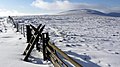
 Border fence - geograph.org.uk - 239572.jpg 640 × 479; 234 KB
-
 Bracken on Black Braes - geograph.org.uk - 65147.jpg 640 × 480; 72 KB
-
 Cheviots - geograph.org.uk - 16011.jpg 640 × 393; 62 KB
-
 Morning mist on the Cheviot Hills - geograph.org.uk - 239557.jpg 640 × 480; 238 KB
-
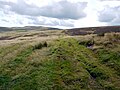
 On the Pennine Way - geograph.org.uk - 538882.jpg 640 × 480; 134 KB
-
 Otterburn Ranges above Ridleeshope - geograph.org.uk - 657166.jpg 640 × 480; 65 KB
-
 Path junction at Plea Knowe - geograph.org.uk - 1221717.jpg 640 × 480; 77 KB
-
 Pennine Way at Mozie Law - geograph.org.uk - 1221709.jpg 640 × 480; 83 KB
-
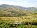
 Rowhope with a distant Windy Gyle - geograph.org.uk - 351995.jpg 640 × 480; 61 KB
-
 Southern ridge of The Curr - geograph.org.uk - 152084.jpg 640 × 423; 111 KB
-
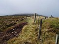
 Stile over the Border fence - geograph.org.uk - 1131708.jpg 640 × 360; 66 KB
-
 The Hanging Stone - geograph.org.uk - 1336372.jpg 640 × 480; 85 KB
-
 The Pennine Way at Foulstep Sike - geograph.org.uk - 1221718.jpg 640 × 480; 88 KB
-
 The Street near Gunner's Well - geograph.org.uk - 1423720.jpg 640 × 480; 158 KB
-
 Valley of the Trows Burn - geograph.org.uk - 1510736.jpg 640 × 480; 55 KB
-
 View looking east from Camel's Path - geograph.org.uk - 1090098.jpg 640 × 480; 82 KB
-


