Category:Dive site maps of the Cape Peninsula and False Bay
Media in category "Dive site maps of the Cape Peninsula and False Bay"
The following 179 files are in this category, out of 179 total.
-
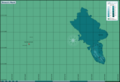
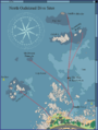
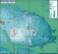
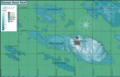
 TMNP MPA boundaries.png 1,224 × 1,268; 212 KB
-
 13th Apostle Map.png 2,691 × 1,933; 565 KB
-
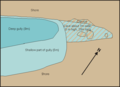
 A-Frame route.png 1,224 × 939; 86 KB
-
 A-Frame site map.png 1,222 × 938; 86 KB
-
 Alpha Reef Map.png 7,800 × 5,714; 2.1 MB
-
 Anvil Rock Reef map.png 4,000 × 3,772; 1,013 KB
-
 Ark Rock and wrecks.png 4,166 × 7,799; 2.85 MB
-
 Ark Rock map.png 6,780 × 5,332; 1.66 MB
-
 Aster and Katsu Maru.png 2,500 × 2,237; 600 KB
-
 Atlantis Reef map.png 7,800 × 4,738; 2.97 MB
-
 Bakleiplaasmap.png 7,790 × 6,424; 1.65 MB
-
 Bakoven Rock Reef Map.png 7,313 × 5,081; 2.74 MB
-
 Bantry Bay Pinnacles map.png 3,000 × 2,673; 483 KB
-
 Batsata Maze map.png 7,791 × 5,797; 2.96 MB
-
 Blue Flame Pinnacles map.png 3,000 × 3,697; 560 KB
-
 Blue Flash Reefs map.png 7,125 × 5,621; 2.68 MB
-
 Boardroom pinnacle map.png 4,998 × 4,944; 897 KB
-
 Bruce's Mark reef map.png 8,779 × 5,994; 1.46 MB
-
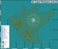 Cape Matapan wreck map.png 6,559 × 5,534; 1.58 MB
-
 Castle Rocks Map.png 3,008 × 2,854; 1.82 MB
-
 Castor Rock Reef map.png 7,312 × 5,522; 4.72 MB
-
 Choirboys Reef Map.png 3,000 × 3,086; 583 KB
-
 Cleeve's Tunnel map.png 1,597 × 1,910; 279 KB
-
 Coral Gardens offshore pinnacles map.png 7,800 × 4,632; 1.34 MB
-
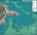
 Coral Gardens Oudekraal site map Detail.png 2,557 × 1,606; 1.07 MB
-
 Coral Gardens Oudekraal site map Large.png 2,000 × 1,256; 1.03 MB
-
 Coral Gardens Rooi-els dive site map.png 3,000 × 2,000; 540 KB
-
 CP and FB topographical map with dive sites.png 1,236 × 1,236; 234 KB
-
 Dangerous Doug Reefs Map.png 7,800 × 7,000; 3.01 MB
-
 Daves Caves detail.png 1,384 × 1,008; 231 KB
-
 Deep South Whittle Reef map.png 3,000 × 2,969; 521 KB
-
 Die Josie map.png 7,800 × 5,969; 1.39 MB
-
 Die Perd map.png 6,998 × 6,773; 1.79 MB
-
 Dive sites of Batsata Reef.png 5,529 × 6,406; 4.33 MB
-
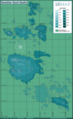
 Dive sites of Cape Town.png 3,068 × 3,202; 2.19 MB
-
 Dive sites of Caravan Reef.png 7,087 × 7,312; 4.57 MB
-
 Dive sites of Rocklands Point.png 3,000 × 3,097; 1.59 MB
-
 Dive sites of the Castle Rocks area Map.png 7,313 × 6,167; 6.74 MB
-
 Dive sites of the Seaforth area.png 8,076 × 4,273; 3.12 MB
-
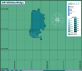
 Dive Sites of the Steenbras Deep Ridge.png 2,902 × 3,893; 631 KB
-
 Dive sites of the Whittle Rock area Hi-Res for mobile.png 7,020 × 4,965; 4.8 MB
-
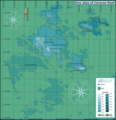
 Dive sites of the Whittle Rock area.png 7,019 × 5,742; 3.08 MB
-
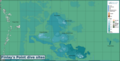
 Dive sites of the Whittle Rock Reef high resolution.png 14,040 × 9,930; 10.26 MB
-
 Dome Rock Reef map.png 2,999 × 2,293; 707 KB
-
 Dreadlocks Reef map.png 1,852 × 1,321; 277 KB
-
 Drop Zone Reef Map.png 2,988 × 2,851; 524 KB
-
 Duiker Island map.png 3,000 × 2,157; 594 KB
-
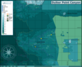 Duiker Point Canyon map.png 5,000 × 4,084; 2.57 MB
-
 Duiker Point dive sites map with Geoscience contours all depths.svg 8,494 × 13,222; 5.71 MB
-
 Duiker Point dive sites map.png 7,313 × 8,670; 6.87 MB
-
 Dusky Pinnacles detail map.png 7,800 × 6,066; 2.53 MB
-
 False Bay offshore dive sites.png 1,224 × 1,206; 124 KB
-
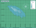
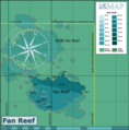 Fan Reef Map.png 7,391 × 7,486; 2.7 MB
-
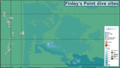
 Finlay's Point dive sites map.png 3,684 × 1,878; 874 KB
-
 Finlay's Point dive sites.png 3,000 × 1,693; 584 KB
-
 Fish Hoek Reef.png 7,800 × 6,058; 1.71 MB
-
 Fish Tank reef map.png 7,795 × 6,398; 1.96 MB
-
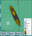 Fleur map.png 2,000 × 2,278; 483 KB
-
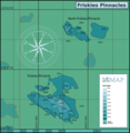 Friskies Pinnacle Map.png 2,899 × 2,983; 902 KB
-
 Giant's Castle map.png 7,800 × 5,923; 2.44 MB
-
 Glencairn Barge wreck.png 1,845 × 2,237; 402 KB
-
 Gordons Bay dive sites.png 1,134 × 1,616; 109 KB
-
 Graeme's Spot and The Jambles map.png 7,880 × 5,593; 2.41 MB
-
 Graeme's spot and the Jambles, Carnaby Street and Finlay's Pinnacle map.png 8,566 × 6,064; 3.5 MB
-
 Highfields wreck map.png 4,789 × 3,460; 1.1 MB
-
 Hout Bay and Oudekraal dive sites.png 1,128 × 1,607; 143 KB
-
 Huis te Kraaiestein sketch map.png 1,200 × 857; 26 KB
-
 Humpback Ridge map.png 3,145 × 2,801; 731 KB
-
 Insanity Reef map.png 442 × 394; 40 KB
-
 Josh's Reef map.png 4,855 × 3,843; 736 KB
-
 Justins Caves route.png 3,014 × 2,517; 383 KB
-
 Kanobi's Reef detail map.png 3,269 × 2,477; 740 KB
-
 Ker Yar Vor site map.png 7,926 × 6,795; 2.48 MB
-
 Klein Tafelberg Reef map.png 7,787 × 6,129; 2.64 MB
-
 Kommetjie to Olifantsbospunt map.png 1,000 × 1,863; 246 KB
-
 Livingstone reef.png 7,313 × 4,455; 2.08 MB
-
 Long Beach map.png 2,101 × 3,000; 805 KB
-
 Long Beach Orienteering route map.png 2,460 × 2,943; 744 KB
-
 M&M Pinnacles detail map.png 7,799 × 5,909; 2.79 MB
-
 Maidstone Reef and Rock.png 7,800 × 4,578; 2.26 MB
-
 Map of CT dive site Coral Gardens Oudekraal and Groot Pannekoek trimmed.png 2,207 × 1,389; 219 KB
-
 Map of CT dive site Coral Gardens Oudekraal and Groot Pannekoek.png 2,400 × 1,742; 219 KB
-
 Map of CT dive site Coral Gardens Oudekraal detail.png 1,129 × 853; 92 KB
-
 Map of CT dive site Fan Reef.png 1,200 × 1,056; 26 KB
-
 Map of CT dive site North Paw cave rock.png 1,200 × 1,090; 34 KB
-
 Map of CT dive site South Paw.png 1,200 × 888; 34 KB
-
 Map of CT dive site SS Maori.png 7,313 × 5,063; 3.53 MB
-
 Map of CT dive sites A-Frame and D-frame with grid.png 3,540 × 2,088; 415 KB
-
 Map of dive site Sandy Cove.png 1,326 × 999; 107 KB
-
 Map of the CT dive site Clan Stuart.png 1,200 × 1,053; 42 KB
-
 Map of the CT dive site Cow and Calf.png 1,208 × 873; 91 KB
-
 Map of the CT dive site Pinnacle.png 3,008 × 1,933; 1.2 MB
-
 Map of the CT dive site Pinnacle.svg 744 × 1,052; 1.69 MB
-
 Map of the CT dive site Torch Reef.png 1,200 × 1,150; 22 KB
-
 Map of the CT dive sites at Rocklands Point.png 1,200 × 1,150; 83 KB
-
 Map of the dive sites Photographers Reef Windmill Beach and Penguin Point.png 6,077 × 7,800; 5.35 MB
-
 Map of the SS Lusitania wreck site.png 4,610 × 3,996; 1.6 MB
-
 Map of Whittle Rock dive sites 2021.svg 6,771 × 4,789; 2.42 MB
-
 MFV Harvest Capella wreck map.png 7,773 × 5,125; 1.69 MB
-
 Middelmas and Hakka Reef map.png 7,294 × 5,621; 2.65 MB
-
 Millers Point dive sites.png 1,156 × 1,648; 115 KB
-
 Mont Blanc Reef map.png 3,000 × 2,507; 528 KB
-
 Muizenberg trawler wrecks.png 6,468 × 3,169; 911 KB
-
 MV Daeyang Family wreck map.png 3,750 × 1,751; 748 KB
-
 MV Romelia and Sunset Rocks.png 2,265 × 1,662; 394 KB
-
 MV Treasure wreck map.png 2,353 × 5,678; 892 KB
-
 North Lion's Paw map.png 7,880 × 5,331; 2.74 MB
-
 North Oudekraal dive sites with routes.png 1,200 × 1,592; 100 KB
-
 North-East Pinnacle Map.png 2,463 × 1,870; 508 KB
-
 Oakburn and Bos400 map.png 9,565 × 7,053; 3.83 MB
-
 Off-Whittle Ridge.png 4,866 × 4,202; 859 KB
-
 Omega Reef Map.png 10,057 × 6,269; 4.07 MB
-
 Outer Photographers and Torch Reefs Map.png 7,800 × 7,610; 2.98 MB
-
 P87 dive site map.png 3,421 × 4,132; 778 KB
-
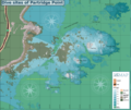
 Partridge Point Big Rock.png 7,956 × 5,503; 4.09 MB
-
 Partridge Point Peters Pinnacle.png 7,800 × 6,402; 2.8 MB
-
 Partridge Point reef map.png 4,329 × 3,671; 3.41 MB
-
 Partridge Point reef map.svg 744 × 1,052; 1.72 MB
-
 Partridge Point Seal Rock and Deep Partridge.png 7,959 × 7,426; 5.22 MB
-
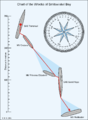
 Percys and Kruis2.gif 1,287 × 1,234; 115 KB
-
 Percys and Kruis2.png 3,000 × 2,265; 1.21 MB
-
 Percys cave.gif 608 × 439; 7 KB
-
 Percys cave.png 600 × 434; 8 KB
-
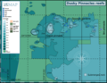
 Phoenix Shoal map.png 7,793 × 5,983; 2.22 MB
-
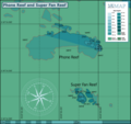 Phone Reef and Super Fan Reef.png 8,397 × 7,891; 2.56 MB
-
 Phone Reef Map.png 7,798 × 5,921; 2 MB
-
 Photographer's reef detail.png 2,000 × 1,488; 713 KB
-
 Pie Rock Reef Map.png 7,312 × 5,954; 4.51 MB
-
 Pie Rock, Outer Castle and Giant's Castle reefs map.png 10,011 × 6,107; 7.02 MB
-
 PMB Pinnacles map.png 4,977 × 3,112; 1.12 MB
-
 Pyramid Reef Map.png 7,800 × 6,675; 4.31 MB
-
 Pyramid Rock Reef and Shark Alley.png 8,665 × 6,828; 5.94 MB
-
 Rachel's Reef map.png 3,047 × 2,365; 590 KB
-
 Rambler North-west Pinnacle Map.png 7,313 × 7,254; 2.43 MB
-
 Rambler Rock Reefs map.png 5,200 × 8,488; 3.39 MB
-
 Random Rocks Reefs map.png 7,800 × 5,823; 1.66 MB
-
 Rocklands sites map.png 7,800 × 6,695; 4.35 MB
-
 Roman Rambler and Castor rocks map.png 7,800 × 7,489; 5.17 MB
-
 Roman Rock Reef Map.png 8,987 × 5,761; 4.69 MB
-
 Rooi els dive sites.png 1,135 × 1,616; 125 KB
-
 SAS Bloemfontein wreck map.png 3,837 × 6,127; 1.03 MB
-
 SAS Gelderland wreck map.png 4,283 × 2,147; 927 KB
-
 Sea Point Ridge Pinnacle map.png 2,000 × 1,782; 280 KB
-
 Shark Alley Map.png 3,000 × 2,500; 1.11 MB
-
 Sherwood Forest Reef map.png 7,800 × 4,738; 2.41 MB
-
 Simons Town dive sites.png 1,156 × 1,648; 126 KB
-
 Site map of wreck of SAS Pietermaritzburg.png 3,000 × 2,999; 868 KB
-
 Smits and Batsata reef map.png 2,813 × 3,425; 1.91 MB
-
 Smits reef map.png 7,774 × 8,321; 6.41 MB
-
 Smits Wrecks and Good Hope Reef map.png 2,471 × 3,168; 703 KB
-
 Smits Wrecks Chart.png 1,200 × 1,635; 54 KB
-
 SS Godetia site map.png 2,496 × 2,983; 501 KB
-
 SS Hypatia wreck map.png 5,484 × 6,563; 1.79 MB
-
 Star of Africa wreck map.png 4,640 × 6,613; 1.38 MB
-
 Star Walls detail map.png 7,312 × 5,542; 4.16 MB
-
 Star Walls Reef Complex map.png 7,938 × 7,183; 6.19 MB
-
 Steenbras Deep North Pinnacle map.png 5,000 × 5,579; 1.02 MB
-
 Steenbras Deep South Pinnacle map.png 6,000 × 5,084; 1.31 MB
-
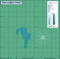 Sterretjies Reef Map.png 7,800 × 7,740; 1.66 MB
-
 Stonehenge dive sites (Cape Town) map.png 7,313 × 5,956; 4.48 MB
-
 Sunfish and Lollipop Pinnacles detail map.png 3,269 × 2,477; 781 KB
-
 SURG Pinnacle detail map.png 8,755 × 6,862; 4.12 MB
-
 Table Bay dive sites.png 1,116 × 1,595; 127 KB
-
 Tafelberg Deep Reef map.png 3,000 × 2,212; 763 KB
-
 Target Reef Map.png 1,598 × 1,527; 318 KB
-
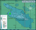 Tivoli Pinnacles Map.png 2,996 × 2,504; 986 KB
-
 Twin barges detail.png 1,000 × 937; 55 KB
-
 Twin Towers Reef map.png 3,249 × 2,251; 487 KB
-
 Unidentified steamer off Robben Island.png 2,689 × 2,003; 517 KB
-
 Vulcan Rock and Di's Cracks map.png 9,231 × 7,445; 3.55 MB
-
 Whittle rock and surrounds 181022.jpg 2,704 × 2,566; 1.21 MB
-
 Whittle Rock main reef.png 7,793 × 7,747; 5.79 MB
-
 Whittle Rock Southern Reefs.png 6,093 × 5,482; 3.57 MB
-
 Whittle Rock Western Reefs.png 5,356 × 3,000; 790 KB
-
 Wilhelms Wall map.png 3,290 × 2,267; 1.6 MB
-
 Windmill beach and offshore reefs map.png 7,800 × 4,346; 2.5 MB
-
 Windmill Offshore Reefs map.png 7,800 × 5,242; 2.13 MB
-
 Winton site map.png 5,484 × 6,563; 1.57 MB
-
 York Shoal Reef map.png 6,415 × 7,800; 1.38 MB


_map.png)


