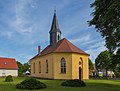
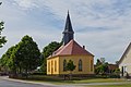
Category:Dorfkirche (Reudnitz)
| Object location | | View all coordinates using: OpenStreetMap |
|---|
church building in Brandenburg state, Germany  | |||||
| Upload media | |||||
| Instance of | |||||
|---|---|---|---|---|---|
| Location | Reudnitz, Friedland (Niederlausitz), Oder-Spree District, Brandenburg, Germany | ||||
| Heritage designation | |||||
 | |||||
This is the category of the Brandenburger Baudenkmal (cultural heritage monument) with the ID 09115462 (Wikidata)
|
Media in category "Dorfkirche (Reudnitz)"
The following 4 files are in this category, out of 4 total.
-
 Reudnitz Dorfkirche 01.jpg 4,216 × 3,214; 8.08 MB
-
 Reudnitz Dorfkirche 02.jpg 5,068 × 3,364; 9.05 MB
-
 Reudnitz Dorfkirche 03.jpg 4,052 × 3,484; 6.66 MB
-
 Reudnitz Kirche.jpg 3,872 × 2,592; 1.02 MB


