Category:Dorfkirche Garz (Temnitztal)
| Object location | | View all coordinates using: OpenStreetMap |
|---|
church building in Ostprignitz-Ruppin district, Brandenburg state, Germany  .jpg) _2021_S%C3%BCdportal.jpg) | |||||
| Upload media | |||||
| Instance of | |||||
|---|---|---|---|---|---|
| Location | Garz, Temnitztal, Ostprignitz-Ruppin District, Brandenburg, Germany | ||||
| Heritage designation | |||||
 | |||||
This is the category of the Brandenburger Baudenkmal (cultural heritage monument) with the ID 09170265 (Wikidata)
|
English: Pictures of the church in Garz , Temnitztal municipality, Ostprignitz-Ruppin district, Brandenburg state, Germany.
Deutsch: Ansichten der Kirche in Garz, Gemeinde Temnitztal, Landkreis Ostprignitz-Ruppin, Land Brandenburg, Deutschland.
Français : Photos de l'église à Garz, commune de Temnitztal, arrondissement de Ostprignitz-Ruppin, état fédéral de Brandebourg, Allemagne
Español: Vistas de la iglesia en Garz, municipio de Temnitztal, distrito de Ostprignitz-Ruppin, estado federado de Brandeburgo, Alemania
Address:
Luchdamm 21, Garz, 16845 Temnitztal
Pages in category "Dorfkirche Garz (Temnitztal)"
This category contains only the following page.
Media in category "Dorfkirche Garz (Temnitztal)"
The following 14 files are in this category, out of 14 total.
-
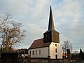
 Dorfkirche Garz (Temnitztal) 2015 NE.jpg 2,592 × 1,944; 1.93 MB
-
 Dorfkirche Garz (Temnitztal) 2015 NW.jpg 2,592 × 1,944; 2.1 MB
-
 Dorfkirche Garz (Temnitztal) 2015 S.jpg 2,592 × 1,944; 2.15 MB
-
 Dorfkirche Garz (Temnitztal) 2015 SE.jpg 2,592 × 1,944; 2.18 MB
-
 Dorfkirche Garz (Temnitztal) 2015 SSW.jpg 2,592 × 1,944; 2.02 MB
-
 Dorfkirche Garz (Temnitztal) 2015 WNW.jpg 1,844 × 2,520; 1.36 MB
-
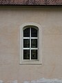 Dorfkirche Garz (Temnitztal) 2021 Fenster.jpg 3,648 × 4,864; 3.39 MB
-
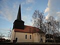
 Dorfkirche Garz (Temnitztal) 2021 N.jpg 4,864 × 3,648; 5.11 MB
-
 Dorfkirche Garz (Temnitztal) 2021 SE.jpg 4,864 × 3,648; 4.8 MB
-
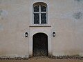
 Dorfkirche Garz (Temnitztal) 2021 Südportal.jpg 3,598 × 4,826; 5.77 MB
-
 Dorfkirche Garz (Temnitztal) 2021 Turmspitze.jpg 3,648 × 4,864; 4.64 MB
-
 Dorfkirche Garz (Temnitztal) 2021 Westportal.jpg 4,864 × 3,648; 3.65 MB
-
 Lütkemüller-Orgel Garz (Temnitztal).jpg 4,000 × 3,000; 2.92 MB
-
 OPR Temnitztal Garz Dorfkirche.jpg 2,228 × 3,062; 3.98 MB
_2015_NE.jpg)
_2015_NW.jpg)
_2015_S.jpg)
_2015_SE.jpg)
_2015_SSW.jpg)
_2015_WNW.jpg)
_2021_Fenster.jpg)
_2021_N.jpg)
_2021_SE.jpg)
_2021_Turmspitze.jpg)
_2021_Westportal.jpg)