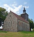
Category:Dorfkirche Hardenbeck
English: Church in Hardenbeck, Boitzenburger Land municipality, Uckermark district, Brandenburg state, Germany
Deutsch: Kirche in Hardenbeck, Gemeinde Boitzenburger Land, Landkreis Uckermark, Land Brandenburg, Deutschland.
Français : Église de Hardenbeck, commune de Boitzenburger Land, arrondissement Uckermark, état fédéral de Brandebourg, Allemagne
| Object location | | View all coordinates using: OpenStreetMap |
|---|
This is the category of the Brandenburger Baudenkmal (cultural heritage monument) with the ID 09130496 (Wikidata)
|
church building in Brandenburg state, Germany   | |||||
| Upload media | |||||
| Instance of | |||||
|---|---|---|---|---|---|
| Location | Hardenbeck, Boitzenburger Land, Uckermark District, Brandenburg, Germany | ||||
| Heritage designation | |||||
 | |||||
Subcategories
This category has only the following subcategory.
I
Media in category "Dorfkirche Hardenbeck"
The following 15 files are in this category, out of 15 total.
-
 Dorfkirche Hardenbeck 2018 ESE.jpg 5,041 × 4,499; 10.27 MB
-
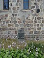 Dorfkirche Hardenbeck 2018 Gefallenendenkmal.jpg 3,648 × 4,864; 6.11 MB
-
 Dorfkirche Hardenbeck 2018 NE.jpg 3,760 × 4,031; 5.73 MB
-
 Dorfkirche Hardenbeck 2018 NW.jpg 3,674 × 2,850; 3.03 MB
-
 Dorfkirche Hardenbeck 2018 Südportal.jpg 4,138 × 4,592; 7.27 MB
-
 Dorfkirche Hardenbeck 2018 Turmhaube.jpg 3,648 × 4,864; 3.65 MB
-
 Dorfkirche Hardenbeck 2018 vermauertes Nordportal.jpg 3,648 × 4,864; 7.61 MB
-
 Dorfkirche Hardenbeck 2018 Westportal.jpg 3,648 × 4,864; 6.4 MB
-
 Dorfkirche Hardenbeck 2018 WNW.jpg 3,648 × 4,864; 7.14 MB
-
 Hardenbeck, Dorfkirche.jpg 2,048 × 1,536; 1.23 MB
-
 HardenbeckKirkeKors.jpg 2,868 × 2,052; 533 KB
-
 HardenbeckKirkeKorsNær.jpg 2,664 × 1,716; 520 KB
-
 HardenbeckKirkeSkakbrætstenN.jpg 2,664 × 1,716; 359 KB
-
 HardenbeckKirkeSkakbrætstenNV.jpg 2,632 × 1,814; 428 KB
-
 HardenbeckKirkeSkakbrætstenNVNær.jpg 823 × 507; 380 KB


