Category:Down Ampney
village in United Kingdom .jpg) | |||||
| Upload media | |||||
| Instance of | |||||
|---|---|---|---|---|---|
| Location | Cotswold, Gloucestershire, South West England, England | ||||
| official website | |||||
 | |||||
English: Down Ampney is a medium-sized village located in Cotswold district in Gloucestershire, in England, noted as the birthplace of the composer Ralph Vaughan Williams
Subcategories
This category has the following 6 subcategories, out of 6 total.
A
- All Saints' Church, Down Ampney (64 F)
D
- Down Ampney War Memorial (6 F)
G
H
- Down Ampney House (1 F)
R
- RAF Down Ampney (5 F)
Media in category "Down Ampney"
The following 118 files are in this category, out of 118 total.
-
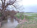 Ampney Brook from Sheeppen Bridge - geograph.org.uk - 350346.jpg 640 × 480; 109 KB
-
 Ampney Brook from the road bridge - geograph.org.uk - 3127248.jpg 480 × 640; 230 KB
-
 Arable land, Down Ampney - geograph.org.uk - 4890879.jpg 4,000 × 3,000; 4.89 MB
-
 Arnhem and Normandy memorial - geograph.org.uk - 3276144.jpg 1,024 × 768; 654 KB
-
 Barn opposite Poulton Hill Farm - geograph.org.uk - 3126661.jpg 640 × 480; 162 KB
-
 Bordering on farcical (23) - geograph.org.uk - 4085895.jpg 640 × 480; 89 KB
-
 Bridleway from Down Ampney - geograph.org.uk - 1919570.jpg 1,600 × 1,068; 1.17 MB
-
 Bridleway to Charlham Farm and beyond, Down Ampney - geograph.org.uk - 1965031.jpg 1,440 × 1,080; 1.11 MB
-
 Bridleway to Charlham Farm House - geograph.org.uk - 4890804.jpg 4,000 × 3,000; 4.74 MB
-
 Bridleway to Down Ampney - geograph.org.uk - 1919551.jpg 1,600 × 1,068; 1.09 MB
-
 Bridleway to Litton - geograph.org.uk - 3276142.jpg 768 × 1,024; 744 KB
-
 Charlham Farm, near Driffield - geograph.org.uk - 1919546.jpg 1,600 × 1,068; 986 KB
-
 Charlham Lane, Down Ampney - geograph.org.uk - 1965040.jpg 1,440 × 1,079; 1.13 MB
-
 Charlham Way, Down Ampney - geograph.org.uk - 4875392.jpg 4,000 × 3,000; 4.79 MB
-
 Concrete farm track, Down Ampney - geograph.org.uk - 5697015.jpg 4,608 × 3,072; 3.48 MB
-
 Cut through to Oak Road - geograph.org.uk - 1570279.jpg 640 × 480; 167 KB
-
 Derelict farm cottages, nos. 66 ^ 67 Castle Hill Farm - geograph.org.uk - 4874162.jpg 4,000 × 3,000; 4.53 MB
-
 Dispersed site near former RAF Down Ampney airfield - geograph.org.uk - 3295521.jpg 4,000 × 3,000; 6.27 MB
-
 Dispersed site near former RAF Down Ampney airfield - geograph.org.uk - 3295534.jpg 4,000 × 3,000; 2.88 MB
-
 Dispersed site near former RAF Down Ampney airfield - geograph.org.uk - 3295561.jpg 4,000 × 3,000; 2.81 MB
-
 Dispersed site near former RAF Down Ampney airfield - geograph.org.uk - 3295564.jpg 4,000 × 3,000; 2.87 MB
-
 Dispersed site near former RAF Down Ampney airfield - geograph.org.uk - 3295572.jpg 4,000 × 3,000; 2.88 MB
-
 Dispersed site near former RAF Down Ampney airfield - geograph.org.uk - 3295582.jpg 4,000 × 3,000; 2.93 MB
-
 Dispersed site near former RAF Down Ampney airfield - geograph.org.uk - 3295589.jpg 3,872 × 2,016; 6.4 MB
-
 Dispersed site near former RAF Down Ampney airfield - geograph.org.uk - 3295595.jpg 4,000 × 3,000; 2.89 MB
-
 Dispersed site near former RAF Down Ampney airfield - geograph.org.uk - 3295602.jpg 4,000 × 3,000; 2.89 MB
-
 Dispersed site near former RAF Down Ampney airfield - geograph.org.uk - 3295623.jpg 4,000 × 3,000; 2.9 MB
-
 Ditch and field, near Marston Meysey - geograph.org.uk - 1137449.jpg 640 × 480; 181 KB
-

-
 Down Ampney church and churchyard - geograph.org.uk - 3276131.jpg 768 × 1,024; 575 KB
-
 Down Ampney primary school - geograph.org.uk - 5324172.jpg 640 × 428; 108 KB
-
 Entrance to Poulton Hill Farm - geograph.org.uk - 3126664.jpg 640 × 480; 130 KB
-
 Farmland north of Down Ampney - geograph.org.uk - 1965013.jpg 1,440 × 1,080; 881 KB
-
 Farmland south of Meysey Hampton - geograph.org.uk - 3127117.jpg 640 × 480; 171 KB
-
 Farmland south of Meysey Hampton - geograph.org.uk - 3127140.jpg 640 × 480; 134 KB
-
 Field boundary near Down Ampney - geograph.org.uk - 3126642.jpg 640 × 480; 191 KB
-

-

-
 Footpath to Poulton, near Driffield - geograph.org.uk - 1919548.jpg 1,600 × 1,068; 1.31 MB
-
 Former horse engine house and barn, Castle Hill Farm - geograph.org.uk - 4874251.jpg 3,900 × 2,832; 5.14 MB
-

-
 Former horse engine house, Castle Hill Farm - geograph.org.uk - 4874257.jpg 4,000 × 3,000; 5.68 MB
-

-
 Free horse manure in Down Ampney - geograph.org.uk - 2499784.jpg 640 × 480; 101 KB
-
 Giraffe sculptures, Poulton Hill Farm - geograph.org.uk - 4890713.jpg 4,000 × 3,000; 3.93 MB
-
 Hedgerow and field entrance - geograph.org.uk - 3126366.jpg 640 × 480; 165 KB
-
 House near Down Ampney - geograph.org.uk - 3294555.jpg 4,000 × 3,000; 2.82 MB
-
 Houses on Charlham Way, Down Amney - geograph.org.uk - 1570395.jpg 640 × 480; 137 KB
-
 Inscription on Normandy and Arnhem memorial - geograph.org.uk - 3276154.jpg 1,024 × 768; 765 KB
-
 Junction of Charlham Way and Oak Road - geograph.org.uk - 1570422.jpg 640 × 480; 120 KB
-

-

-
 Looking NW along Oak Road - geograph.org.uk - 1570438.jpg 640 × 480; 143 KB
-
 Lych-gate of Down Ampney church - geograph.org.uk - 3276135.jpg 1,024 × 768; 727 KB
-
 Oilseed rape crop, near Cerney Wick - geograph.org.uk - 439081.jpg 640 × 426; 98 KB
-
 Parkland at Down Ampney - geograph.org.uk - 2416084.jpg 1,024 × 680; 220 KB
-

-

-
 Poppies on the path - geograph.org.uk - 2500954.jpg 640 × 480; 132 KB
-
 Poulton Hill Farm - geograph.org.uk - 4890721.jpg 3,988 × 2,756; 1.79 MB
-
 Poulton Hill Farm, near Down Ampney - geograph.org.uk - 1919567.jpg 1,600 × 1,068; 779 KB
-
 Poulton Priory - geograph.org.uk - 4890770.jpg 4,000 × 3,000; 2.71 MB
-
 Private road to Peasburge Barn - geograph.org.uk - 3126389.jpg 640 × 480; 165 KB
-

-
 Public footpath through parkland, Down Ampney - geograph.org.uk - 3294584.jpg 4,000 × 3,000; 2.86 MB
-
 Razed dispersed site near former RAF Down Ampney airfield - geograph.org.uk - 3295566.jpg 4,000 × 3,000; 2.81 MB
-
 Razed dispersed site near former RAF Down Ampney airfield - geograph.org.uk - 3295606.jpg 4,000 × 3,000; 2.89 MB
-
 Razed dispersed site near former RAF Down Ampney airfield - geograph.org.uk - 3295613.jpg 4,000 × 3,000; 6.13 MB
-
 Road from Down Ampney to Poulton - geograph.org.uk - 4890871.jpg 4,000 × 3,000; 5.01 MB
-

-
 Road to Down Ampney from the church - geograph.org.uk - 1570274.jpg 640 × 480; 142 KB
-
 Road to Meysey Hampton - geograph.org.uk - 3276198.jpg 1,024 × 768; 475 KB
-
 Road to Meysey Hampton with bare trees - geograph.org.uk - 3276209.jpg 1,024 × 768; 599 KB
-

-
 Road to the village shop, Down Ampney - geograph.org.uk - 1570409.jpg 640 × 480; 162 KB
-

-
 Sheep awaiting transport - geograph.org.uk - 3127253.jpg 640 × 480; 172 KB
-
 Sheep farming - geograph.org.uk - 5324178.jpg 640 × 480; 135 KB
-
 Sheeppen Bridge inscription - geograph.org.uk - 354578.jpg 640 × 480; 98 KB
-
 Stable block and barn, Castle Hill Farm - geograph.org.uk - 4874244.jpg 4,000 × 3,000; 4.8 MB
-
 Stepping back in time - geograph.org.uk - 1570337.jpg 640 × 480; 158 KB
-
 Stone barn, Charlham Farm - geograph.org.uk - 4890837.jpg 4,000 × 3,000; 4.45 MB
-

-

-
 The Lodge, Down Ampney - geograph.org.uk - 4874305.jpg 4,000 × 3,000; 4.47 MB
-
 The Old Vicarage, Down Ampney (geograph 2501512).jpg 640 × 480; 131 KB
-
 The Old Vicarage, Down Ampney - geograph.org.uk - 1570362.jpg 640 × 480; 182 KB
-
 The road through Down Ampney - geograph.org.uk - 1570353.jpg 640 × 480; 119 KB
-
 The road to Down Ampney - geograph.org.uk - 1137493.jpg 640 × 480; 158 KB
-
 The road to Marston Meysey - geograph.org.uk - 1137554.jpg 640 × 480; 148 KB
-
 The road to Meysey Hampton - geograph.org.uk - 3127120.jpg 640 × 480; 139 KB
-
 Two old barns beside the footpath - geograph.org.uk - 2500945.jpg 640 × 480; 88 KB
-
 View across the fields S of Down Ampney - geograph.org.uk - 1570432.jpg 640 × 480; 121 KB
-

-
 View along Charlham Way, Down Ampney - geograph.org.uk - 1570365.jpg 640 × 480; 136 KB
-
 View along road from Down Ampney - geograph.org.uk - 3126648.jpg 640 × 480; 114 KB
-
 View along road to Down Ampney - geograph.org.uk - 3126639.jpg 640 × 480; 141 KB
-

-
 View east across wheat fields - geograph.org.uk - 3126671.jpg 640 × 480; 158 KB
-

-
 Village Shop, Down Ampney - geograph.org.uk - 4875415.jpg 4,000 × 3,000; 4.58 MB
-
 Wetstone Bridge - geograph.org.uk - 3276564.jpg 1,024 × 768; 500 KB
-
 Work in progress, Poulton Hill Farm, near Down Ampney - geograph.org.uk - 1919561.jpg 1,600 × 1,062; 726 KB
-
 Charlham Lane, Down Ampney - geograph.org.uk - 353594.jpg 640 × 480; 104 KB
-

-
 Cottages, Down Ampney - geograph.org.uk - 331236.jpg 640 × 480; 71 KB
-
 Culvert by the lane to Marston Meysey - geograph.org.uk - 350350.jpg 640 × 480; 123 KB
-
 East House, Down Ampney - geograph.org.uk - 331224.jpg 640 × 481; 76 KB
-
 Hedge and field north of Down Ampney - geograph.org.uk - 350342.jpg 640 × 480; 98 KB
-
 High Street, Meysey Hampton - geograph.org.uk - 331136.jpg 640 × 480; 96 KB
-
 Kennels, Meysey Hampton - geograph.org.uk - 331200.jpg 640 × 480; 93 KB
-
 Oak Road - geograph.org.uk - 353587.jpg 640 × 480; 86 KB
-
 Oaks Road - geograph.org.uk - 350348.jpg 640 × 480; 113 KB
-
 Poulton Hill Farm - geograph.org.uk - 350339.jpg 640 × 480; 56 KB
-

-
 Thames Water pumping station - geograph.org.uk - 331204.jpg 640 × 480; 98 KB
-
 Track off Oak Road - geograph.org.uk - 350343.jpg 640 × 480; 100 KB
-
 View east of Down Ampney Road - geograph.org.uk - 414584.jpg 640 × 480; 85 KB


_-_geograph.org.uk_-_4085895.jpg)


.jpg)


