Category:Drawings by Geo Swan
Media in category "Drawings by Geo Swan"
The following 200 files are in this category, out of 206 total.
(previous page) (next page)-
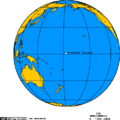
 0rthographic projection over Austral Island.png 488 × 487; 21 KB
-
 Alaska north shore.png 513 × 461; 19 KB
-
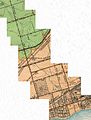
 Algoma Central Railway waypoints 1.png 514 × 638; 20 KB
-
 Approximate area of the Niagara Escarpment 2.PNG 514 × 458; 30 KB
-
 Arctic management area and disputed waters.jpg 2,095 × 1,312; 1.14 MB
-
 Arctic Ocean Seaports.png 488 × 787; 25 KB
-
 Avalon peninsula - nfld.png 514 × 526; 13 KB
-
 Baffinland Iron Mine.png 513 × 504; 35 KB
-
 Beaufort Sea and disputed waters cropped.png 509 × 456; 122 KB
-
 Beaufort Sea and disputed waters.png 512 × 602; 31 KB
-
 Beaufort Sea and disputed waters1.png 511 × 455; 25 KB
-
 Boothia and melville peninsula 1.PNG 514 × 613; 72 KB
-
 Breeze - Toronto, Rochester ferry.png 514 × 298; 12 KB
-
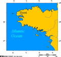 Brittany - France.png 514 × 480; 11 KB
-
 Cape breton island.png 514 × 562; 16 KB
-
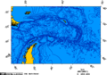
 Cape horn.png 519 × 428; 18 KB
-
 Churchill river newfoundland and churchill falls.PNG 514 × 423; 18 KB
-
 Cities of the Black Sea.png 514 × 352; 13 KB
-
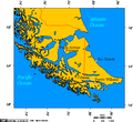 Cities of Tierra del Fuego.png 519 × 475; 21 KB
-
 Communities of the Greater Toronto Area 2.png 514 × 435; 8 KB
-
 Communities where Inuinnaqtun is spoken.png 513 × 761; 43 KB
-
 Course of Bonar Creek, a tributary to Mimico Creek.jpg 738 × 367; 199 KB
-
 Creeks feeding Frenchman's Bay, Pickering, Ontario.jpg 818 × 1,111; 454 KB
-
-
-
-
 Drake Passage - Lambert Azimuthal projection 0.png 517 × 562; 26 KB
-
 Drake Passage - Lambert Azimuthal projection.png 517 × 562; 42 KB
-
 Drake Passage - Orthographic projection.png 488 × 487; 21 KB
-
 Dudinka and dikson 2.png 514 × 760; 24 KB
-
 Elbe watershed 7.png 514 × 484; 21 KB
-
 Erie PA on Lake Erie 1.png 514 × 283; 9 KB
-
 Fogo Island and St. John's on the Avaon Peninsula.png 514 × 685; 23 KB
-
 Ghazni and Kabul -- Afghanistan.png 514 × 418; 18 KB
-
 Great Bear Lake DE.png 514 × 426; 16 KB
-
 Great Bear Lake ES.png 514 × 426; 16 KB
-
 Great Bear Lake FR.png 514 × 426; 16 KB
-
 Great Bear Lake IT.png 514 × 426; 16 KB
-
 Great Bear Lake PL.png 514 × 426; 16 KB
-
 Great Bear Lake.png 514 × 426; 12 KB
-
 Great Slave Lake and Lake Athabasca 6.png 514 × 493; 19 KB
-
 Great Slave Lake and Lake Athabasca T.jpg 514 × 493; 156 KB
-
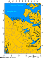 Hay River connection to the Arctic Ocean.png 514 × 691; 32 KB
-
 Howland Island Locator1.png 488 × 487; 8 KB
-
 Indian Ocean.png 488 × 487; 22 KB
-
 Inuvialiut communities -3.png 513 × 412; 26 KB
-
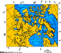 Iqaluit and Cambridge Bay.png 513 × 450; 37 KB
-
 Jackson's Creek in Etobicoke, Ontario.jpg 1,082 × 1,432; 909 KB
-
 Jan Mayen orthographic.png 488 × 487; 12 KB
-
 Jutland peninsula 2.png 514 × 774; 13 KB
-
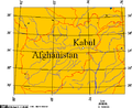 Kabul Afghanistan.png 514 × 418; 19 KB
-
 Kabul, Jalalabad, Torkham, Peshawar -3.png 514 × 608; 18 KB
-
 Kabul, Jalalabad, Torkham, Peshawar -4.png 514 × 721; 15 KB
-
 Kabul, Jalalabad, Torkham, Peshawar -5.png 514 × 721; 52 KB
-
 Kabul, Jalalabad, Torkham, Peshawar -7.png 514 × 482; 15 KB
-
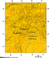
 Kabul, Peshawar, and some cities in Nangarhar, Afghanistan 6.png 514 × 342; 6 KB
-
 Kerguelen Island.png 518 × 541; 8 KB
-
 Khyber Pass, Kabul, Jalalabad, Torkham, Peshawar -1.png 514 × 549; 37 KB
-
 Khyber Pass, Kabul, Jalalabad, Torkham, Peshawar -2.png 514 × 608; 54 KB
-
 Labrador City.png 523 × 774; 30 KB
-
 Lake Athabasca.png 514 × 321; 8 KB
-
 Lake Simcoe Ontario.png 534 × 708; 10 KB
-

-
 Lambert Projection of Western Nunavut.png 514 × 539; 19 KB
-
 Lambert Projection showing Bathurst Inlet, Nunavut, and environs.png 514 × 622; 22 KB
-

-

-
 Larsen iceshelves.png 496 × 774; 11 KB
-
 Lejah, Helmand Province, and some major cities of Afghanistan 1.png 514 × 438; 19 KB
-
 Locations mentioned in Khirullah Khairkhwa Tribunal.png 514 × 417; 104 KB
-
 Lower course of Garrison Creek, 1818.jpg 185 × 204; 34 KB
-
 Lower course of Mimico Creek.jpg 2,069 × 2,002; 495 KB
-
 Lower course of the Rouge River, circa 1932.jpg 4,717 × 2,012; 4.02 MB
-
 Lower yangtze 2.png 514 × 454; 11 KB
-
 Mackenzie River drainage basin.PNG 513 × 569; 57 KB
-
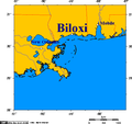 Map of Biloxi and Mississippi coast.png 514 × 482; 13 KB
-
 Map of cuxhaven hamburg lauenburg lubeck.png 514 × 318; 5 KB
-
 Map of Grand River, Ontario.png 514 × 705; 10 KB
-
 Marine Atlantic ferry ports.png 534 × 747; 22 KB
-
 MerdeBeaufort.png 495 × 455; 134 KB
-
 Minusa River Valley 1.png 514 × 549; 7 KB
-
 Mountain passes of Afghanistan.png 514 × 450; 41 KB
-
 Mountain passes of Afghanistan2.png 495 × 425; 23 KB
-
 Neckar river watershed.png 514 × 637; 14 KB
-
 North pole february ice-pack 1978-2002.png 976 × 974; 98 KB
-
 North pole september ice-pack 1978-2002.png 488 × 487; 27 KB
-
 Novy Port and Dikson -- Russian Arctic ports on the Kara Sea -b.png 514 × 626; 24 KB
-
 Nunavut communites affected by Baffinland's freighters -a.png 513 × 498; 17 KB
-
 Ob River estuary, Russia.png 556 × 774; 8 KB
-
 Orthographic projection above St Helena.png 488 × 487; 9 KB
-
-
 Orthographic projection centered over Bouvet Island.png 488 × 487; 35 KB
-
 Orthographic projection centered over Easter Island.png 437 × 487; 31 KB
-
-
 Orthographic projection centered over Iqaluit.png 488 × 487; 18 KB
-
 Orthographic projection centered over Kongsfjord, Svalbard.png 488 × 487; 21 KB
-
 Orthographic projection centered over Nagurskoye, Russia.png 488 × 487; 21 KB
-
 Orthographic projection centered over Nanisivik, Nunavut.png 488 × 487; 21 KB
-
 Orthographic projection centered over the Baffinland Iron Mine.png 488 × 487; 21 KB
-
 Orthographic projection centred on Kanton Island.png 488 × 487; 20 KB
-
 Orthographic projection centred on the Avalon Peninsula.png 488 × 487; 21 KB
-
 Orthographic projection centred on the South Sandwich Islands.png 488 × 487; 17 KB
-
 Orthographic projection centred over Alert Nunavut.png 488 × 487; 21 KB
-
 Orthographic projection centred over Astana Kazakhstan.png 488 × 487; 20 KB
-
 Orthographic projection centred over Bishkek Kyrgyzstan.png 488 × 487; 20 KB
-

-
 Orthographic projection centred over Churchill, Manitoba, Canada.png 488 × 487; 21 KB
-
 Orthographic projection centred over Cocos Island.png 488 × 487; 18 KB
-
 Orthographic projection centred over Cocos Islands, Indian Ocean.png 488 × 487; 20 KB
-
 Orthographic projection centred over Diego Garcia.png 488 × 487; 32 KB
-
 Orthographic projection centred over Easter Island.png 488 × 487; 19 KB
-
 Orthographic projection centred over Fernando de Noronha.png 488 × 487; 19 KB
-
 Orthographic projection centred over Gongga Shan 1.png 488 × 487; 22 KB
-
 Orthographic projection centred over Gongga Shan 2.png 488 × 487; 17 KB
-
 Orthographic projection centred over Gongga Shan 3.png 488 × 487; 14 KB
-
 Orthographic projection centred over Guam.png 488 × 487; 21 KB
-
 Orthographic projection centred over Gwadar, Pakistan.png 488 × 487; 23 KB
-
 Orthographic projection centred over Ile Amsterdam.png 488 × 487; 37 KB
-
 Orthographic projection centred over Jordan.png 488 × 487; 20 KB
-
 Orthographic projection centred over Juan Fernandez.png 488 × 487; 19 KB
-
 Orthographic projection centred over Karachi, Pakistan.png 488 × 487; 23 KB
-
 Orthographic projection centred over Kerguelen Island.png 488 × 487; 21 KB
-
 Orthographic projection centred over King George Island.png 488 × 487; 20 KB
-
 Orthographic projection centred over Magadan.png 488 × 487; 21 KB
-
 Orthographic projection centred over midway.png 488 × 487; 20 KB
-
 Orthographic projection centred over Nakhodka.png 488 × 487; 21 KB
-
 Orthographic projection centred over Palau.png 488 × 487; 21 KB
-
 Orthographic projection centred over Pitcairn Island.png 488 × 487; 19 KB
-
 Orthographic projection centred over Prince Rupert.png 488 × 487; 21 KB
-
 Orthographic projection centred over Qasim Port, Pakistan.png 488 × 487; 23 KB
-
-
 Orthographic projection centred over Ross Island.png 488 × 487; 21 KB
-
 Orthographic projection centred over sisimiut.png 488 × 487; 13 KB
-
 Orthographic projection centred over South Georgia Island.png 488 × 487; 17 KB
-
 Orthographic projection centred over St Peter and St Paul Rocks.png 488 × 487; 19 KB
-
 Orthographic projection centred over Tashkent, Uzbekistan.png 488 × 487; 20 KB
-
 Orthographic projection centred over the Azores.png 488 × 487; 21 KB
-
 Orthographic projection centred over the Bounty Islands.png 488 × 487; 20 KB
-
 Orthographic projection centred over the Galapagos.png 488 × 487; 18 KB
-
 Orthographic projection centred over the Heard Islands 2.png 488 × 487; 28 KB
-
 Orthographic projection centred over the Heard Islands.png 488 × 487; 21 KB
-
 Orthographic projection centred over the Iles Crozet.png 488 × 487; 21 KB
-
 Orthographic projection centred over the Inuvialuit communities.png 488 × 487; 21 KB
-
 Orthographic projection centred over Wallis and Futuna Islands.png 488 × 487; 20 KB
-
 Orthographic projection centred over Yellowknife, NWT.png 488 × 487; 23 KB
-
 Orthographic projection over Baker Island.png 488 × 487; 20 KB
-
 Orthographic projection over Bathurst Inlet, Nunavut.png 488 × 487; 29 KB
-
 Orthographic projection over Diego Garcia.png 488 × 487; 19 KB
-
 Orthographic projection over Gough Island.png 488 × 487; 20 KB
-
 Orthographic projection over Grise Fjord.png 488 × 487; 12 KB
-
 Orthographic projection over Jarvis Island.png 488 × 487; 19 KB
-
 Orthographic projection over Johnston Atoll.png 488 × 487; 20 KB
-
 Orthographic projection over Kingman Reef.png 488 × 487; 19 KB
-
 Orthographic projection over Kirkenes Norway.png 488 × 487; 20 KB
-
 Orthographic projection over Labrador City.png 488 × 487; 21 KB
-
 Orthographic projection over Macquarie Island.png 488 × 487; 21 KB
-
 Orthographic projection over Palmyra Atoll.png 488 × 487; 19 KB
-
 Orthographic projection over Qaanaag.png 488 × 487; 12 KB
-
 Orthographic projection over Raoul Island.png 488 × 487; 20 KB
-
 Orthographic projection over Svalbard.png 488 × 487; 20 KB
-
 Orthographic projection over the Heard Islands.png 488 × 487; 21 KB
-
 Orthographic projection over the larsen b ice shelf.png 488 × 487; 20 KB
-

-
 Orthographic projection over Tuktoyaktuk.png 488 × 487; 18 KB
-
 Orthographic projection over Vardø.png 488 × 487; 20 KB
-
 Orthographic projection over Vladisvostok.png 488 × 487; 21 KB
-
 Orthographic projection over Wake Island.png 488 × 487; 20 KB
-
 Orthographic sisimiut, qaanag, grise fiord.png 488 × 487; 13 KB
-
 Petticoat Creek -c.jpg 1,422 × 1,753; 377 KB
-
 Pine Point, Northwest Territories, Canada -2.png 514 × 554; 18 KB
-
 Polar siberia 4.png 488 × 487; 23 KB
-
 Port Elgin, Lake Huron, Georgian Bay.jpg 514 × 600; 106 KB
-
 Port Stanley, St. Thomas, London, Conneaut.jpg 514 × 372; 80 KB
-
 Portion of the New England hotspot.png 514 × 453; 17 KB
-
 Porto, Lisboa, Port of Sines, Faro, on the Portuguese coast.png 514 × 689; 26 KB
-
 Ports Colbourne, Weller, Maitland.PNG 514 × 774; 10 KB
-
 Ports of New Orleans - Biloxi - Mobile.png 514 × 444; 12 KB
-
 Prince Rupert and Vancouver on the BC Coast.png 514 × 696; 40 KB
-
 Prince Rupert Harbour.png 534 × 731; 16 KB
-
 Queen Charlotte Islands, off the coast of BC.png 514 × 748; 35 KB
-
 Resolute Bay, Nunavut, Canada - Lambert Projection.png 513 × 522; 39 KB
-
 Rhine river 3.PNG 514 × 642; 20 KB
-
 Scarboro RT -- light rail or heavy rail....jpg 1,790 × 2,241; 92 KB
-
 Seine river watershed.png 514 × 490; 11 KB
-
 Selected cities of upstate new york.png 514 × 279; 9 KB
-
 South sandwich islands.png 519 × 629; 41 KB
-
 Strait of belle isle.png 514 × 543; 17 KB
-
 Superior Creek, Etobicoke Ontario.jpg 1,016 × 722; 484 KB
-
 Thunder Bay Ontario.png 514 × 389; 12 KB
-
 Tiksi - Siberia - Laptev Sea.png 514 × 675; 37 KB
-
 Township of Collingwood, Grey County, Ontario, 1880 -- watercourses traced in blue.jpg 2,981 × 4,275; 3.82 MB
-
 Township of Normanby, Grey County, Ontario, 1880 -- watercourses traced in blue.jpg 3,324 × 3,226; 2.64 MB
-
 Tuktoyatuk Nunavut.png 514 × 619; 27 KB
-
 Vancouver-island-lambert-azimuthal.png 514 × 411; 13 KB
-
 Walpole island ontario.png 514 × 611; 9 KB
-
 Watercourses of Adjala Township, Simcoe County, Ontario, 1880.jpg 2,766 × 4,242; 2.53 MB
-
 Watercourses of Albion Township, Peel County, Ontario, 1880.jpg 2,663 × 4,249; 5.58 MB
-
 Watercourses of Tecumseth Township, Simcoe County, Ontario, 1880.jpg 3,856 × 3,289; 2.8 MB
-
 Watercourses of West Gwillimbury Township, Simcoe County, Ontario, 1880.jpg 3,427 × 4,352; 4.89 MB
-
 Watershed of Big Creek, Ontario -b.jpg 255 × 352; 33 KB


.png)


