Category:Drumlithie

village in Aberdeenshire, Scotland, UK  | |||||
| Upload media | |||||
| Instance of | |||||
|---|---|---|---|---|---|
| Location |
| ||||
 | |||||
English: Drumlithie is a village in the northeast of Scotland in the area known as the Howe o' the Mearns. Situated seven miles south of Stonehaven in Aberdeenshire, it is affectionately known by locals as 'Skite', although the origin of this name remains disputed.
Media in category "Drumlithie"
The following 41 files are in this category, out of 41 total.
-
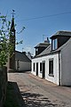
 A street in Drumlithie - geograph.org.uk - 1387936.jpg 640 × 434; 44 KB
-
 A treen avenue - geograph.org.uk - 1388023.jpg 640 × 480; 108 KB
-
 A90 over Bervie Water - geograph.org.uk - 168584.jpg 640 × 475; 127 KB
-
 A90, Fiddes - geograph.org.uk - 476401.jpg 640 × 480; 62 KB
-
 Back road from Arbuthnott near Barras - geograph.org.uk - 176327.jpg 640 × 466; 92 KB
-
 Back road near Barras - geograph.org.uk - 176345.jpg 640 × 480; 99 KB
-
 Bankhead Farm - geograph.org.uk - 800299.jpg 640 × 427; 239 KB
-
 Broombank steadings - geograph.org.uk - 1410186.jpg 640 × 391; 69 KB
-
 Carmont Hill - geograph.org.uk - 178190.jpg 640 × 480; 101 KB
-
 Cocketty - geograph.org.uk - 537191.jpg 640 × 427; 260 KB
-
 Collieston - geograph.org.uk - 575822.jpg 640 × 427; 276 KB
-
 Combine harvester - geograph.org.uk - 177420.jpg 640 × 480; 78 KB
-
 Corbies Pot - geograph.org.uk - 172437.jpg 640 × 480; 129 KB
-
 Drumlithie Hall - geograph.org.uk - 1387954.jpg 640 × 480; 80 KB
-
 Drumlithie near Stonehaven, Aberdeenshire.jpg 4,896 × 2,432; 1.98 MB
-

-
 Farmland and trees - geograph.org.uk - 1410240.jpg 640 × 444; 75 KB
-
 Fields From A90 Southbound - geograph.org.uk - 153650.jpg 640 × 475; 54 KB
-
 High Street - geograph.org.uk - 3505994.jpg 427 × 640; 364 KB
-
 Junction for Broombank - geograph.org.uk - 1387893.jpg 640 × 464; 46 KB
-
 Little Wairds - geograph.org.uk - 244797.jpg 640 × 480; 107 KB
-
-
 Railway at Drumlithie near Stonehaven, Aberdeenshire.jpg 4,896 × 3,672; 7.55 MB
-
 Railway Bridge Near Drumlithie - geograph.org.uk - 153645.jpg 640 × 475; 96 KB
-
 Silos at Alpity, near Arbuthnott - geograph.org.uk - 177411.jpg 640 × 480; 64 KB
-
 Straw Bales - panoramio.jpg 4,272 × 2,848; 2.29 MB
-
 Transmitters on Bruxie Hill - geograph.org.uk - 176765.jpg 640 × 194; 41 KB
-
 Wood of Fallside Reservoir - geograph.org.uk - 178202.jpg 640 × 480; 96 KB
-
 Bervie Water From Old Mondynes Bridge - geograph.org.uk - 168582.jpg 640 × 475; 123 KB
-
 Burns Monument - geograph.org.uk - 11555.jpg 640 × 480; 123 KB
-
 Disused Quarry near Barras - geograph.org.uk - 176351.jpg 640 × 241; 52 KB
-
 Drumlithie Hotel - geograph.org.uk - 177418.jpg 640 × 480; 67 KB
-
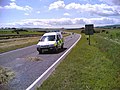
 Junction at A90 - geograph.org.uk - 176340.jpg 640 × 371; 69 KB
-
 Keabog - geograph.org.uk - 575802.jpg 640 × 427; 244 KB
-
 Knap of Lawhardie - geograph.org.uk - 175589.jpg 640 × 480; 100 KB
-
 Livestock pens on Hill of Gyratesmyre - geograph.org.uk - 177416.jpg 640 × 480; 78 KB
-
 Looking Towards Drumlithie - geograph.org.uk - 153647.jpg 640 × 475; 73 KB
-
 Near Keabog - geograph.org.uk - 575795.jpg 640 × 427; 266 KB
-
 Railway bridge near Drumlithie - geograph.org.uk - 177433.jpg 640 × 480; 77 KB
-
 Road and Field near Barras - geograph.org.uk - 176336.jpg 640 × 128; 33 KB
-
 Stream at Drumlithie - geograph.org.uk - 177419.jpg 640 × 480; 111 KB


