Category:Duisky
human settlement in Highland, Scotland, UK  | |||||
| Upload media | |||||
| Instance of | |||||
|---|---|---|---|---|---|
| Location |
| ||||
 | |||||
English: Duisky is a small hamlet on the south shore of Loch Eil, directly across from Fassfern, and approximately 6 miles west of Fort William across Loch Linnhe, Kinlocheil, Inverness-shire, Scottish Highlands and is in the Scottish council area of Highland.
Media in category "Duisky"
The following 15 files are in this category, out of 15 total.
-
 Blooming cherry in a Duisky garden - geograph.org.uk - 2933093.jpg 1,024 × 754; 216 KB
-
 Gulls rest on the shore at Duisky - geograph.org.uk - 2933083.jpg 1,600 × 1,080; 480 KB
-
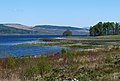
 Loch Eil from Camas Dubh Uisge - geograph.org.uk - 3472811.jpg 1,600 × 1,200; 470 KB
-
 Rubha Dubh Uisge from the nearby road - geograph.org.uk - 1914327.jpg 2,112 × 1,188; 491 KB
-
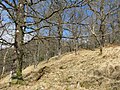
 Abandoned Crofthouse - geograph.org.uk - 410070.jpg 640 × 480; 54 KB
-
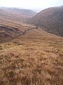
 Coirie a' Chearcaill. - geograph.org.uk - 266999.jpg 640 × 448; 55 KB
-
 Doire Driseach - geograph.org.uk - 753490.jpg 640 × 480; 131 KB
-
 Duisky, South shore of Loch Eil - geograph.org.uk - 469566.jpg 640 × 480; 78 KB
-
 East From Coire a' Chearcaill - geograph.org.uk - 598808.jpg 480 × 640; 76 KB
-
 Loch Eil near Blaich. - geograph.org.uk - 125284.jpg 640 × 480; 137 KB
-
 Looking towards Rubha Dubh Uisge - geograph.org.uk - 125280.jpg 640 × 476; 113 KB
-
 Near Duiskey - geograph.org.uk - 125288.jpg 640 × 458; 107 KB
-
 River Crossing - geograph.org.uk - 598791.jpg 472 × 640; 95 KB
-
 Scots Pine and Ancient Woodland - geograph.org.uk - 598459.jpg 640 × 480; 95 KB
-
 Trees and Pasture Land - geograph.org.uk - 410072.jpg 640 × 480; 59 KB


