Category:Dunchideock
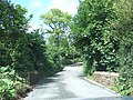
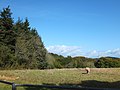
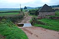
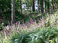
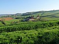
English: Dunchideock is a small civil parish on the north eastern slopes of the Haldon Hills in Teignbridge, Devon, England. It covers an area of 392 hectares (970 acres)cite web
village in United Kingdom  | |||||
| Upload media | |||||
| Instance of | |||||
|---|---|---|---|---|---|
| Location | Teignbridge, Devon, South West England, England | ||||
 | |||||
Subcategories
This category has the following 3 subcategories, out of 3 total.
Media in category "Dunchideock"
The following 182 files are in this category, out of 182 total.
-
 Across the Kenn valley - geograph.org.uk - 5995449.jpg 4,288 × 2,848; 2.8 MB
-
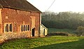
 Barn, Cuckoo Green - geograph.org.uk - 5923829.jpg 4,288 × 2,848; 1.3 MB
-
 Barn, Dunchideock (geograph 6060484).jpg 4,252 × 2,492; 1.63 MB
-
 Beech, Buller's Hill - geograph.org.uk - 239577.jpg 640 × 480; 136 KB
-
 Bench with a view, Haldon Forest Park - geograph.org.uk - 1429578.jpg 640 × 480; 115 KB
-
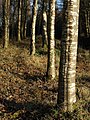 Birch trunks, Windy Cross - geograph.org.uk - 690751.jpg 480 × 640; 137 KB
-
 Bovine grazing by Webberton Wood - geograph.org.uk - 688125.jpg 640 × 480; 123 KB
-

-
 Clearing, Underdown - geograph.org.uk - 2001878.jpg 640 × 480; 229 KB
-
 Cottage in Dunchideock.jpg 3,808 × 2,848; 6.1 MB
-
 Cottages, near Dunchideock - geograph.org.uk - 1429842.jpg 640 × 480; 63 KB
-
 Country Lane, near Idestone Cross - geograph.org.uk - 1875419.jpg 1,024 × 768; 223 KB
-
 Countryside, near Dunchideock - geograph.org.uk - 1458011.jpg 640 × 480; 79 KB
-
 Cuckoo Green - geograph.org.uk - 5923793.jpg 4,059 × 2,680; 1.9 MB
-
 Dunchideock (geograph 5920007).jpg 3,376 × 1,740; 1.05 MB
-
 Dunchideock - geograph.org.uk - 798517.jpg 640 × 403; 58 KB
-
 Dunchideock Bridge - geograph.org.uk - 1306755.jpg 640 × 481; 181 KB
-
 Dunchideock Bridge - geograph.org.uk - 2434688.jpg 800 × 600; 521 KB
-
 Dunchideock, near Lawrence Castle - geograph.org.uk - 686986.jpg 640 × 427; 245 KB
-
 Family cycle trail, Tower Wood, Haldon - geograph.org.uk - 238723.jpg 480 × 640; 152 KB
-
 Farm buildings, Ashlake Cross - geograph.org.uk - 5996183.jpg 4,288 × 2,848; 1.61 MB
-
 Farm entrance at Ashlake Cross - geograph.org.uk - 2434640.jpg 800 × 600; 400 KB
-
 Farmland near Dunchideock - geograph.org.uk - 5926235.jpg 4,042 × 2,037; 1.7 MB
-
 Fence near Tower Court - geograph.org.uk - 798425.jpg 480 × 640; 110 KB
-
 Field beside South Wood - geograph.org.uk - 2654174.jpg 800 × 600; 408 KB
-
 Field beside Webberton Wood - geograph.org.uk - 688431.jpg 640 × 469; 102 KB
-
 Field boundary by Ashlake Cross - geograph.org.uk - 5996179.jpg 4,284 × 2,656; 2.39 MB
-
 Field boundary near Cuckoo Green - geograph.org.uk - 5923934.jpg 4,288 × 2,848; 2.52 MB
-
 Field by Leachway Lane Cross - geograph.org.uk - 5926157.jpg 4,288 × 2,628; 1.73 MB
-
 Field gate south of Manstree Cross - geograph.org.uk - 1589722.jpg 640 × 480; 67 KB
-
 Field near Cuckoo Green - geograph.org.uk - 5923937.jpg 2,368 × 1,454; 540 KB
-
 Field, Dunchideock - geograph.org.uk - 6172018.jpg 2,702 × 1,733; 682 KB
-

-
 Fields, trees and Exeter in the distance - geograph.org.uk - 1565605.jpg 640 × 480; 156 KB
-
 Footpath from Haldon Gate - geograph.org.uk - 6053651.jpg 2,848 × 4,288; 2.29 MB
-
 Footpath from Haldon Gate to Dunchideock - geograph.org.uk - 2654147.jpg 800 × 600; 509 KB
-
 Footpath through School Wood - geograph.org.uk - 2434664.jpg 800 × 600; 516 KB
-
 Footpath to Haldon Gate - geograph.org.uk - 2654154.jpg 600 × 800; 518 KB
-
 Ford at Yeo's Farm - geograph.org.uk - 3690029.jpg 3,872 × 2,592; 1.26 MB
-

-
 Forestry operations in North Wood - geograph.org.uk - 2434610.jpg 800 × 600; 403 KB
-
 Foxgloves, Tower Wood - geograph.org.uk - 2001847.jpg 640 × 480; 205 KB
-
 Foxgloves, Tower Wood - geograph.org.uk - 2001865.jpg 640 × 480; 225 KB
-
 Gate and farm track across field - geograph.org.uk - 2654164.jpg 600 × 800; 468 KB
-
 George VI Postbox, Webberton Cross - geograph.org.uk - 1306685.jpg 480 × 640; 191 KB
-
 Grazing field south of Cuckoo Green - geograph.org.uk - 3663504.jpg 640 × 480; 79 KB
-
 Gruffalo Spotters Trail, Haldon Forest - geograph.org.uk - 5498816.jpg 2,048 × 3,072; 1.9 MB
-
 Haldon Forest Trail - geograph.org.uk - 1429568.jpg 640 × 480; 130 KB
-
 Haldon Gate - geograph.org.uk - 239591.jpg 640 × 480; 133 KB
-
 Haldon Gate - geograph.org.uk - 239594.jpg 640 × 480; 114 KB
-
 Haldon Gate, Haldon Hill, Devon - geograph.org.uk - 19408.jpg 640 × 480; 81 KB
-
 Haldon Oak - geograph.org.uk - 2181363.jpg 1,600 × 1,071; 1.6 MB
-
 Haldon Riding Stables - geograph.org.uk - 1458072.jpg 640 × 462; 79 KB
-
 Haldon Sunrise - geograph.org.uk - 2181367.jpg 1,600 × 938; 982 KB
-
 Heather, Haldon Plantation - geograph.org.uk - 239581.jpg 480 × 640; 154 KB
-
 High noon on Haldon Ridge - geograph.org.uk - 688354.jpg 640 × 473; 103 KB
-
 Horse chestnut candle, Dunchideock - geograph.org.uk - 1306766.jpg 480 × 640; 140 KB
-
 House on the edge of Dunchideock - geograph.org.uk - 2434686.jpg 800 × 600; 366 KB
-
 Idestone - geograph.org.uk - 160180.jpg 640 × 480; 115 KB
-
 Idestone - geograph.org.uk - 5919978.jpg 4,254 × 2,227; 802 KB
-
 Idestone - geograph.org.uk - 798815.jpg 640 × 480; 71 KB
-
 Idestone Cottage, Dunchideock - geograph.org.uk - 1876827.jpg 1,024 × 768; 146 KB
-
 In School Wood - geograph.org.uk - 2434677.jpg 800 × 600; 444 KB
-
 Isolated tree, on the road to Idestone Cross - geograph.org.uk - 1875396.jpg 1,024 × 768; 183 KB
-
 Junction at Haldon Gate - geograph.org.uk - 2654134.jpg 800 × 600; 425 KB
-
 Kenn Valley (geograph 6064929).jpg 2,905 × 1,475; 598 KB
-
 Kenn valley at Idetone - geograph.org.uk - 5995451.jpg 3,975 × 2,438; 731 KB
-
 Kenn valley from near Horrels - geograph.org.uk - 5995416.jpg 4,288 × 2,676; 1.49 MB
-
 King's Road, Tower Wood, Haldon - geograph.org.uk - 238717.jpg 640 × 480; 118 KB
-
 Lane above Webberton Wood - geograph.org.uk - 689446.jpg 423 × 640; 103 KB
-
 Lane and barn at Cuckoo Green - geograph.org.uk - 3548197.jpg 640 × 480; 73 KB
-
 Lane from Cuckoo Green - geograph.org.uk - 5923820.jpg 4,288 × 2,848; 1.89 MB
-

-
 Lane past Ridgeway Plantation - geograph.org.uk - 687982.jpg 480 × 640; 106 KB
-
 Lane past School Wood - geograph.org.uk - 688083.jpg 640 × 584; 138 KB
-
 Lane to Biddypark Lane Cross - geograph.org.uk - 5995532.jpg 2,445 × 3,034; 1.24 MB
-
 Lane to Dunchideock - geograph.org.uk - 1565588.jpg 640 × 480; 163 KB
-
 Lane to Dunchideock - geograph.org.uk - 5564202.jpg 2,033 × 1,406; 524 KB
-
 Lane to Haldon Grange - geograph.org.uk - 5187657.jpg 1,763 × 1,229; 610 KB
-
 Lane to Haldon Grange - geograph.org.uk - 798338.jpg 640 × 480; 127 KB
-
 Lane to Leachway Lane Cross - geograph.org.uk - 5996185.jpg 4,238 × 2,440; 1.23 MB
-
 Lane to Lower Horrells - geograph.org.uk - 5995447.jpg 2,848 × 4,288; 2.58 MB
-
 Lane to Willhayes Cross - geograph.org.uk - 5995530.jpg 4,288 × 2,652; 1.96 MB
-
 Lane, Dunchideock - geograph.org.uk - 6263335.jpg 1,024 × 684; 271 KB
-
 Lane, Higher Horrells - geograph.org.uk - 5995446.jpg 2,830 × 3,886; 1.39 MB
-
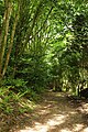
 Laurel tunnel, Haldon Plantation - geograph.org.uk - 4588263.jpg 1,920 × 1,554; 729 KB
-
 Lawrence Castle - Haldon Belvedere - geograph.org.uk - 5564156.jpg 1,536 × 2,048; 600 KB
-

-
 Meadow near Borough - geograph.org.uk - 5187575.jpg 3,039 × 1,934; 1.14 MB
-
 Milestone, Webberton Cross - geograph.org.uk - 1306747.jpg 640 × 480; 229 KB
-
 Minor road, to Dunchideock - geograph.org.uk - 1458084.jpg 640 × 480; 99 KB
-
 Narrow lane, near Dunchideock House - geograph.org.uk - 1429852.jpg 640 × 480; 119 KB
-
-

-
 Oak leaves - geograph.org.uk - 798438.jpg 640 × 471; 147 KB
-
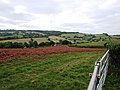
 Oilseed rape near Borough - geograph.org.uk - 5185270.jpg 2,751 × 1,785; 1.29 MB
-
 Oilseed rape near Borough - geograph.org.uk - 5187465.jpg 3,041 × 1,868; 1.45 MB
-
 Oilseed rape near Borough - geograph.org.uk - 5187556.jpg 2,574 × 1,495; 1,017 KB
-
 Old Bridge Feature Near Haldon Belvedere Entrance - geograph.org.uk - 3253822.jpg 1,600 × 1,200; 713 KB
-

-
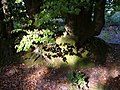
 Old tree base, Haldon - geograph.org.uk - 5499028.jpg 3,072 × 2,048; 1.66 MB
-
 Orange Way in Devon and Torbay (175) - geograph.org.uk - 2701305.jpg 1,024 × 768; 190 KB
-
 Orange Way in Devon and Torbay (176) - geograph.org.uk - 2701319.jpg 768 × 1,024; 112 KB
-

-
 Part of an estate wall of Haldon Grange - geograph.org.uk - 2654157.jpg 800 × 600; 533 KB
-
 Path below Haldon Belvedere - geograph.org.uk - 5777058.jpg 4,288 × 2,848; 1.73 MB
-
 Path below Haldon Belvedere - geograph.org.uk - 5780058.jpg 2,848 × 4,288; 2.45 MB
-
 Path near Haldon Belvedere - geograph.org.uk - 5779972.jpg 2,848 × 4,288; 2.32 MB
-
 Path to Haldon Gate - geograph.org.uk - 5780260.jpg 2,848 × 4,288; 2.76 MB
-
 Path to Haldon Gate - geograph.org.uk - 5780298.jpg 2,848 × 4,288; 2.15 MB
-
 Path to Tower Court - geograph.org.uk - 5780149.jpg 2,848 × 4,288; 1.73 MB
-
 Penhill Farm - geograph.org.uk - 5780255.jpg 4,260 × 2,126; 871 KB
-
 Pieris sp., Haldon Forest Park - geograph.org.uk - 1429600.jpg 640 × 480; 74 KB
-
 Private road to Borough - geograph.org.uk - 5187445.jpg 1,946 × 2,572; 1.09 MB
-
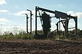
 Pylon, North Wood - geograph.org.uk - 5925919.jpg 1,832 × 3,264; 996 KB
-
 Pyronia tithonus - geograph.org.uk - 1429814.jpg 640 × 480; 72 KB
-
 Redundant gate, Knowle Hill - geograph.org.uk - 5923941.jpg 2,848 × 4,288; 2.08 MB
-
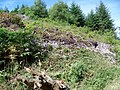
 Remains of barn, Knowle Hill - geograph.org.uk - 5923948.jpg 1,858 × 1,218; 283 KB
-
 Rhododendron at Dunchideock - geograph.org.uk - 1306484.jpg 480 × 640; 204 KB
-
 Road east from Leachway Lane Cross - geograph.org.uk - 2434633.jpg 800 × 600; 399 KB
-
 Road from Horrells to Idestone - geograph.org.uk - 2434619.jpg 800 × 600; 446 KB
-

-
 Road junction below Haldon Belvedere - geograph.org.uk - 1589712.jpg 640 × 480; 76 KB
-
 Road to Dunchideock from Idestone Brook - geograph.org.uk - 2434625.jpg 800 × 600; 433 KB
-
 Road to Idestone Cross from Cuckoo Green - geograph.org.uk - 2434446.jpg 800 × 600; 425 KB
-
 Road to the Dunchideock church - geograph.org.uk - 1565596.jpg 640 × 480; 182 KB
-
 School Wood - geograph.org.uk - 2434672.jpg 800 × 600; 403 KB
-
 Seats on the Haldon Forest Discovery Trail - geograph.org.uk - 5499003.jpg 3,264 × 2,448; 1.47 MB
-
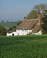
 Sheep and cottage, Dunchideock - geograph.org.uk - 6172133.jpg 3,048 × 1,925; 829 KB
-
 Sheep grazing at Dunchideock - geograph.org.uk - 798700.jpg 640 × 441; 90 KB
-
 Sheep in the field near Dunchideock - geograph.org.uk - 1565584.jpg 640 × 480; 169 KB
-
 Sheep, Dunchideock - geograph.org.uk - 6172023.jpg 2,567 × 1,507; 417 KB
-
 Sheep, Dunchideock - geograph.org.uk - 6172028.jpg 2,806 × 1,490; 516 KB
-
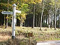 Signpost at Windy Cross - geograph.org.uk - 2654195.jpg 800 × 600; 580 KB
-
 Slopes below Haldon - geograph.org.uk - 5780271.jpg 4,282 × 2,691; 1.62 MB
-
 Slopes below Haldon - geograph.org.uk - 798406.jpg 640 × 470; 70 KB
-

-
 Teignbridge , Exe Estuary - geograph.org.uk - 3730107.jpg 4,286 × 2,846; 7.81 MB
-
 Teignbridge , Exe Estuary - geograph.org.uk - 3730108.jpg 4,288 × 2,848; 7.61 MB
-
 Teignbridge , Haldon Forest - Path - geograph.org.uk - 3730111.jpg 3,645 × 2,421; 7.66 MB
-
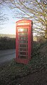 Telephone box, Dunchideock - geograph.org.uk - 6171454.jpg 1,832 × 3,264; 1.12 MB
-
 Telephone box, Webberton Cross - geograph.org.uk - 1306737.jpg 640 × 480; 206 KB
-
 Thatched building, Webberton Cross - geograph.org.uk - 5564242.jpg 2,007 × 1,437; 204 KB
-

-

-

-
 The north edge of North Wood - geograph.org.uk - 2434599.jpg 800 × 600; 360 KB
-
 The Old Post Office, Dunchideock - geograph.org.uk - 5564261.jpg 2,048 × 1,536; 415 KB
-
 The Old Post Office, Dunchideock - geograph.org.uk - 798493.jpg 517 × 640; 91 KB
-
 Towards Knowle Plantation - geograph.org.uk - 5923949.jpg 4,288 × 2,848; 2.22 MB
-
 Towards Lyalls (geograph 5780292).jpg 3,936 × 2,238; 1,022 KB
-
 Tower Court - geograph.org.uk - 1458066.jpg 640 × 480; 97 KB
-
 Tower Court, Haldon - geograph.org.uk - 154657.jpg 640 × 480; 108 KB
-
 Track off Biddypark Lane - geograph.org.uk - 798677.jpg 487 × 640; 126 KB
-
 Trees, Dunchideock - geograph.org.uk - 6172026.jpg 4,288 × 2,848; 1.67 MB
-
 Trig point, Knowle Hill - geograph.org.uk - 5923944.jpg 3,215 × 2,188; 1.54 MB
-
 Trig Point, on Parson's Plot Brake - geograph.org.uk - 1875382.jpg 1,600 × 1,200; 326 KB
-
 Underdown - geograph.org.uk - 1458079.jpg 640 × 480; 86 KB
-
 Underdown - geograph.org.uk - 154651.jpg 640 × 480; 104 KB
-
 Unofficial way into Hackaton Plantation - geograph.org.uk - 2654187.jpg 600 × 800; 556 KB
-
 Valley Form - geograph.org.uk - 1974387.jpg 778 × 519; 82 KB
-
 View below Haldon Belvedere - geograph.org.uk - 5780158.jpg 4,036 × 2,848; 1.39 MB
-
 View from Ashlake Cross - geograph.org.uk - 5995810.jpg 4,170 × 2,495; 1.58 MB
-
 View from lane from Ide to Dunchideock - geograph.org.uk - 6263330.jpg 1,024 × 684; 235 KB
-
 View north from beside the Lord Haldon Hotel - geograph.org.uk - 2467573.jpg 5,638 × 2,293; 3.16 MB
-
 View north, from Haldon Belvedere - geograph.org.uk - 1227081.jpg 640 × 480; 81 KB
-
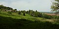
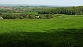
 View over Dunchideock - geograph.org.uk - 798783.jpg 640 × 480; 91 KB
-
 View over Dunchideock.jpg 640 × 480; 91 KB
-

-
 Viewpoint, Haldon - geograph.org.uk - 5498811.jpg 1,461 × 1,690; 422 KB
-
 Village notice board, Dunchideock - geograph.org.uk - 1306773.jpg 640 × 482; 220 KB
-
 Webberton Cross - geograph.org.uk - 2434683.jpg 800 × 600; 460 KB
-
 Webberton Wood - geograph.org.uk - 689404.jpg 640 × 480; 121 KB
-
 Webberton, Dunchideock - geograph.org.uk - 144882.jpg 640 × 480; 148 KB
-
 Willhayes Cross - geograph.org.uk - 2434648.jpg 800 × 600; 333 KB
-
 Willhayes Cross - geograph.org.uk - 5926251.jpg 4,288 × 2,848; 2.65 MB
-
 Windy Cross - geograph.org.uk - 164760.jpg 640 × 480; 146 KB
-
 Windy Cross - geograph.org.uk - 690653.jpg 640 × 480; 134 KB
-
 Windy Cross - geograph.org.uk - 690844.jpg 480 × 640; 159 KB
-
 Woodland below Haldon Belvedere - geograph.org.uk - 5780064.jpg 2,848 × 4,288; 2.63 MB
-
 Young trees in clearing, Haldon Forest - geograph.org.uk - 5499007.jpg 2,457 × 1,887; 1.47 MB
-


.jpg)


.jpg)


.jpg)


_-_geograph.org.uk_-_2701305.jpg)
_-_geograph.org.uk_-_2701319.jpg)


.jpg)


