Category:Duncton
village in United Kingdom  | |||||
| Upload media | |||||
| Instance of | |||||
|---|---|---|---|---|---|
| Location | Chichester, West Sussex, South East England, England | ||||
| Area |
| ||||
| Said to be the same as | Duncton (Wikimedia duplicated page, civil parish) | ||||
| official website | |||||
 | |||||
Subcategories
This category has the following 4 subcategories, out of 4 total.
Media in category "Duncton"
The following 163 files are in this category, out of 163 total.
-
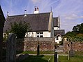
 "Village Hall House" at Duncton - geograph.org.uk - 2047905.jpg 800 × 600; 152 KB
-
 A view from Duncton Hill - geograph.org.uk - 35643.jpg 640 × 512; 56 KB
-
 A285 at Dogkennel Cottages - geograph.org.uk - 3122813.jpg 640 × 480; 43 KB
-
 A285 at Seaford College entrance - geograph.org.uk - 3123884.jpg 640 × 480; 67 KB
-
 A285 at Toad Hall - geograph.org.uk - 3123898.jpg 640 × 480; 66 KB
-
 A285 crosses the South Downs Way at Littleton Farm - geograph.org.uk - 4019640.jpg 3,227 × 2,292; 1.37 MB
-
 A285 near Littleton Farm - geograph.org.uk - 3122806.jpg 640 × 480; 54 KB
-
 A285 SW to Chichester - geograph.org.uk - 2534391.jpg 4,000 × 3,000; 3.5 MB
-
 A285 takes a sharp right at Fryan's Hanger - geograph.org.uk - 4019684.jpg 3,188 × 1,803; 1.28 MB
-
 A285 west of Burton Park Farm - geograph.org.uk - 3123909.jpg 640 × 480; 68 KB
-
 A285 west of Duncton Hanger - geograph.org.uk - 4019708.jpg 3,166 × 2,452; 1.81 MB
-
 Advent at Holy Trinity, Duncton (a) - geograph.org.uk - 6005726.jpg 480 × 640; 64 KB
-
 Advent at Holy Trinity, Duncton (b) - geograph.org.uk - 6005727.jpg 480 × 640; 59 KB
-
 Advent at Holy Trinity, Duncton (c) - geograph.org.uk - 6005728.jpg 640 × 480; 69 KB
-
 Approaching Black Pond Copse - geograph.org.uk - 5950166.jpg 1,600 × 1,200; 919 KB
-
-
 At Duncton Hill Viewpoint - geograph.org.uk - 231483.jpg 640 × 480; 111 KB
-
 Attachment for tractor for hauling logs - geograph.org.uk - 1247511.jpg 640 × 480; 140 KB
-
 Bank erosion on the River Rother - geograph.org.uk - 2538887.jpg 4,000 × 3,000; 3.37 MB
-
 Barn at Perryfields - geograph.org.uk - 2538813.jpg 4,000 × 3,000; 3.48 MB
-
 Barn at Ridlington Farm - geograph.org.uk - 2110462.jpg 640 × 428; 74 KB
-
 Beechwood Lane, Duncton - geograph.org.uk - 3967884.jpg 1,536 × 1,052; 922 KB
-
 Bend on the A285 south of Littleton Farm - geograph.org.uk - 3793701.jpg 800 × 600; 137 KB
-
 Berries - geograph.org.uk - 2048300.jpg 800 × 600; 233 KB
-
 Biddulph Mews - geograph.org.uk - 3461477.jpg 1,202 × 783; 293 KB
-
 Blocked footpath in Fryan's Hanger - geograph.org.uk - 1806906.jpg 1,600 × 1,200; 864 KB
-
 Bracken carpet in woodland - geograph.org.uk - 1379348.jpg 640 × 480; 155 KB
-
 Bridleway between ponds - geograph.org.uk - 3272841.jpg 800 × 600; 212 KB
-
 Bridleway descends from Duncton Hanger - geograph.org.uk - 3800173.jpg 800 × 600; 160 KB
-
 Bridleway off the A285 at Duncton - geograph.org.uk - 2047908.jpg 800 × 600; 165 KB
-
 Bridleway past Black Pond Copse - geograph.org.uk - 5950180.jpg 1,600 × 1,200; 921 KB
-
 Bridleway through clearing - geograph.org.uk - 5738481.jpg 4,608 × 3,456; 7.93 MB
-
 Bridleway to A285 - geograph.org.uk - 5738136.jpg 4,608 × 3,456; 7.34 MB
-
 Bridleway to Duncton Mill from Duncton - geograph.org.uk - 1456834.jpg 640 × 480; 100 KB
-
 Bridleway, Duncton Hanger - geograph.org.uk - 2269997.jpg 640 × 480; 179 KB
-
 Bridleway, Duncton Hanger - geograph.org.uk - 5738513.jpg 4,608 × 3,456; 6.75 MB
-
 Building at Manor Farm Duncton - geograph.org.uk - 1806873.jpg 1,600 × 1,200; 711 KB
-
 Burton Mill - geograph.org.uk - 5950806.jpg 1,600 × 1,200; 550 KB
-
 Burton Park - geograph.org.uk - 3118749.jpg 2,848 × 2,134; 1.08 MB
-
 Burton Park - geograph.org.uk - 4693324.jpg 800 × 530; 534 KB
-
 Burton Park - geograph.org.uk - 4693325.jpg 800 × 530; 584 KB
-
 Burton Park - geograph.org.uk - 4693327.jpg 800 × 530; 580 KB
-
 Burton Park and Garden - geograph.org.uk - 3461472.jpg 1,203 × 787; 307 KB
-
 Burton Park, Duncton - geograph.org.uk - 3486222.jpg 640 × 409; 175 KB
-
 Bus stop and shelter, Duncton - geograph.org.uk - 3967890.jpg 1,536 × 1,152; 1.09 MB
-
 Cathanger Farm - geograph.org.uk - 2358509.jpg 800 × 600; 161 KB
-
 Cathanger Farmhouse - geograph.org.uk - 2450234.jpg 640 × 480; 91 KB
-
 Chingford Pond - geograph.org.uk - 4984399.jpg 640 × 480; 67 KB
-
 Chingford Pond - geograph.org.uk - 5949824.jpg 2,048 × 1,536; 613 KB
-

-
 Cottages at Duncton - geograph.org.uk - 2048735.jpg 800 × 505; 83 KB
-
 Country road near Duncton - geograph.org.uk - 2045115.jpg 640 × 493; 218 KB
-
 Daffodils by the A285 on Duncton Down - geograph.org.uk - 2361043.jpg 800 × 600; 167 KB
-
 Descending towards Littleton Farm and the A285 - geograph.org.uk - 2686038.jpg 3,968 × 2,976; 2.91 MB
-
 Disused chalk pit - geograph.org.uk - 1246893.jpg 640 × 480; 144 KB
-
 Dog kennel cottages by the A285 - geograph.org.uk - 3966581.jpg 1,536 × 878; 745 KB
-
 Downhill path on Fran's Hanger - geograph.org.uk - 5739879.jpg 4,608 × 3,456; 6 MB
-
 Downland view - geograph.org.uk - 3790755.jpg 800 × 600; 113 KB
-
 Downland view from bridleway near Duncton Mill - geograph.org.uk - 1806811.jpg 1,600 × 1,200; 708 KB
-
 Ducks by Beechwood Lane - geograph.org.uk - 2048278.jpg 800 × 600; 150 KB
-
 Dunction Hill Viewpoint - geograph.org.uk - 6217608.jpg 1,024 × 768; 221 KB
-
 Duncton Common (1) - geograph.org.uk - 2045088.jpg 480 × 640; 304 KB
-
 Duncton Common (4) - geograph.org.uk - 2045194.jpg 640 × 344; 130 KB
-
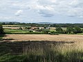
 Duncton Down - geograph.org.uk - 2403402.jpg 1,280 × 856; 303 KB
-
 Duncton Down hillside - geograph.org.uk - 1804568.jpg 1,600 × 1,200; 356 KB
-
 Duncton from Duncton Hill - geograph.org.uk - 2916333.jpg 2,520 × 1,680; 456 KB
-
 Duncton Hanger, terraced bridleway - geograph.org.uk - 5739504.jpg 4,608 × 3,456; 6.37 MB
-
 Duncton Hill Viewpoint - geograph.org.uk - 6181270.jpg 3,264 × 2,448; 3.71 MB
-
 Duncton Hill, looking towards Black Down.JPG 1,536 × 2,048; 811 KB
-
 Duncton Mill - geograph.org.uk - 201282.jpg 640 × 480; 122 KB
-
 Duncton Mill - geograph.org.uk - 2696392.jpg 1,600 × 1,200; 562 KB
-
 Duncton School seen from footpath - geograph.org.uk - 2358800.jpg 800 × 600; 141 KB
-
 Dye House Lane junction with Folly Lane - geograph.org.uk - 4019766.jpg 3,352 × 2,556; 1.7 MB
-
 Entrance to Duncton Quarry - geograph.org.uk - 2269913.jpg 640 × 480; 169 KB
-
 Fields west of Duncton village - geograph.org.uk - 201285.jpg 640 × 480; 87 KB
-
 Fishing lake near Duncton Mill - geograph.org.uk - 2696395.jpg 1,600 × 1,200; 702 KB
-
 Footbridge at Duncton - geograph.org.uk - 2047888.jpg 600 × 800; 174 KB
-
 Footpath climbing through Fryan's Hanger - geograph.org.uk - 1806899.jpg 1,600 × 1,200; 807 KB
-
 Footpath junction - geograph.org.uk - 5740877.jpg 4,608 × 3,456; 6.66 MB
-
-
-
 Footpath towards A285, Duncton - geograph.org.uk - 2110464.jpg 640 × 428; 85 KB
-
 Forest track to Barlavington - geograph.org.uk - 5739486.jpg 4,608 × 3,456; 7.29 MB
-
 Forest track, Duncton Hanger - geograph.org.uk - 5738276.jpg 4,608 × 3,456; 7.18 MB
-
 Fryan's Hanger car-park and view - geograph.org.uk - 3966591.jpg 1,535 × 1,536; 1.4 MB
-
 Game in progress - geograph.org.uk - 2048666.jpg 800 × 600; 101 KB
-
 Gate on bridleway in Burton Park - geograph.org.uk - 3272835.jpg 800 × 600; 210 KB
-
 Gate piers and walls near Duncton - geograph.org.uk - 2083690.jpg 640 × 384; 178 KB
-
 Gates, Duncton - geograph.org.uk - 2083720.jpg 640 × 330; 171 KB
-
 Gateway to field - geograph.org.uk - 2047880.jpg 529 × 800; 146 KB
-
 Grand gateway to footpath - geograph.org.uk - 2047957.jpg 800 × 599; 190 KB
-
 Ironwork on roof - geograph.org.uk - 2047825.jpg 800 × 600; 85 KB
-
 Lane across Duncton Common - geograph.org.uk - 204438.jpg 640 × 480; 147 KB
-
 Lane to Duncton Church - geograph.org.uk - 3597149.jpg 1,600 × 1,064; 442 KB
-
 Lime kiln at Duncton Hanger - geograph.org.uk - 1246885.jpg 640 × 480; 151 KB
-
 Littleton Farm on the A285 - geograph.org.uk - 3818315.jpg 800 × 560; 104 KB
-
 Lodge Green - geograph.org.uk - 5950158.jpg 1,600 × 1,200; 422 KB
-
 Lodge Green, Duncton - geograph.org.uk - 4984472.jpg 640 × 512; 66 KB
-
 Logpiles alongside the SDW - geograph.org.uk - 4590505.jpg 1,112 × 832; 425 KB
-

-
 Man and machine at work - geograph.org.uk - 2048002.jpg 800 × 600; 148 KB
-
 Mud and puddles on The Serpent Trail, Duncton Common - geograph.org.uk - 4957050.jpg 4,608 × 3,456; 6.64 MB
-
 Muddy patch on The Serpent Trail, Duncton Common - geograph.org.uk - 4957017.jpg 4,608 × 3,456; 7.81 MB
-
 Old farm machinery at Dog Kennels - geograph.org.uk - 1804573.jpg 1,600 × 1,200; 938 KB
-
 Old limekiln, Duncton Hill - geograph.org.uk - 448977.jpg 428 × 640; 209 KB
-
-
 Old school. Duncton 2.JPG 1,280 × 960; 292 KB
-
 On Duncton Down - geograph.org.uk - 3966588.jpg 1,536 × 1,152; 929 KB
-
 Outbuilding at Manor Farm - geograph.org.uk - 2048288.jpg 800 × 600; 207 KB
-
 Overview of Duncton Mill Fishery - geograph.org.uk - 1456903.jpg 640 × 480; 92 KB
-
 Parkland at Burton Park - geograph.org.uk - 5950174.jpg 1,600 × 1,200; 643 KB
-
 Play area in Duncton - geograph.org.uk - 2047893.jpg 800 × 403; 84 KB
-
 Ridlington Farm - geograph.org.uk - 1456682.jpg 640 × 480; 74 KB
-

-
 Rookery Island - geograph.org.uk - 5949837.jpg 2,048 × 1,536; 1.7 MB
-

-
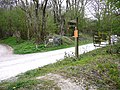 Signpost by entrance to Duncton Quarry - geograph.org.uk - 2361027.jpg 800 × 600; 208 KB
-
 Signposts for the South Downs Way off the A285 - geograph.org.uk - 2686042.jpg 3,968 × 2,976; 3.04 MB
-
 Signs for Duncton Mill - geograph.org.uk - 1246867.jpg 640 × 480; 113 KB
-
 South Downs National Park - geograph.org.uk - 3118744.jpg 8,280 × 1,784; 4.82 MB
-
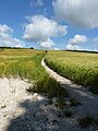 South Downs Way at Littleton - geograph.org.uk - 4590501.jpg 857 × 1,142; 386 KB
-
 South Downs Way East of the A285 - geograph.org.uk - 2420078.jpg 4,320 × 3,240; 3.08 MB
-
 South Downs Way eastbound - geograph.org.uk - 3165079.jpg 3,264 × 2,448; 2.83 MB
-
 South Downs Way near Littleton Farm - geograph.org.uk - 3599393.jpg 1,600 × 1,064; 706 KB
-
-
 Start of the climb for the South Downs Way - geograph.org.uk - 3165069.jpg 3,264 × 2,448; 4.63 MB
-

-
-
 Terraced bridleway, Duncton Hanger - geograph.org.uk - 5738576.jpg 4,608 × 3,456; 6.96 MB
-
 The A285 at the bottom of Duncton Hill - geograph.org.uk - 1806832.jpg 1,600 × 1,200; 624 KB
-

-
 The A285 near Duncton Quarry - geograph.org.uk - 2361041.jpg 800 × 600; 159 KB
-
 The A285 through Duncton - geograph.org.uk - 1456623.jpg 640 × 480; 91 KB
-
-
 The Cricketers at Duncton - geograph.org.uk - 3967886.jpg 1,536 × 1,151; 1 MB
-
 The Cricketers, Duncton - geograph.org.uk - 5390966.jpg 1,024 × 684; 174 KB
-
 The drive to Seaford College - geograph.org.uk - 2047948.jpg 800 × 600; 167 KB
-
-
 The lodges at Seaford College - geograph.org.uk - 2047966.jpg 800 × 452; 124 KB
-
 The Serpent Trail, Duncton Common - geograph.org.uk - 4956202.jpg 4,608 × 3,456; 6.8 MB
-
 The Serpent Trail, Duncton Common - geograph.org.uk - 4956212.jpg 4,608 × 3,456; 7.93 MB
-
 The South Downs Way climbing Burton Down - geograph.org.uk - 2437882.jpg 4,000 × 3,000; 2.86 MB
-
 The South Downs Way near Littleton Farm - geograph.org.uk - 3959262.jpg 800 × 600; 119 KB
-
 The straight road north of Duncton - geograph.org.uk - 3967900.jpg 1,536 × 1,152; 1.34 MB
-
 The way to Ridlington Farm - geograph.org.uk - 2358768.jpg 800 × 600; 166 KB
-
 Troubled junction on the A285 - geograph.org.uk - 2359179.jpg 800 × 600; 104 KB
-
 View across field to Redlands Farm - geograph.org.uk - 1456629.jpg 640 × 480; 60 KB
-
 View from footpath above Duncton Mill - geograph.org.uk - 2048313.jpg 800 × 630; 166 KB
-
 View from Fryan's Hanger - geograph.org.uk - 3597165.jpg 1,600 × 1,064; 449 KB
-
 View from the lower slopes of Fryan's Hanger - geograph.org.uk - 1806885.jpg 1,600 × 1,200; 359 KB
-

-
 Viewpoint at Duncton Hill - geograph.org.uk - 35640.jpg 640 × 512; 88 KB
-
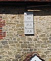
 Viewpoint plaque at car park on Duncton Hill - geograph.org.uk - 1800665.jpg 1,600 × 1,200; 379 KB
-
 Waterfall under bridleway bridge - geograph.org.uk - 1377818.jpg 640 × 480; 131 KB
-
 Western edge of Duncton Common - geograph.org.uk - 204449.jpg 640 × 480; 100 KB
-
 Wet field entrance, Littleton Down - geograph.org.uk - 2269934.jpg 640 × 480; 109 KB
-
 Woodberry House on Burton Park Road - geograph.org.uk - 2358806.jpg 800 × 600; 133 KB
-
 Woodland clearing on Duncton Common - geograph.org.uk - 2539766.jpg 4,000 × 3,000; 3.39 MB
-
 Woodland, Coopers Moor - geograph.org.uk - 2563806.jpg 768 × 1,024; 344 KB
-
 Work party on the South Downs Way - geograph.org.uk - 3599401.jpg 1,600 × 1,064; 409 KB
-
 Yew tree adjacent to footpath - geograph.org.uk - 5740915.jpg 4,608 × 3,456; 7.09 MB
-
 Bridleway hairpin, Duncton Hill - geograph.org.uk - 448954.jpg 640 × 428; 201 KB
-


_-_geograph.org.uk_-_6005726.jpg)
_-_geograph.org.uk_-_6005727.jpg)
_-_geograph.org.uk_-_6005728.jpg)


_-_geograph.org.uk_-_2045088.jpg)
_-_geograph.org.uk_-_2045194.jpg)


.jpg)


