Category:Dunkirk, Kent
English: Category:Villages in Kent
village in Kent, England, United Kingdom  | |||||
| Upload media | |||||
| Instance of | |||||
|---|---|---|---|---|---|
| Location | Dunkirk, Swale, Kent, South East England, England | ||||
 | |||||
Subcategories
This category has only the following subcategory.
C
- Christ Church, Dunkirk, Kent (4 F)
Media in category "Dunkirk, Kent"
The following 200 files are in this category, out of 206 total.
(previous page) (next page)-
 A2 - geograph.org.uk - 5207737.jpg 640 × 426; 43 KB
-
 A2 between Dunkirk and Upper Harbledown - geograph.org.uk - 3757484.jpg 3,488 × 2,616; 2.16 MB
-
 A2 slip road to Dunkirk - geograph.org.uk - 4272797.jpg 640 × 480; 125 KB
-
 A2, Canterbury Road Bridge - geograph.org.uk - 2495693.jpg 640 × 430; 59 KB
-
 Access road to High Wood Lodge - geograph.org.uk - 1559173.jpg 640 × 427; 122 KB
-
 Blean woods - geograph.org.uk - 1559195.jpg 640 × 427; 132 KB
-
 Bossenden Farm - geograph.org.uk - 1559836.jpg 640 × 427; 62 KB
-
 Bossenden Farm Road (2) - geograph.org.uk - 1559851.jpg 640 × 427; 121 KB
-
 Bossenden Farm Road - geograph.org.uk - 1559850.jpg 640 × 427; 64 KB
-
 Bossenden House - geograph.org.uk - 1559845.jpg 640 × 414; 61 KB
-
 Bridge over A2 - geograph.org.uk - 4272793.jpg 640 × 480; 130 KB
-
 Bridge over the A2 - geograph.org.uk - 5207750.jpg 640 × 426; 49 KB
-
 Bridleway enters Clay Pits Wood - geograph.org.uk - 1559182.jpg 640 × 427; 95 KB
-
 Bridleway heading into Blean Wood - geograph.org.uk - 1559191.jpg 640 × 427; 129 KB
-
 Bridleway in Blean Wood (1) - geograph.org.uk - 1559193.jpg 640 × 427; 133 KB
-
 Bridleway in Blean Wood (2) - geograph.org.uk - 1559194.jpg 640 × 427; 128 KB
-
 Bridleway in Blean Woods - geograph.org.uk - 5940381.jpg 1,024 × 768; 562 KB
-
 Bridleway in Clay Pits Wood (2) - geograph.org.uk - 1559180.jpg 640 × 427; 128 KB
-
 Bridleway in Clay Pits Wood - geograph.org.uk - 1559178.jpg 640 × 427; 123 KB
-
 Bridleway in High Wood - geograph.org.uk - 1559174.jpg 427 × 640; 116 KB
-
 Bridleway in Joan Beech Wood - geograph.org.uk - 1583990.jpg 427 × 640; 146 KB
-
 Bridleway in North Bishopden Wood - geograph.org.uk - 1559811.jpg 640 × 427; 94 KB
-
 Bridleway in North Bishopden Wood - geograph.org.uk - 1559821.jpg 640 × 427; 114 KB
-
 Bridleway in North Bishopden Wood - geograph.org.uk - 1559823.jpg 640 × 427; 133 KB
-

-

-
 Bridleway to Bossenden Farm - geograph.org.uk - 1559827.jpg 640 × 427; 104 KB
-
 Bridleway to North Bishopden Wood - geograph.org.uk - 1559830.jpg 640 × 427; 71 KB
-
 Building Dunkirk's New Village Hall - geograph.org.uk - 2053780.jpg 3,072 × 2,304; 1.64 MB
-
 Bungalows on Courtenay Road - geograph.org.uk - 1972022.jpg 1,024 × 683; 180 KB
-
 Canterbury Road - geograph.org.uk - 1972037.jpg 1,024 × 683; 180 KB
-
 Canterbury Road meets the A2 - geograph.org.uk - 1559859.jpg 640 × 427; 77 KB
-
 Canterbury Road, Dunkirk - geograph.org.uk - 1241676.jpg 640 × 462; 98 KB
-
 Canterbury Road, Dunkirk - geograph.org.uk - 3757471.jpg 3,286 × 2,513; 1.88 MB
-
 Canterbury Road, Dunkirk - geograph.org.uk - 3757473.jpg 3,488 × 2,616; 2 MB
-
 Canterbury Road, near Boughton-under-Blean - geograph.org.uk - 3757458.jpg 3,488 × 2,616; 2.92 MB
-
 Canterbury Road, near Boughton-under-Blean - geograph.org.uk - 3757460.jpg 3,488 × 2,616; 3.01 MB
-
 Cattle, Courtenay Road, Dunkirk - geograph.org.uk - 5804639.jpg 640 × 471; 83 KB
-
 Christ Church, Dunkirk - geograph.org.uk - 3757466.jpg 3,488 × 2,616; 2.52 MB
-
 Cleared area of forest near Winterbourne - geograph.org.uk - 1477886.jpg 640 × 480; 276 KB
-

-
 Clearing in Court Wood - geograph.org.uk - 1476212.jpg 640 × 480; 318 KB
-
 Clearing, North Bishopden Wood - geograph.org.uk - 1209756.jpg 640 × 430; 107 KB
-

-
 Coppice on the slopes of Iron Hill - geograph.org.uk - 1477961.jpg 640 × 480; 428 KB
-
 Coppiced woods, Fishpond Woods - geograph.org.uk - 1132916.jpg 640 × 430; 128 KB
-
 Court Wood - geograph.org.uk - 2652491.jpg 640 × 480; 165 KB
-
 Court Wood - geograph.org.uk - 2652497.jpg 640 × 480; 179 KB
-
 Courtenay Cottages, Courtenay Road, Dunkirk - geograph.org.uk - 3757470.jpg 3,488 × 2,616; 1.95 MB
-
 Courtenay Farm, Courtenay Road - geograph.org.uk - 1972014.jpg 1,024 × 768; 180 KB
-
 Courtenay House - geograph.org.uk - 1559170.jpg 640 × 427; 75 KB
-
 Courtenay Road, Dunkirk - geograph.org.uk - 1241668.jpg 640 × 475; 92 KB
-
 Dargate Road - geograph.org.uk - 5804717.jpg 640 × 480; 135 KB
-

-
 Dawes Road, Dunkirk - geograph.org.uk - 5804652.jpg 640 × 480; 54 KB
-

-

-
 Dead tree in South Bishops Den - geograph.org.uk - 1476234.jpg 480 × 640; 514 KB
-
 Denestroude Lane - geograph.org.uk - 1559776.jpg 640 × 427; 66 KB
-
 Denstead Lane meets the A2 - geograph.org.uk - 1132903.jpg 640 × 430; 46 KB
-
 Denstroude Farm buildings, Denstroude Lane - geograph.org.uk - 5705098.jpg 3,264 × 1,701; 1.48 MB
-

-
 Disused shack, Courtenay Road - geograph.org.uk - 5804687.jpg 640 × 480; 140 KB
-
 Dunkirk transmitter - geograph.org.uk - 1477793.jpg 640 × 480; 157 KB
-
 Dunkirk turning, A2 - geograph.org.uk - 5207742.jpg 640 × 426; 45 KB
-
 Dunkirk TV Mast - geograph.org.uk - 1355560.jpg 480 × 640; 46 KB
-
 Edge of Fishpond Woods - geograph.org.uk - 1132923.jpg 640 × 430; 77 KB
-
 Entrance to a vacant site - geograph.org.uk - 1476301.jpg 640 × 480; 227 KB
-
 Entrance to Victory Wood, near Dargate - geograph.org.uk - 5804764.jpg 480 × 640; 138 KB
-
 Esso filling station at Dunkirk - geograph.org.uk - 1476304.jpg 640 × 480; 252 KB
-

-
 Farm Road to Bossenden Wood - geograph.org.uk - 1559838.jpg 640 × 427; 63 KB
-
 First light of the day - geograph.org.uk - 3360479.jpg 640 × 430; 32 KB
-
 First light of the day over the A2 - geograph.org.uk - 3360480.jpg 640 × 478; 28 KB
-
 Fishpond Woods - geograph.org.uk - 1132944.jpg 640 × 430; 137 KB
-
 Forest track through South Bishops Den - geograph.org.uk - 1476243.jpg 640 × 480; 471 KB
-

-
 Forester's Lodge Farm from the south - geograph.org.uk - 1477785.jpg 640 × 480; 244 KB
-
 Former Dunkirk County Primary School - geograph.org.uk - 3757468.jpg 3,488 × 2,616; 2.23 MB
-
 Former Dunkirk Primary School - geograph.org.uk - 5702970.jpg 3,114 × 2,370; 2.11 MB
-
 French Navy Flamant Class P676 entering Dunkirk harbour (7961651562).jpg 4,000 × 2,672; 3.6 MB
-
 Fungi in Blean Woods, Dunkirk - geograph.org.uk - 5168602.jpg 640 × 480; 103 KB
-
-
 Fungus in Blean Woods, Dunkirk - geograph.org.uk - 5168566.jpg 480 × 640; 70 KB
-
 Fungus in Blean Woods, Dunkirk - geograph.org.uk - 5168572.jpg 480 × 640; 93 KB
-
 Fungus in Blean Woods, Dunkirk - geograph.org.uk - 5168579.jpg 480 × 640; 85 KB
-
 Fungus in Blean Woods, Dunkirk - geograph.org.uk - 5168609.jpg 480 × 640; 106 KB
-
 Grain silos at Forester's Lodge Farm - geograph.org.uk - 1477777.jpg 640 × 480; 228 KB
-
 Grazing sheep near Dunkirk - geograph.org.uk - 4272804.jpg 640 × 480; 104 KB
-
 Holly Hill Farm - geograph.org.uk - 1559190.jpg 640 × 427; 61 KB
-
 Horselees Road, Boughton Street - geograph.org.uk - 5862930.jpg 1,024 × 684; 169 KB
-

-
 House on Canterbury Road - geograph.org.uk - 1972028.jpg 1,024 × 683; 152 KB
-
 Houses between Courtenay Road ^ Dargate Road - geograph.org.uk - 1972006.jpg 1,024 × 768; 330 KB
-
 Houses cut off by the Broughton Bypass - geograph.org.uk - 1476323.jpg 640 × 480; 176 KB
-
 Iron Hill from the east - geograph.org.uk - 1477940.jpg 640 × 480; 314 KB
-
 Junction on Holly Hill Road - geograph.org.uk - 1559189.jpg 640 × 427; 66 KB
-
 Kissing Gate near Winterbourne Wood - geograph.org.uk - 1583927.jpg 640 × 427; 127 KB
-
 Kissing Gate near Winterbourne Wood - geograph.org.uk - 1583940.jpg 640 × 427; 94 KB
-

-
 Kissing gates on a track junction - geograph.org.uk - 1583953.jpg 640 × 427; 112 KB
-
-
 Link Sculpture, Victory Wood - geograph.org.uk - 5584153.jpg 640 × 468; 84 KB
-
 Link Sculpture, Victory Wood - geograph.org.uk - 5584174.jpg 640 × 469; 78 KB
-

-
 Little Chef near Dunkirk, Kent - geograph.org.uk - 1475013.jpg 640 × 480; 61 KB
-
 London Road, Dunkirk - geograph.org.uk - 3757477.jpg 3,488 × 2,616; 2.36 MB
-
 London Road, Dunkirk - geograph.org.uk - 3757478.jpg 3,488 × 2,616; 2.14 MB
-
 London Road, Dunkirk - geograph.org.uk - 3757480.jpg 3,488 × 2,616; 2.15 MB
-

-
 Mixed Oak Woodland, North Bishopden Wood - geograph.org.uk - 1209814.jpg 640 × 430; 137 KB
-
 Mixed woodland, North Bishopden Wood - geograph.org.uk - 1209801.jpg 640 × 430; 127 KB
-
 New drainage for a forest track - geograph.org.uk - 1476258.jpg 640 × 480; 426 KB
-
 New House Nurseries, Dunkirk - geograph.org.uk - 1559866.jpg 640 × 427; 51 KB
-
 New Road - geograph.org.uk - 534514.jpg 640 × 479; 205 KB
-
 North Bishopden Wood - geograph.org.uk - 1209807.jpg 640 × 430; 124 KB
-
 North Bishopden Wood - geograph.org.uk - 2437068.jpg 480 × 640; 192 KB
-
 Old Inn, new food - geograph.org.uk - 156514.jpg 640 × 426; 62 KB
-
 Orchards by Denstead Lane - geograph.org.uk - 2648133.jpg 640 × 480; 91 KB
-
 Ordnance Survey Flush Bracket S6173 - geograph.org.uk - 4935190.jpg 4,000 × 3,000; 3.52 MB
-
 Path in Blean Woods - geograph.org.uk - 5940389.jpg 1,024 × 768; 453 KB
-
 Path in Blean Woods - geograph.org.uk - 5940403.jpg 1,024 × 768; 552 KB
-
 Path in North Bishopden Wood, Dunkirk - geograph.org.uk - 5145893.jpg 640 × 480; 130 KB
-
 Path into Bossenden Wood - geograph.org.uk - 1559876.jpg 640 × 427; 88 KB
-
 Phone Mast near High Wood - geograph.org.uk - 1559175.jpg 427 × 640; 117 KB
-
 Pond on the path, Denstead Wood - geograph.org.uk - 1584142.jpg 427 × 640; 132 KB
-
 Poundfall Wood - geograph.org.uk - 1477767.jpg 640 × 480; 272 KB
-
 Public footpath crossing a forest track - geograph.org.uk - 1476248.jpg 640 × 480; 498 KB
-
 Remains of a bonfire - geograph.org.uk - 1476224.jpg 640 × 480; 427 KB
-
 Rhode Common - geograph.org.uk - 5674511.jpg 640 × 428; 144 KB
-
-
 Roadworks on Canterbury Road - geograph.org.uk - 1583815.jpg 640 × 427; 95 KB
-
 Roof of Bell Harry Tower, Canterbury Cathedral.jpg 1,262 × 1,600; 1,016 KB
-
 Sawmill on the edge of Joan Beech Wood - geograph.org.uk - 1476196.jpg 640 × 480; 228 KB
-
 Secluded meadow - geograph.org.uk - 1477993.jpg 640 × 480; 385 KB
-
 Shy llama in Courtney Road, Dunkirk - geograph.org.uk - 5804621.jpg 640 × 456; 92 KB
-
 Slip road, turnoff to Dunkirk - geograph.org.uk - 1476329.jpg 640 × 480; 167 KB
-
 Small stream, North Bishopden Wood - geograph.org.uk - 1209810.jpg 430 × 640; 133 KB
-

-

-
 Stairs on the A2 Embankment - geograph.org.uk - 1583763.jpg 427 × 640; 132 KB
-
 Stile at the boundary of Joan Beech Wood - geograph.org.uk - 1476200.jpg 640 × 480; 348 KB
-
 Stubble in a field near Dunkirk - geograph.org.uk - 1477757.jpg 640 × 480; 241 KB
-
 Thames Estuary from the Air - geograph.org.uk - 2668465.jpg 1,024 × 682; 218 KB
-
 The A2 - geograph.org.uk - 5207756.jpg 640 × 426; 47 KB
-
 The A2 by Denstead Lane - geograph.org.uk - 3038447.jpg 3,872 × 2,592; 4.09 MB
-

-

-
 The edge of Fishpond Woods - geograph.org.uk - 1132940.jpg 640 × 430; 87 KB
-
 The edge of South Bishop's Den Wood - geograph.org.uk - 1132948.jpg 640 × 430; 78 KB
-
 The Gate Little Chef - geograph.org.uk - 1589137.jpg 640 × 427; 40 KB
-
 The Link Sculpture, Victory Wood - geograph.org.uk - 1198152.jpg 640 × 480; 71 KB
-
 The Old Vicarage Farm, Dunkirk - geograph.org.uk - 767954.jpg 640 × 480; 329 KB
-
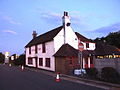
 The Red Lion Inn, Dunkirk, UK.jpg 640 × 480; 145 KB
-
 The Red Lion, Dunkirk - geograph.org.uk - 3757475.jpg 3,488 × 2,616; 1.68 MB
-

-
 The Winter Bourne^ - geograph.org.uk - 1477905.jpg 640 × 480; 419 KB
-

-
 Track in Bossenden Wood - geograph.org.uk - 1559816.jpg 640 × 427; 143 KB
-
 Track in Bossenden Wood, Dunkirk - geograph.org.uk - 5145873.jpg 640 × 480; 153 KB
-
 Track in Court Wood - geograph.org.uk - 1583967.jpg 427 × 640; 94 KB
-
 Track in Joan Beech Wood - geograph.org.uk - 1583998.jpg 640 × 427; 146 KB
-
 Track in North Bishopden Wood - geograph.org.uk - 1559826.jpg 640 × 427; 92 KB
-
 Track through Bishopsden Wood - geograph.org.uk - 2437048.jpg 640 × 480; 139 KB
-
 Track through Court Wood - geograph.org.uk - 2648130.jpg 640 × 480; 124 KB
-
 Track through Joan Beech Wood - geograph.org.uk - 1476172.jpg 640 × 480; 435 KB
-
 Track to Saw Mill - geograph.org.uk - 2649035.jpg 640 × 480; 124 KB
-
 Track, North Bishopden Wood (2) - geograph.org.uk - 1209777.jpg 640 × 430; 125 KB
-
 Track, North Bishopden Wood (3) - geograph.org.uk - 1209796.jpg 640 × 430; 104 KB
-
 Track, North Bishopden Wood - geograph.org.uk - 1209748.jpg 640 × 430; 106 KB
-
 Tunnel under the A2 Dual Carriageway - geograph.org.uk - 1583773.jpg 640 × 427; 78 KB
-
 Two stiles and footbridge in Court Wood - geograph.org.uk - 1583960.jpg 640 × 427; 114 KB
-
 View along Courtenay Road to Dunkirk - geograph.org.uk - 767927.jpg 640 × 480; 180 KB
-

-
 View from Winterborne Wood - geograph.org.uk - 1583887.jpg 640 × 427; 52 KB
-
 View from Winterbourne Wood (2) - geograph.org.uk - 1583901.jpg 640 × 427; 46 KB
-
 View from Winterbourne Wood (2) - geograph.org.uk - 1583913.jpg 640 × 427; 30 KB
-
 View from Winterbourne Wood - geograph.org.uk - 1583909.jpg 640 × 427; 33 KB
-
 View from Winterbourne Wood - geograph.org.uk - 1583943.jpg 640 × 427; 27 KB
-
 View of Hernhill, from Dawes Road - geograph.org.uk - 1559187.jpg 640 × 427; 45 KB
-

-
 Water troughs - geograph.org.uk - 5940368.jpg 1,024 × 684; 207 KB
-
 Wet lane through the woods - geograph.org.uk - 5674510.jpg 640 × 428; 165 KB
-
 Wind-break trees - geograph.org.uk - 4272806.jpg 640 × 480; 72 KB
-
 Winterborne Wood - geograph.org.uk - 1583877.jpg 427 × 640; 130 KB
-
 Woodlands for sale - geograph.org.uk - 1476285.jpg 640 × 480; 445 KB
-
 Anthill in the woods - geograph.org.uk - 1476261.jpg 640 × 480; 466 KB
-
 Brotherhood Woods - geograph.org.uk - 534703.jpg 479 × 640; 199 KB
-
 Court Wood - geograph.org.uk - 534738.jpg 479 × 640; 246 KB
-
 Courtenay Farm on Courtenay Road - geograph.org.uk - 766781.jpg 640 × 480; 177 KB
-
 Courtenay House, Dunkirk - geograph.org.uk - 767961.jpg 640 × 480; 170 KB
-
 Courtenay Road, Dunkirk - geograph.org.uk - 770521.jpg 640 × 480; 163 KB
-
 Dawes Road junction with Courtenay Road - geograph.org.uk - 766773.jpg 640 × 480; 163 KB
-
 Dunkirk County Primary School - geograph.org.uk - 770534.jpg 640 × 480; 203 KB
-
 Dunkirk primary school, on the old A2 - geograph.org.uk - 770535.jpg 640 × 480; 202 KB
-

-
 Firs near Courtwood Beech - geograph.org.uk - 534743.jpg 479 × 640; 217 KB
-
 Fishpond Wood - geograph.org.uk - 534706.jpg 479 × 640; 232 KB
-
 Footbridge near Oak Pollard - geograph.org.uk - 534717.jpg 479 × 640; 205 KB
-
 Gateway to fields and Bossenden Wood - geograph.org.uk - 770503.jpg 640 × 480; 190 KB


_-_geograph.org.uk_-_1559851.jpg)


_-_geograph.org.uk_-_1559193.jpg)
_-_geograph.org.uk_-_1559194.jpg)

_-_geograph.org.uk_-_1559180.jpg)


.jpg)


_-_geograph.org.uk_-_1209773.jpg)


_-_geograph.org.uk_-_1209777.jpg)
_-_geograph.org.uk_-_1209796.jpg)


_-_geograph.org.uk_-_1583901.jpg)
_-_geograph.org.uk_-_1583913.jpg)


