Category:Dunnockshaw
English: Dunnockshaw is a settlement and civil parish in the borough of Burnley, in Lancashire, England. The parish is situated between Burnley and Rawtenstall.

village and civil parish in Lancashire, England, United Kingdom  | |||||
| Upload media | |||||
| Instance of | |||||
|---|---|---|---|---|---|
| Location | Burnley, Lancashire, North West England, England | ||||
 | |||||
Subcategories
This category has the following 2 subcategories, out of 2 total.
C
- Clowbridge Reservoir (22 F)
H
- Hameldon Hill (41 F)
Media in category "Dunnockshaw"
The following 93 files are in this category, out of 93 total.
-
 A cow on Hameldon Hill - geograph.org.uk - 3543025.jpg 3,872 × 2,592; 4.17 MB
-
 A682 towards Burnley - geograph.org.uk - 5922854.jpg 640 × 480; 80 KB
-
 Across the wood to the water - geograph.org.uk - 3964430.jpg 3,648 × 2,736; 4.89 MB
-
 Bank Clough and Clow Height - geograph.org.uk - 5215949.jpg 5,152 × 3,864; 7.14 MB
-

-

-
 Burnley Road - geograph.org.uk - 1332554.jpg 640 × 421; 52 KB
-
 Burnley Road, Dunnockshaw - geograph.org.uk - 2102357.jpg 640 × 480; 175 KB
-
 Burnley Way (geograph 2996963).jpg 4,320 × 3,240; 4.85 MB
-
 Clow Bridge - geograph.org.uk - 3333147.jpg 3,648 × 2,736; 4.42 MB
-
 Clow Bridge - geograph.org.uk - 3802328.jpg 3,648 × 2,736; 3.61 MB
-
 Clow Bridge - geograph.org.uk - 5215876.jpg 5,152 × 3,864; 7.69 MB
-
 Clow Bridge Reservoir - geograph.org.uk - 1927576.jpg 2,592 × 1,944; 1.46 MB
-
 Clowbridge and Dunnockshaw - geograph.org.uk - 3155443.jpg 3,648 × 2,736; 4.74 MB
-
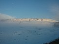
 Clowbridge Reservoir - geograph.org.uk - 3860309.jpg 3,648 × 2,736; 4.58 MB
-
 Clowbridge Reservoir - geograph.org.uk - 5757165.jpg 5,184 × 3,456; 6.66 MB
-
 Clowbridge Reservoir - geograph.org.uk - 5922864.jpg 5,184 × 3,888; 7.69 MB
-
 Clowbridge Reservoir from Hameldon Hill - geograph.org.uk - 4496653.jpg 5,360 × 1,803; 1.62 MB
-
 Clowbridge Reservoir from Springfield Road - geograph.org.uk - 5757142.jpg 5,184 × 3,456; 6.13 MB
-
 Clowbridge Reservoir from the Memorial Forest - geograph.org.uk - 3964376.jpg 3,648 × 2,736; 4.67 MB
-
 Clowbridge Reservoir to the Memorial Forest - geograph.org.uk - 3964491.jpg 3,648 × 2,736; 4.61 MB
-
 Clowbridge Reservoir, Rossendale, from the air - geograph.org.uk - 4738445.jpg 1,024 × 588; 116 KB
-
 Cottages on the A682 at Dunnockshaw - geograph.org.uk - 2781526.jpg 1,600 × 1,198; 366 KB
-
 Crawshawbooth from Hameldon Hill - geograph.org.uk - 4496669.jpg 4,737 × 1,636; 1.51 MB
-
 Dinghies on Clowbridge Reservoir - geograph.org.uk - 4754433.jpg 1,024 × 768; 161 KB
-

-
 Dinghies Racing on Clowbridge Reservoir - geograph.org.uk - 3559610.jpg 640 × 480; 111 KB
-

-
 Dunnockshaw - geograph.org.uk - 4322646.jpg 3,648 × 2,736; 4.65 MB
-
 Dunnockshaw Community Woodland in green (geograph 3964383).jpg 3,648 × 2,736; 4.83 MB
-
 Dunnockshaw from the Limy Lane end - geograph.org.uk - 3336179.jpg 3,648 × 2,736; 4.75 MB
-
 Dunnockshaw Reservoir - geograph.org.uk - 2150660.jpg 1,103 × 400; 47 KB
-
 Farmhouse at New Laithe - geograph.org.uk - 124214.jpg 640 × 480; 104 KB
-

-
 Footbridge at Dunnockshaw Farm - geograph.org.uk - 2763297.jpg 3,072 × 2,304; 1.21 MB
-
 Footpath by Bank Clough - geograph.org.uk - 3543013.jpg 3,872 × 2,592; 5.08 MB
-
 Footpath junction S of Clowbridge Reservoir - geograph.org.uk - 4754394.jpg 1,024 × 768; 179 KB
-
 Footpath through New Laithe wood - geograph.org.uk - 2763299.jpg 3,072 × 2,304; 1.23 MB
-
 From Cotton Row to Stony Hill - geograph.org.uk - 3860362.jpg 3,648 × 2,736; 3.91 MB
-
 From Dunnockshaw Memorial Forest - geograph.org.uk - 3802334.jpg 3,648 × 2,736; 3.95 MB
-
 Gambleside and Stony Hill - geograph.org.uk - 3336167.jpg 3,648 × 2,736; 4.68 MB
-
 Grazing near Moorlands View School - geograph.org.uk - 5922855.jpg 640 × 480; 74 KB
-
 Grazing, Dunnockshaw - geograph.org.uk - 5922852.jpg 640 × 480; 104 KB
-
 Grazing, Lower Nutshaw - geograph.org.uk - 5922861.jpg 640 × 462; 88 KB
-
 Greenhill Clough - geograph.org.uk - 5864545.jpg 3,680 × 2,760; 1.79 MB
-
 Hameldon Hill - geograph.org.uk - 5215775.jpg 2,840 × 2,130; 1.09 MB
-
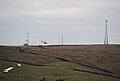
 Hameldon Hill Weather Radar Station - geograph.org.uk - 3755473.jpg 2,474 × 1,800; 2.18 MB
-
 Helicopter taking off from Nutshaw Hill - geograph.org.uk - 2217501.jpg 3,583 × 2,429; 2.32 MB
-
 Lane from Pendle Hall (geograph 2721783).jpg 3,872 × 2,592; 3.71 MB
-
 Limey Lane - geograph.org.uk - 5922868.jpg 640 × 480; 73 KB
-
 Limy Lane - geograph.org.uk - 1193591.jpg 640 × 480; 77 KB
-
 Limy Lane and Gambleside - geograph.org.uk - 3336254.jpg 3,648 × 2,736; 4.56 MB
-
 Limy Water - geograph.org.uk - 5864509.jpg 3,640 × 2,730; 2.01 MB
-
 Limy Water meets reservoir inflow - geograph.org.uk - 5864484.jpg 5,152 × 3,864; 7.5 MB
-
 Love Clough - geograph.org.uk - 4322634.jpg 3,648 × 2,736; 3.88 MB
-
 Love Clough from Hameldon Hill - geograph.org.uk - 4496662.jpg 7,329 × 1,692; 2.19 MB
-
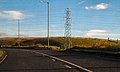 Manchester Road (A682) - geograph.org.uk - 2102406.jpg 800 × 480; 157 KB
-

-
 Manchester Road (A682), Clow Bridge - geograph.org.uk - 2102397.jpg 640 × 480; 149 KB
-
 Manchester Road (A682), Dunnockshaw - geograph.org.uk - 2102362.jpg 640 × 480; 149 KB
-
 Manchester Road (A682), Dunnockshaw - geograph.org.uk - 2102377.jpg 640 × 480; 170 KB
-
 Manchester Road - geograph.org.uk - 5864564.jpg 5,152 × 3,864; 7.76 MB
-
 Memorial Forest, Clowbridge Reservoir - geograph.org.uk - 3336309.jpg 3,648 × 2,736; 4.7 MB
-
 New Laithe - geograph.org.uk - 3333141.jpg 3,648 × 2,736; 4.71 MB
-
 New Laithe and Hameldon Hill - geograph.org.uk - 3797310.jpg 3,648 × 2,736; 4.75 MB
-
 Nutshaw Hill - geograph.org.uk - 3166861.jpg 3,648 × 2,736; 3.31 MB
-
 Nutshaw Hill - geograph.org.uk - 3860324.jpg 3,648 × 2,736; 4.41 MB
-
 Nutshaw Hill - geograph.org.uk - 4322654.jpg 3,648 × 2,736; 3.91 MB
-

-
 Ordnance Survey Cut Mark - geograph.org.uk - 5348506.jpg 4,000 × 3,000; 3.83 MB
-
 Radar Weather Station and Trig Point on Hameldon Hill - geograph.org.uk - 5757170.jpg 5,184 × 3,456; 6.95 MB
-
 Remnant of a Former Building at the End of Springfield Road - geograph.org.uk - 5757196.jpg 5,184 × 3,456; 5.69 MB
-
 Reservoir and sailing club - geograph.org.uk - 5864555.jpg 5,152 × 3,864; 7.72 MB
-
 Reservoir outflow alongside Manchester Road - geograph.org.uk - 3860367.jpg 3,648 × 2,736; 4.34 MB
-
 Rossendale Sailing Club - geograph.org.uk - 3336183.jpg 3,648 × 2,736; 4.15 MB
-
 Sailing the reservoir - geograph.org.uk - 5864516.jpg 5,152 × 3,864; 7.65 MB
-
 School conversion - geograph.org.uk - 1727491.jpg 1,632 × 1,224; 495 KB
-
 School conversion - geograph.org.uk - 1927171.jpg 2,592 × 1,944; 1.53 MB
-
 Springfield Road - geograph.org.uk - 5757133.jpg 5,184 × 3,456; 7.7 MB
-
 Springfield Road approaching Hameldon Hill - geograph.org.uk - 5757167.jpg 5,184 × 3,456; 5.77 MB
-
 The road up Hameldon Hill - geograph.org.uk - 2996952.jpg 4,320 × 3,240; 4.32 MB
-
 The ruined hamlet of Gambleside - geograph.org.uk - 5864537.jpg 5,152 × 3,864; 7.63 MB
-

-
 Track (footpath), Dunnockshaw - geograph.org.uk - 5922859.jpg 640 × 480; 103 KB
-
 Track ascending the Eastern Flank of Hameldon Hill - geograph.org.uk - 5757191.jpg 5,184 × 3,456; 7.23 MB
-
 Track at the rear of Springfield House - geograph.org.uk - 3467352.jpg 640 × 480; 185 KB
-
 Unusual Stone with Five holes - geograph.org.uk - 1247554.jpg 640 × 480; 167 KB
-
 View Towards Clowbridge Reservoir - geograph.org.uk - 3755484.jpg 2,560 × 1,920; 3.69 MB
-

-
 Weather Radar at Hameldon Hill - geograph.org.uk - 4496646.jpg 2,848 × 2,134; 1.18 MB
-

-
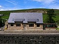
 Cottages at Oak St Dunnockshaw - geograph.org.uk - 671723.jpg 500 × 375; 48 KB
-
 Signs next to bridleway - geograph.org.uk - 124217.jpg 640 × 480; 130 KB


_towards_Burnley_-_geograph.org.uk_-_5922867.jpg)


.jpg)


.jpg)


.jpg)


_-_geograph.org.uk_-_2102406.jpg)
_towards_Burnley_-_geograph.org.uk_-_5922863.jpg)
,_Clow_Bridge_-_geograph.org.uk_-_2102397.jpg)
,_Dunnockshaw_-_geograph.org.uk_-_2102362.jpg)
,_Dunnockshaw_-_geograph.org.uk_-_2102377.jpg)


,_Dunnockshaw_-_geograph.org.uk_-_5922859.jpg)


