Category:ESA files uploaded by Revent
Media in category "ESA files uploaded by Revent"
The following 200 files are in this category, out of 256 total.
(previous page) (next page)-
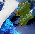
 A cloud-free southern Europe captured by Envisat.jpg 2,811 × 2,464; 5.84 MB
-
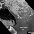 A further break-up in Wilkins Ice Shelf.gif 400 × 400; 1.15 MB
-
 A smoke-free Iceland.jpg 3,000 × 3,000; 2.14 MB
-
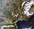
 A snowy southern Norway.jpg 1,602 × 1,524; 1.07 MB
-
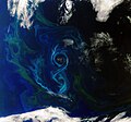 A southern summer bloom.jpg 2,201 × 2,059; 2.7 MB
-
 A united Europe from space ESA236276 (Ukraine).jpg 524 × 386; 230 KB
-
 A united Europe from space ESA236276.jpg 1,498 × 1,408; 1.24 MB
-
 A virtually cloudless Western Europe.jpg 3,885 × 4,030; 9.86 MB
-
 Africa's Atlas Mountains.jpg 2,719 × 2,648; 1.74 MB
-
 Alaska's Yukon Delta.jpg 4,587 × 3,101; 10.7 MB
-
 Algal bloom off Ireland.jpg 2,803 × 2,670; 2.18 MB
-
 Algerian Sahara.jpg 1,969 × 1,842; 1.95 MB
-
 American West.jpg 3,620 × 2,816; 7.33 MB
-
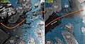
 Annotated image of Wilkins Ice Shelf acquired on 9 July 2008.jpg 1,377 × 1,886; 1.22 MB
-
 Antarctic Peninsula.jpg 2,496 × 1,844; 3.44 MB
-
 Antarctica ice shelf system.jpg 3,515 × 3,455; 4.29 MB
-
 Arctic bloom.jpg 2,239 × 2,239; 1.54 MB
-
 Arctic ice cover June-August 2008.gif 2,650 × 2,650; 17.13 MB
-
 Arctic islands.jpg 3,000 × 2,880; 2.95 MB
-
 Arctic Northwest Russia.jpg 2,830 × 2,224; 1.53 MB
-
 Arctic Ocean swirls.jpg 2,680 × 2,680; 4.8 MB
-
 Arctic sea ice extent in September 2007 and September 2008.jpg 2,650 × 2,650; 1.76 MB
-
 Ash plume.jpg 4,163 × 4,737; 2.96 MB
-
 Atacama Desert - Envisat.jpg 2,926 × 2,000; 3.96 MB
-
 Australia's deadliest wildfires captured by Envisat.jpg 1,622 × 1,472; 1.3 MB
-
 Australia's Red Centre.jpg 2,000 × 1,945; 3.29 MB
-
 Austria by Proba-V.jpg 2,474 × 1,270; 2.29 MB
-
 Baltic ice.jpg 4,173 × 4,168; 12.72 MB
-
 Baltic Sea - Envisat.jpg 3,525 × 4,494; 12.66 MB
-
 Bay of Naples - Envisat.jpg 5,000 × 5,010; 16.29 MB
-
 Billowing smoke from Northern California wildfires.jpg 684 × 702; 174 KB
-
 Bitter cold grips Europe.jpg 4,279 × 5,459; 19 MB
-
 Bloom-filled Baltic.jpg 3,000 × 3,000; 1.33 MB
-
 Boca do Acre Brazil.jpg 3,281 × 2,213; 6.92 MB
-
 Brazil's Amazon Basin.jpg 1,898 × 1,894; 1.57 MB
-
 Brazilian coast.jpg 2,727 × 2,684; 7.06 MB
-
 Break-up of the Wilkins Ice Shelf in Antarctica.gif 1,151 × 1,123; 4.53 MB
-
 Break-up of the Wilkins Ice Shelf.gif 996 × 973; 5.25 MB
-
 Buenos Aires - Envisat.jpg 2,038 × 1,726; 1.96 MB
-
 Canada's James Bay.jpg 1,860 × 1,860; 1.45 MB
-
 Canada's Maritime Provinces.jpg 2,873 × 2,873; 3.48 MB
-
 Canada's Prairie Provinces.jpg 2,973 × 2,988; 5.35 MB
-
 Canadian Arctic - Envisat.jpg 926 × 893; 232 KB
-
 Canadian Arctic and Greenland as seen by Envisat.jpg 4,647 × 4,647; 8.85 MB
-
 Canadian Arctic.jpg 1,512 × 2,428; 1.63 MB
-
 Canaries new hot spot.jpg 1,405 × 1,302; 943 KB
-
 Cape Verde Archipelago.jpg 3,452 × 3,162; 2.17 MB
-
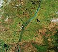
 Central Europe - Envisat.jpg 2,295 × 3,000; 4.84 MB
-
 Chaiten Volcano blasting ash.jpg 1,168 × 1,344; 811 KB
-
 Changes in Arctic sea ice between June and September 2008.gif 662 × 662; 1.34 MB
-
 Cloud streets over Scandinavia.jpg 4,279 × 5,243; 17.8 MB
-
 Cloud-free France.jpg 3,695 × 3,688; 23.78 MB
-
 Cloud-free image of Iceland.jpg 3,000 × 3,000; 4.46 MB
-
 Congo River, Africa.jpg 2,858 × 2,598; 4.53 MB
-
 Contrail cluster.jpg 2,736 × 2,232; 2.67 MB
-
 Contrail graffiti over the North Sea.jpg 1,634 × 1,634; 1.33 MB
-
 Contrails and volcanic ash.jpg 2,406 × 5,000; 7.34 MB
-
 Cool lava in Africa's Great Rift Valley.jpg 3,030 × 4,171; 7.48 MB
-
 Crisis image over the Cortes Department.jpg 990 × 622; 303 KB
-
 Cuba - Envisat.jpg 5,132 × 1,709; 8.31 MB
-
 Cyclone Nargis seen by Envisat.jpg 1,178 × 1,904; 2.24 MB
-
 Cyprus - Envisat.jpg 3,000 × 3,195; 8.43 MB
-
 Czech Republic by Proba-V.jpg 2,157 × 1,233; 1.97 MB
-
 Dasht-e Lut salt desert Iran.jpg 2,241 × 1,988; 2.17 MB
-
 Denmark by Proba-V.jpg 2,129 × 1,680; 709 KB
-
 Depression in North Atlantic.jpg 2,305 × 3,500; 1.74 MB
-
 Direct route through the Northwest Passage.jpg 2,017 × 1,330; 1.34 MB
-
 Dust and plankton in the Atlantic.jpg 2,835 × 5,259; 5.8 MB
-
 Earth from Space - Volga Delta.jpg 1,024 × 947; 388 KB
-
 Earth's North Magnetic Pole.jpg 1,200 × 1,200; 1.67 MB
-
 Ecuador's highlands.jpg 6,023 × 5,196; 18.66 MB
-
 Ellesmere Island and northwestern Greenland.jpg 4,647 × 4,647; 17.48 MB
-
 Envisat captures Burma Myanmar.jpg 2,964 × 2,964; 5.25 MB
-
 Envisat captures Hurricane Jimena.jpg 1,051 × 1,611; 581 KB
-
 Envisat image of a patch of Sargassum.jpg 1,200 × 1,062; 1.87 MB
-
 Envisat optical image.jpg 1,428 × 1,077; 367 KB
-
 Envisat radar image of the Gobi Desert.jpg 5,011 × 4,708; 21 MB
-
 Envisat radar image of the Netherlands.jpg 8,346 × 8,525; 34.4 MB
-
 Envisat radar image of the oil spill.jpg 1,271 × 930; 460 KB
-
 Envisat vs. Sentinel-1 radar.jpg 2,296 × 1,436; 1.13 MB
-
 Envisat's view of Pine Island and Thwaites glaciers.jpeg 3,013 × 4,461; 4.15 MB
-
 Estonia by Proba-V.jpg 1,978 × 1,266; 823 KB
-
 Etosha National Park, Namibia.jpg 1,408 × 1,408; 1.51 MB
-
 Extent of fire damage in Norway.jpg 500 × 500; 557 KB
-
 Finland by Proba-V.jpg 3,471 × 4,404; 2.04 MB
-
 Fjords and glaciers.jpg 1,024 × 956; 1.02 MB
-
 Flooding in the Irrawaddy delta, Myanmar.jpg 2,400 × 1,196; 1.74 MB
-
 Florida, USA.jpg 2,911 × 2,504; 6.07 MB
-
 Foxe Basin, Canada.jpg 1,024 × 864; 996 KB
-
 France by Proba-V.jpg 4,669 × 4,226; 3.19 MB
-
 France covered in snow.jpg 3,081 × 3,081; 2.65 MB
-
 Germany by Proba-V.jpg 2,638 × 3,222; 3.28 MB
-
 Giant iceberg enters Nares Strait.gif 629 × 769; 4.21 MB
-
 Gifts from the ice age.jpg 2,944 × 2,301; 5.14 MB
-
 Gobi Desert - Envisat.jpg 1,803 × 1,540; 1.41 MB
-
 Grand Canyon - Envisat.jpg 2,182 × 2,223; 1.34 MB
-
 Great Britain and Ireland - Envisat.jpg 1,500 × 1,353; 1.19 MB
-
 Great Lakes North America.jpg 2,232 × 2,226; 2.72 MB
-
 Greenland's east coast.jpg 5,448 × 4,945; 29.03 MB
-
 Greenland's ice sheet.jpg 4,184 × 4,473; 3.21 MB
-
 Gulf of Mexico oil spill seen from space.jpg 1,111 × 774; 135 KB
-
 Himalayan Mountains - Envisat.jpg 2,241 × 2,241; 1.43 MB
-
 Hungary by Proba-V.jpg 2,166 × 1,320; 967 KB
-
 Hurricane Gustav - Envisat.jpg 1,755 × 1,367; 913 KB
-
 Hurricane Gustav captured by Envisat.jpg 1,187 × 1,643; 2 MB
-
 Hurricane Ike captured by Envisat.jpg 771 × 1,060; 513 KB
-
 Hurricane Irene - Envisat.gif 318 × 836; 1.72 MB
-
 Ice-free Northwest Passage.jpg 1,368 × 3,982; 2.19 MB
-
 Iceberg Alley, Labrador.jpg 2,000 × 2,000; 1.83 MB
-
 Iceland covered in snow.jpg 3,284 × 2,497; 1.94 MB
-
 Icy waters in Greenland.jpg 2,000 × 2,005; 3.09 MB
-
 Indonesia's Kalimantan region.jpg 3,500 × 3,516; 15.28 MB
-
 Indonesian islands.jpg 1,920 × 1,519; 1.18 MB
-
 Indus River - Envisat.jpg 1,440 × 1,370; 1.09 MB
-
 Inglefield Gulf.jpg 1,204 × 555; 409 KB
-
 Inundated areas in Australia.jpg 1,574 × 1,133; 1.61 MB
-
 Iraq dust storm.jpg 2,156 × 2,272; 1.22 MB
-
 Irrawaddy Delta, Myanmar.jpg 1,024 × 916; 961 KB
-
 Island of Guadalupe.jpg 4,096 × 3,392; 8.88 MB
-
 Istanbul Turkey - Envisat.jpg 2,000 × 2,000; 1.61 MB
-
 Italy by Proba-V.jpg 3,668 × 4,497; 1.65 MB
-
 Kamchatka Peninsula - Envisat.jpg 2,835 × 2,576; 5.8 MB
-
 Kamchatka Peninsula Russia.jpg 2,061 × 2,036; 790 KB
-
 Kenya Tanzania Uganda.jpg 2,952 × 2,089; 6.16 MB
-
 Kimberley region Australia.jpg 4,291 × 3,268; 6.66 MB
-
 Kuwaiti islands.jpg 4,242 × 3,815; 5.39 MB
-
 Lake Azhabachje - Envisat (cropped).jpg 627 × 291; 181 KB
-
 Lake Malawi, Great Rift Valley.jpg 3,293 × 3,482; 12.78 MB
-
 Lake Mead, USA.jpg 4,000 × 4,270; 14.38 MB
-
 Lakes and mountains of western Uganda.jpg 5,699 × 4,692; 17.1 MB
-
 Lakes of Africa.jpg 4,261 × 4,296; 7.42 MB
-
 Lena Delta.jpg 1,024 × 1,024; 1.03 MB
-
 Luxemburg by Proba-V.jpg 210 × 300; 97 KB
-
 Madagascar - Envisat.jpg 3,770 × 5,771; 14.33 MB
-
 Mapping flood with Envisat's radar.jpg 789 × 1,152; 233 KB
-
 Mauritania, Africa.jpg 2,564 × 2,028; 1.65 MB
-
 MERIS image acquired on 2 May.jpg 1,296 × 1,242; 417 KB
-
 MERIS image before loss of contact.jpg 837 × 959; 780 KB
-
 MERIS mosaic of Europe.jpg 8,000 × 5,331; 4.68 MB
-
 Mertz Glacier Tongue and the B-9B iceberg in December 2007.jpg 2,059 × 2,940; 2.05 MB
-
 Middle Eastern terrain.jpg 3,554 × 3,200; 11.01 MB
-
 Mountains of snow.jpg 3,372 × 2,884; 8.69 MB
-
 Nettilling Lake (15 July 2008).jpg 608 × 340; 287 KB
-
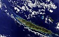 New Caledonia - Envisat.jpg 2,318 × 1,465; 1.41 MB
-
 New Zealand - Envisat.jpg 2,032 × 2,309; 2.91 MB
-
 New Zealand's South Island.jpg 1,967 × 1,623; 1.28 MB
-
 Northern China - Envisat.jpg 1,920 × 1,269; 1.5 MB
-
 Northwest Passage.jpg 2,570 × 1,353; 1.2 MB
-
 Norway by Proba-V.jpg 8,111 × 7,930; 4.74 MB
-
 Novaya Zemlya archipelago Arctic Circle.jpg 3,102 × 3,448; 11.08 MB
-
 Oil spill nears the coast.jpg 1,951 × 1,334; 1.05 MB
-
 Okavango Delta in northern Botswana.jpg 4,266 × 3,230; 13.49 MB
-
 Open Northern Sea Route.jpg 2,500 × 2,500; 3.68 MB
-
 Parana - Envisat.jpg 2,250 × 2,011; 4.6 MB
-
 Persian Gulf sandstorm.jpg 1,061 × 1,720; 1.37 MB
-
 Phytoplankton bloom captured by Envisat.jpg 4,186 × 4,233; 10.19 MB
-
 Phytoplankton bloom in the Bay of Biscay - Envisat.jpg 2,755 × 2,795; 2.68 MB
-
 Phytoplankton bloom off the coast of Scotland.jpg 1,644 × 1,535; 399 KB
-
 Pine Island cracked.jpg 4,042 × 2,599; 5.3 MB
-
 Plankton arrives in Scandinavia.jpg 3,638 × 2,983; 7.75 MB
-
 Plume of ash from the Eyjafjallajoekull volcano.jpg 4,000 × 4,000; 5.54 MB
-
 Plume of ash from the Eyjafjallajoekull Volcano.jpg 1,685 × 2,000; 1.83 MB
-
 Poland by Proba-V.jpg 3,023 × 2,723; 3.08 MB
-
 Portugal by Proba-V.jpg 625 × 1,232; 569 KB
-
 Qeshm Island Iran.jpg 4,000 × 3,726; 8.66 MB
-
 Queensland inundated.jpg 930 × 805; 424 KB
-
 Radar image acquired on 2 May.jpg 1,228 × 931; 463 KB
-
 Radar image of Hawaii.jpg 1,024 × 762; 179 KB
-
 Radar image showing a fissure on the massive A53A iceberg.jpg 2,717 × 2,717; 4.59 MB
-
 Rainforest river Brazil.jpg 3,685 × 2,888; 8.42 MB
-
 Raystown Lake.jpg 5,754 × 4,833; 27.85 MB
-
 Romania by Proba-V.jpg 3,004 × 2,082; 1.97 MB
-
 Russia's Far East.jpg 4,147 × 5,365; 14.86 MB
-
 Russia's Tsimlyansk Reservoir.jpg 1,262 × 1,326; 1.06 MB
-
 Russia's Volga Delta and the Caspian Sea.jpg 3,838 × 3,861; 8.25 MB
-
 Sahara sand and dust seen by ESA's Envisat.jpg 4,309 × 4,794; 9.77 MB
-
 Sahara's end.jpg 3,969 × 2,499; 5.66 MB
-
 Salt Lake Utah.jpg 3,738 × 5,100; 3.37 MB
-
 Salty plain in Bolivia.jpg 1,676 × 1,676; 1.77 MB
-
 Sao Francisco River, Brazil.jpg 2,961 × 2,961; 6.49 MB
-
 Saudi Arabia.jpg 2,746 × 2,165; 4 MB
-
 Scandinavian snows.jpg 2,657 × 1,752; 3.06 MB
-
 Scotland and Northern Ireland.jpg 2,155 × 2,730; 4.61 MB
-
 Sea ice in the Sea of Okhotsk.jpg 2,930 × 3,055; 7.13 MB
-
 Sea-ice coverage in Aug 2008 and Sept 2007 minimum.jpg 2,000 × 2,000; 1.61 MB
-
 Siberian 'gecko'.jpg 1,417 × 1,390; 2.33 MB
-
 Smoke over Moscow.jpg 2,539 × 1,728; 1.26 MB
-
 Snow-kissed Alps.jpg 3,327 × 3,349; 5.6 MB
-
 Snowy Italy.jpg 3,783 × 4,564; 8.67 MB
-
 Snowy Siberia.jpg 2,288 × 1,851; 7.52 MB
-
 South Africa - Envisat.jpg 3,489 × 3,879; 9.71 MB
-
 Southeastern Brazil.jpg 1,024 × 953; 971 KB
-
 Southern Argentina and Chile.jpg 3,268 × 2,408; 8.77 MB
-
 Spain by Proba-V.jpg 4,291 × 3,283; 1.94 MB
-
 Spitsbergen Norway's largest island.jpg 3,539 × 3,540; 8.43 MB
-
 Splitting iceberg captured by Envisat.jpg 936 × 888; 974 KB
-
 Springtime in Europe.jpg 1,920 × 1,531; 2.23 MB
-
 Strait of Bonifacio - Envisat.jpg 2,621 × 2,000; 2.84 MB
-
 Straits of Florida.jpg 3,899 × 4,247; 7.01 MB
-
 Suez Canal - Envisat.jpg 2,161 × 2,484; 6.23 MB


.jpg)


.jpg)


.jpg)


