Category:Eaglesham (civil parish)
Scottish parish in East Renfrewshire, Scotland, UK | |||||
| Upload media | |||||
| Instance of | |||||
|---|---|---|---|---|---|
| Part of |
| ||||
| Named after | |||||
| Location |
| ||||
| Population |
| ||||
| Area |
| ||||
 | |||||
Media in category "Eaglesham (civil parish)"
The following 200 files are in this category, out of 412 total.
(previous page) (next page)-
 11 Polnoon Street, Eaglesham - geograph.org.uk - 4164575.jpg 5,184 × 3,456; 6.64 MB
-
 17 Polnoon Street, Eaglesham - geograph.org.uk - 4164649.jpg 5,184 × 3,456; 7.16 MB
-
 A 40 metre blade - geograph.org.uk - 5880242.jpg 2,000 × 1,333; 1.48 MB
-
 A bug hotel - geograph.org.uk - 5880252.jpg 1,333 × 2,000; 2.61 MB
-
 A farm track - geograph.org.uk - 5100240.jpg 800 × 600; 196 KB
-
 A line of turbines - geograph.org.uk - 5880244.jpg 1,333 × 2,000; 1.56 MB
-
 A Rare Sight - geograph.org.uk - 4916570.jpg 1,920 × 1,280; 2.17 MB
-
 A Seat at Turbine 42 - geograph.org.uk - 4916598.jpg 1,920 × 1,280; 1.86 MB
-
 A726 and B767 junction - geograph.org.uk - 5063821.jpg 640 × 472; 45 KB
-
 A726 bridge - geograph.org.uk - 5100241.jpg 800 × 600; 219 KB
-
 A726 east of Bonyton Farm - geograph.org.uk - 3526465.jpg 640 × 481; 51 KB
-
 A726 passes under Titwood Road - geograph.org.uk - 3526458.jpg 640 × 480; 66 KB
-
 Approaching Blackwood Hill Viewpoint - geograph.org.uk - 4916503.jpg 1,920 × 1,280; 1.51 MB
-
 Approaching Old Craig Mill - geograph.org.uk - 6248885.jpg 1,024 × 575; 154 KB
-
 Avenue to Castlehill - geograph.org.uk - 5848154.jpg 1,600 × 1,067; 346 KB
-
 B764 looking towards Eaglesham - geograph.org.uk - 5031577.jpg 3,504 × 2,336; 2.15 MB
-
 B764 to Eaglesham - geograph.org.uk - 5031538.jpg 3,504 × 2,336; 2.57 MB
-
 Ballageich Hill - geograph.org.uk - 1866731.jpg 640 × 480; 114 KB
-
 Ballageich Hill - geograph.org.uk - 5100339.jpg 800 × 600; 235 KB
-
 Bell Craig and the Weary Tree - geograph.org.uk - 2106380.jpg 640 × 480; 105 KB
-
 Belle Craig Roundabout - geograph.org.uk - 3280767.jpg 640 × 480; 53 KB
-
 Belle Craig Roundabout - geograph.org.uk - 3494882.jpg 640 × 403; 54 KB
-
 Bennan Loch - geograph.org.uk - 3744047.jpg 640 × 480; 53 KB
-
 Bennan Loch Dam - geograph.org.uk - 3744037.jpg 640 × 480; 74 KB
-
 Blackwood Hill Viewpoint - geograph.org.uk - 4916523.jpg 1,920 × 1,280; 1.47 MB
-
 Blackwood Hill Viewpoint - geograph.org.uk - 4916536.jpg 1,920 × 1,280; 500 KB
-
 Blackwood Hill Viewpoint - geograph.org.uk - 4916540.jpg 1,920 × 1,280; 1.23 MB
-
 Blackwood Hill Viewpoint - geograph.org.uk - 4916548.jpg 1,920 × 1,280; 1.55 MB
-
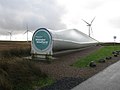
 Blade Display, Whitelee Windfarm - geograph.org.uk - 4916312.jpg 1,920 × 1,280; 1.29 MB
-
 Bog below High Dam - geograph.org.uk - 5100315.jpg 800 × 600; 199 KB
-
 Bonnyton Farm - geograph.org.uk - 3280839.jpg 640 × 480; 78 KB
-
 Bonnyton Golf Club from the air - geograph.org.uk - 4377796.jpg 640 × 480; 151 KB
-
 Bonnyton Golf Club from the air - geograph.org.uk - 4377801.jpg 640 × 480; 140 KB
-
 Bonnyton Golf Club from the air - geograph.org.uk - 4588590.jpg 640 × 480; 143 KB
-

-
 Bonnyton Moor - geograph.org.uk - 1866669.jpg 640 × 480; 127 KB
-
 Bonnyton Moor at sunset - geograph.org.uk - 1926777.jpg 640 × 474; 53 KB
-
 Bonnyton Moor grassland - geograph.org.uk - 4963623.jpg 1,600 × 1,200; 470 KB
-
 Bonnyton Moor Road - geograph.org.uk - 4963672.jpg 1,600 × 1,200; 430 KB
-
 Boshee Hill - geograph.org.uk - 1860552.jpg 640 × 480; 92 KB
-
 Boundary fence and wall near Blackhouse - geograph.org.uk - 6350228.jpg 5,152 × 3,864; 6.98 MB
-
 Bridge over Borland Burn - geograph.org.uk - 5848170.jpg 1,600 × 1,067; 494 KB
-
 Bridge over Earn Water - geograph.org.uk - 3758926.jpg 640 × 480; 107 KB
-
 Bridge over the Bennan Burn - geograph.org.uk - 6177451.jpg 1,600 × 1,200; 386 KB
-
 Building Turbine 40 Information - geograph.org.uk - 4916634.jpg 1,920 × 1,280; 1.08 MB
-
 Bunker on Bonnyton Golf Course - geograph.org.uk - 5848158.jpg 1,600 × 991; 477 KB
-
 Burn on Bonnyton Golf Course - geograph.org.uk - 3280893.jpg 640 × 480; 94 KB
-
 Burn on Corse Hill - geograph.org.uk - 4398077.jpg 800 × 533; 307 KB
-
 Buttercup meadow by Kirktonmoor Road - geograph.org.uk - 5848177.jpg 1,600 × 1,067; 558 KB
-
 Car Park and Turning Point, Whitelee Visitor Centre - geograph.org.uk - 4916307.jpg 1,920 × 1,280; 1.09 MB
-
 Carrot - geograph.org.uk - 1845773.jpg 640 × 313; 269 KB
-
 Carrot Burn - geograph.org.uk - 3936430.jpg 640 × 480; 98 KB
-
 Carrot Moor Farm - geograph.org.uk - 3536941.jpg 800 × 534; 254 KB
-
 Carrot Moor Farm housing - geograph.org.uk - 3536956.jpg 800 × 534; 238 KB
-
 Carrot road wetlands - geograph.org.uk - 3211297.jpg 901 × 677; 99 KB
-
 Carswell Halls - geograph.org.uk - 1897780.jpg 640 × 479; 67 KB
-
 Castlehill rainbow - geograph.org.uk - 1833077.jpg 640 × 423; 38 KB
-
 Cattle Grid, Whitelee Windfarm - geograph.org.uk - 4916452.jpg 1,920 × 1,280; 1.59 MB
-
 Causeway in Lochgoin reservoir - geograph.org.uk - 3749815.jpg 640 × 480; 68 KB
-
 Clearing in Whitelee Forest - geograph.org.uk - 3606076.jpg 800 × 600; 154 KB
-
 Clearing in Whitelee Forest - geograph.org.uk - 6176878.jpg 5,152 × 3,864; 7.38 MB
-
 Club house at Bonnyton Golf Club - geograph.org.uk - 1866644.jpg 640 × 480; 109 KB
-
 Coo Lane - geograph.org.uk - 2385541.jpg 640 × 480; 88 KB
-
 Corse Hill triangulation pillar - geograph.org.uk - 4398119.jpg 800 × 533; 407 KB
-
 Corse Hill trig point - geograph.org.uk - 3606212.jpg 1,024 × 768; 185 KB
-
 Corse Hill Trig Point - geograph.org.uk - 3936509.jpg 640 × 480; 97 KB
-
 Corse Hill Trig Point - geograph.org.uk - 5873689.jpg 2,980 × 2,042; 1.15 MB
-
 Covenanters' memorial - geograph.org.uk - 1821589.jpg 369 × 640; 107 KB
-
 Crook Hill - geograph.org.uk - 4396679.jpg 800 × 533; 336 KB
-
 Cross Keys cottage - geograph.org.uk - 1821585.jpg 640 × 480; 127 KB
-
 Cross Keys Inn - geograph.org.uk - 1875376.jpg 640 × 480; 111 KB
-

-
 Dam on Bennan Loch - geograph.org.uk - 6077814.jpg 5,035 × 3,777; 3.86 MB
-
 Derelict cottage south of High Craig Farm - geograph.org.uk - 4164705.jpg 5,184 × 3,456; 7.34 MB
-
 Dirt track in moors west of Eaglesham - geograph.org.uk - 1860581.jpg 640 × 480; 142 KB
-
 Drumduff Hill - geograph.org.uk - 4396709.jpg 800 × 533; 303 KB
-
 Drumduff Hill - geograph.org.uk - 4396731.jpg 800 × 533; 334 KB
-
 Drumduff Hill is no longer remote - geograph.org.uk - 4396722.jpg 800 × 533; 327 KB
-
 Dunwan Dam - geograph.org.uk - 3749759.jpg 640 × 480; 57 KB
-
 Dunwan Dam - geograph.org.uk - 4916553.jpg 1,920 × 1,280; 1.62 MB
-
 Dunwan Dam - geograph.org.uk - 4958326.jpg 3,264 × 2,448; 3.76 MB
-
 Dunwan Dam - geograph.org.uk - 5031569.jpg 3,504 × 2,336; 2.59 MB
-

-
 Eaglesham from the air - geograph.org.uk - 4517227.jpg 640 × 480; 115 KB
-
 Eaglesham from the air - geograph.org.uk - 4517235.jpg 640 × 480; 119 KB
-
 Eaglesham from the air - geograph.org.uk - 4588597.jpg 640 × 480; 158 KB
-
 Eaglesham Moor - geograph.org.uk - 5100791.jpg 800 × 600; 201 KB
-
 Eaglesham Moor beside Picketlaw Reservoir - geograph.org.uk - 5085174.jpg 1,600 × 1,200; 364 KB
-

-
 Eaglesham Moor road - geograph.org.uk - 3952793.jpg 1,024 × 768; 116 KB
-
 Eaglesham Moor road - geograph.org.uk - 5085044.jpg 1,200 × 1,600; 309 KB
-
 Eaglesham Moor Road - geograph.org.uk - 5100330.jpg 800 × 600; 144 KB
-
 Eaglesham Moor Road - geograph.org.uk - 5100332.jpg 800 × 600; 157 KB
-
 Eaglesham Moor Road - geograph.org.uk - 5100778.jpg 800 × 600; 163 KB
-
 Eaglesham Moor road - let's pretend - geograph.org.uk - 5100299.jpg 800 × 600; 146 KB
-
 Eaglesham Old Mill - geograph.org.uk - 2354417.jpg 640 × 480; 145 KB
-
 Eaglesham Parish Church - geograph.org.uk - 1821651.jpg 640 × 480; 93 KB
-
 Eaglesham Parish Church and the Orry - geograph.org.uk - 5085084.jpg 1,600 × 1,200; 517 KB
-
 Eaglesham Post Office - geograph.org.uk - 5100261.jpg 800 × 600; 194 KB
-
 Eaglesham village - geograph.org.uk - 5880265.jpg 2,000 × 1,428; 2.11 MB
-
 Eaglesham, Montgomery Street - geograph.org.uk - 2980249.jpg 1,719 × 1,273; 796 KB
-
 Eaglesham, The Common - geograph.org.uk - 2980241.jpg 1,891 × 1,162; 942 KB
-
 Eaglinton Arms Hotel - geograph.org.uk - 3493315.jpg 640 × 480; 51 KB
-
 East Kilbride from the air - geograph.org.uk - 4588608.jpg 640 × 480; 194 KB
-
 East Moorhouse - geograph.org.uk - 1866701.jpg 640 × 480; 165 KB
-
 East Moorhouse - geograph.org.uk - 6350244.jpg 5,149 × 3,678; 3.85 MB
-
 Edge of Bennan Loch - geograph.org.uk - 3744074.jpg 640 × 480; 63 KB
-
 Eglinton Arms, Eaglesham - geograph.org.uk - 3280736.jpg 640 × 480; 55 KB
-
-
 Entrance to Castlehill Farm - geograph.org.uk - 3280961.jpg 640 × 480; 59 KB
-
 Entrance to Eaglesham - geograph.org.uk - 3493306.jpg 640 × 480; 73 KB
-
 Entrance to Eaglesham - geograph.org.uk - 3493331.jpg 640 × 463; 75 KB
-
 Entrance to Eaglesham - geograph.org.uk - 3493343.jpg 640 × 480; 67 KB
-
 Entrance to Greenfield Farm - geograph.org.uk - 5032621.jpg 1,791 × 2,534; 1.45 MB
-
 Entrance to Shieldhill Farm - geograph.org.uk - 1953167.jpg 2,272 × 1,704; 870 KB
-
 Entrance to Whitelee Windfarm - geograph.org.uk - 2081130.jpg 1,024 × 768; 143 KB
-
 Entrance to Whitelee Windfarm - geograph.org.uk - 3749719.jpg 640 × 480; 54 KB
-
 Entrance to Whitelee Windfarm - geograph.org.uk - 4916284.jpg 1,920 × 1,280; 1.22 MB
-
 Entrance to Whitelee Windfarm - geograph.org.uk - 4916288.jpg 1,920 × 1,280; 352 KB
-
 Exhibition Hall, Whitelee Windfarm Visitor Centre - geograph.org.uk - 4916296.jpg 1,920 × 1,280; 1.13 MB
-
 Exhibition Hall, Whitelee Windfarm Visitor Centre - geograph.org.uk - 4916297.jpg 1,920 × 1,280; 1.17 MB
-
 Exit Road from Whitelee Windfarm - geograph.org.uk - 4916325.jpg 1,920 × 1,280; 1.44 MB
-
 Facts ^ Figures about Turbines - geograph.org.uk - 4916645.jpg 1,280 × 1,920; 1.16 MB
-
 Farm buildings at Polnoon - geograph.org.uk - 4164744.jpg 5,184 × 3,456; 6.76 MB
-
 Farm buildings at Polnoon - geograph.org.uk - 4164755.jpg 5,184 × 3,456; 6.02 MB
-

-
 Farmland at Ardoch - geograph.org.uk - 3936564.jpg 640 × 480; 80 KB
-
 Farmland south of Eaglesham - geograph.org.uk - 3606153.jpg 1,024 × 768; 152 KB
-
 Fence at the Eaglesham to Kingswell road - geograph.org.uk - 1866741.jpg 640 × 480; 122 KB
-
 Field near Nethercraig - geograph.org.uk - 6248880.jpg 1,024 × 575; 148 KB
-
 Fields beside Millhall Road - geograph.org.uk - 5926158.jpg 1,600 × 1,200; 318 KB
-
 Fields south east of Eaglesham - geograph.org.uk - 3493346.jpg 640 × 480; 74 KB
-
 Flooded path - geograph.org.uk - 1860556.jpg 640 × 480; 135 KB
-
 Floors Farm - geograph.org.uk - 3280801.jpg 640 × 480; 56 KB
-
 Footpath between North Moorhouse and Blackhouse - geograph.org.uk - 6350233.jpg 5,152 × 3,864; 6.76 MB
-

-
-
 Gate and footpath sign, North Moorhouse - geograph.org.uk - 6350231.jpg 5,148 × 3,677; 3.45 MB
-
 Gate on Crook Hill - geograph.org.uk - 4396695.jpg 800 × 533; 333 KB
-
 George V postbox - geograph.org.uk - 1821485.jpg 371 × 640; 100 KB
-
 George VI pillar box, Montgomery Street - geograph.org.uk - 5031629.jpg 2,336 × 3,504; 3.96 MB
-
 George VI postbox - geograph.org.uk - 1871200.jpg 640 × 480; 160 KB
-
 Glasgow Road at Low Borland - geograph.org.uk - 3526478.jpg 640 × 480; 67 KB
-
 Glasgow Road at Waterfoot - geograph.org.uk - 3530143.jpg 640 × 480; 88 KB
-
 Glasgow Road shops - geograph.org.uk - 1921847.jpg 640 × 445; 96 KB
-
 Glasgow Road, Eaglesham - geograph.org.uk - 5100260.jpg 800 × 600; 186 KB
-
 Glen of the Borland Burn - geograph.org.uk - 1860546.jpg 640 × 480; 163 KB
-
 Glendinning Place - geograph.org.uk - 2385555.jpg 640 × 480; 97 KB
-
 Glimmer Street, Eaglesham - geograph.org.uk - 5100285.jpg 800 × 600; 180 KB
-
 Grazing at Carrot - geograph.org.uk - 3537004.jpg 800 × 534; 199 KB
-
 Greenfield Hill - geograph.org.uk - 5100782.jpg 800 × 600; 210 KB
-
 Heading west on the A726 - geograph.org.uk - 5869704.jpg 640 × 481; 49 KB
-
 High Borland - geograph.org.uk - 1821607.jpg 640 × 480; 81 KB
-
 High Dam - geograph.org.uk - 5086521.jpg 1,600 × 1,200; 295 KB
-
 High Dam - geograph.org.uk - 5100321.jpg 800 × 600; 170 KB
-
 High Dam and Eaglesham Moor Road - geograph.org.uk - 5085214.jpg 1,600 × 1,200; 307 KB
-
 High Dam from Moor Road - geograph.org.uk - 1860586.jpg 640 × 480; 86 KB
-
 High Dam Near Eaglesham - geograph.org.uk - 5063810.jpg 640 × 452; 35 KB
-
 Hill Drive Eaglesham - geograph.org.uk - 3493341.jpg 640 × 480; 55 KB
-
 Hole ford - geograph.org.uk - 3490070.jpg 1,024 × 768; 182 KB
-
 Hole Ford - geograph.org.uk - 3723853.jpg 640 × 480; 76 KB
-
 Horseshoe and gate keyblock - geograph.org.uk - 2012087.jpg 480 × 640; 57 KB
-
 Humbie Road, Eaglesham - geograph.org.uk - 5100247.jpg 800 × 600; 219 KB
-

-
 Junction of Whitelee Windfarm service road and B764 - geograph.org.uk - 5031522.jpg 3,364 × 2,189; 2.76 MB
-
 Kirkstyle - geograph.org.uk - 2279250.jpg 640 × 480; 78 KB
-
 Kirkton Moor Road - geograph.org.uk - 1866623.jpg 640 × 480; 92 KB
-
 Kirkton Moor Road - geograph.org.uk - 1866657.jpg 640 × 480; 169 KB
-
 Kirkton Moor Road - geograph.org.uk - 3280869.jpg 640 × 480; 66 KB
-
 Kirkton Moor Road - geograph.org.uk - 4963659.jpg 1,600 × 1,200; 326 KB
-
 Kirktonmoor Road - geograph.org.uk - 3493337.jpg 640 × 480; 73 KB
-
 Langlee Farm - geograph.org.uk - 3744101.jpg 640 × 480; 45 KB
-
 Lochcraig Reservoir - geograph.org.uk - 1860570.jpg 640 × 480; 96 KB
-
 Lochcraig Reservoir - geograph.org.uk - 3744029.jpg 640 × 480; 47 KB
-
 Lochcraig Reservoir from the south - geograph.org.uk - 1860575.jpg 640 × 480; 109 KB
-
 Lochcraig Reservoir from the south - geograph.org.uk - 3952787.jpg 1,024 × 768; 110 KB
-
 Lochgoin - geograph.org.uk - 3166485.jpg 2,569 × 939; 527 KB
-
 Lochgoin Circuit, Whitelee Windfarm - geograph.org.uk - 4916486.jpg 1,920 × 1,280; 1.48 MB
-
 Lochgoin Reservoir - geograph.org.uk - 2081158.jpg 1,024 × 768; 132 KB
-
 Lochgoin Reservoir - geograph.org.uk - 4916440.jpg 1,920 × 1,280; 1.75 MB
-
 Lochgoin Reservoir - geograph.org.uk - 4916444.jpg 1,920 × 1,280; 1.65 MB
-
 Lochgoin Reservoir - geograph.org.uk - 4916473.jpg 1,920 × 1,280; 1.64 MB
-
 Lochgoin Reservoir - geograph.org.uk - 4916487.jpg 1,920 × 1,280; 1.5 MB
-
 Lochgoin Reservoir - geograph.org.uk - 4916495.jpg 1,920 × 1,280; 1.61 MB
-
 Lochgoin Reservoir - geograph.org.uk - 4916575.jpg 1,920 × 1,280; 1.29 MB
-
 Lochgoin Reservoir - geograph.org.uk - 4916583.jpg 1,920 × 1,280; 1.49 MB
-
 Lochgoin Reservoir - geograph.org.uk - 4916591.jpg 1,920 × 1,280; 1.14 MB
-
 Lochgoin Reservoir - geograph.org.uk - 4958316.jpg 3,264 × 2,448; 3.76 MB
-
 Lochgoin Reservoir and wind farm - geograph.org.uk - 2982109.jpg 3,264 × 2,448; 2.73 MB
-
 Lochgoin Reservoir Dam - geograph.org.uk - 3749824.jpg 640 × 480; 78 KB
-
 Lochgoin reservoir from the air - geograph.org.uk - 4517213.jpg 640 × 480; 110 KB
-
 Log piles, Whitelee Forest - geograph.org.uk - 6176892.jpg 4,942 × 3,562; 4.51 MB
-
 Lone tree, East Lochcraig - geograph.org.uk - 6077843.jpg 5,152 × 3,864; 7.31 MB
-
 Looking along the Earn Water - geograph.org.uk - 5350287.jpg 1,600 × 1,200; 262 KB
-
 Looking east along Eaglesham Moor - geograph.org.uk - 5085225.jpg 1,600 × 1,200; 434 KB
-
 Looking up - geograph.org.uk - 5880250.jpg 1,333 × 2,000; 968 KB
-
 Looking up Bonnyton Moor Road - geograph.org.uk - 4963688.jpg 1,600 × 1,200; 444 KB
-
 Looking west from Muirshield Bridge - geograph.org.uk - 3908160.jpg 1,024 × 768; 160 KB
-
 Masonic Lodge, Eaglesham, Scotland. - geograph.org.uk - 3004464.jpg 1,600 × 1,315; 594 KB
-
 Melowther Farm - geograph.org.uk - 5880257.jpg 2,000 × 1,333; 1.68 MB


_-_geograph.org.uk_-_3280907.jpg)


&filefrom=Mid+Borland+-+geograph.org.uk+-+5100255.jpg#mw-category-media)